
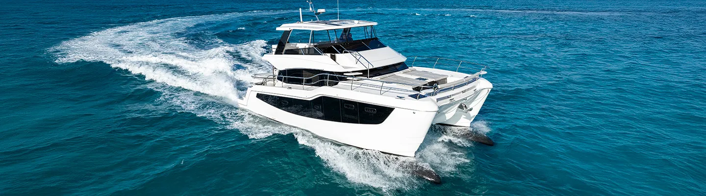
Aquila 50 Yacht 52' 2"
View Specs & ReviewMayport to Amelia Island — the St. Johns River city and the gateway to Georgia
Yachting in Jacksonville
A Minted Location · Jacksonville, Florida
If your boating splits between hundred-mile river weekends and blue-water runs offshore, Jacksonville is the rare harbor that serves both without compromise. The St. Johns entrance is the real thing — an all-weather, deep-draft cut between two rubblestone jetties, federal project 40 to 50 feet, with bar pilots standing by around the clock at Mayport — and inside it lies a navigable city: fuel and dockage three miles from the sea, a downtown marina that took its first boats again on August 12, 2026 after a full rebuild, and the Ortega River, "the major yachting center in the Jacksonville area" in the Coast Pilot's own words.
Minted Yachts runs this coast with buyers, and everything below comes from each facility's or agency's own published information — the same standard behind every yacht review on this site.
For an owner, Jacksonville is a chain of harbors on one river: the ocean-facing village at Mayport, the Intracoastal cluster at Jacksonville Beach, the rebuilt downtown riverfront, the Ortega yachting quarter behind its bascule bridge, the storm-haven lakes upriver — and, at ICW Mile 716, Fernandina's city marina on Amelia Island, the last Florida stop before Georgia. Pick your reach of the river, and the boat follows.
Where to keep a yacht in Jacksonville
Jacksonville dockage follows the water. At the mouth, Mayport's basin puts fuel two miles from the inlet and two from the Intracoastal. On the ICW at Jacksonville Beach, Beach Marine and Palm Cove Marina bracket the Beach Boulevard bridge with fuel, lifts and transient berths. Downtown, the city's rebuilt Met Park Marina reopened August 12, 2026 beside the stadium, with the free Metropolitan Park wood docks alongside and the any-size St. Johns Marina docks on the Southbank. The Ortega River is the yachting quarter — Port 32's slips to 140 feet and Lamb's working yard, behind a 9-foot bascule that keeps the crowds honest. South, Doctors Lake Marina covers the river cruiser's weekend range; north, Fernandina Harbor Marina and Amelia Island Marina close out Florida. Figures below are what each facility or agency publishes about itself.
Marinas
| Name | Where | Max yacht | Slips | Fuel |
|---|---|---|---|---|
| Morningstar Marinas MayportThe first fuel and dockage inside the entrance — wet slips on the St. Johns, enclosed dry storage for boats to 28 ft or 15,000 lb, on-site mechanic, bait and a fish-cleaning station; the Coast Pilot reports about 10 ft in the Mayport basin. | Mayport — 4852 Ocean St, south bank inside the jetties | — | — | Non-ethanol gasoline & high-speed diesel |
| Beach MarineThe Jax Beach ICW anchor, a Suntex property — wet slips, lift slips, dry and outside storage, with MAVI's dock-and-dine deck on the basin; slip counts and lengths come from the office. | Jacksonville Beach — ICW, east side just north of the Beach Blvd bridge (~Mile 747.5) | — | — | Gasoline & diesel (Coast Pilot) |
| Palm Cove MarinaClaims the largest dry storage facility on Jacksonville's Intracoastal, with wet slips, nine on-site businesses and Marker 32's dining room at the docks — the marked channel runs about half a mile off the waterway. | Jacksonville Beach — marked channel west of the ICW at ~Mile 746.8 | — | — | Gas & diesel |
| Met Park MarinaDowntown's docking answer, rebuilt new: owned by the City of Jacksonville and professionally managed by F3 Marina, with fuel, water and pump-out — first boats docked August 12, 2026, and slip figures are still being published. | Downtown — 5 Tower Court, north bank at EverBank Stadium | — | — | Fuel dock on site |
| Metropolitan Park wood docksThe city's own free downtown dockage, stated plainly on its marina-information page — event-day rafting books through the city's WebTrac system. | Downtown — Metropolitan Park, beside Met Park Marina | — | — | — |
| St. Johns Marina (Southbank)The city facility on the Southbank Riverwalk — the walk-ashore dock for the museum district and the downtown riverfront restaurants. | Downtown Southbank — 901 Museum Circle | — | — | — |
| Jim King Park and Boat Ramp at Sisters CreekThe famous city stop where the ICW crosses the St. Johns — dock, ramp, pump-out and restrooms around the clock; the park hosts the Greater Jacksonville Kingfish Tournament each July and closes to the public for it. | Sisters Creek at the ICW/St. Johns junction — 8203 Heckscher Dr (~Mile 739) | — | — | — |
| Port 32 Jacksonville at Ortega LandingThe flagship of the Coast Pilot's "major yachting center in the Jacksonville area" — yachts to 140 ft with 25-ft beam, key-card docks, heated pool and hurricane-hole protection behind the Ortega's 9-ft bascule gate. | Ortega River — NW side, ~0.4 mile above the Grand Ave bascule | 140 ft | — | — |
| Doctors Lake MarinaThe gateway to the river's best storm hole — Doctors Inlet reported 12 ft (1983 report) under the 37-ft fixed bridge, with dry storage and fuel where the lake meets the St. Johns. | Doctors Inlet — south side at the US 17 bridge, Orange Park | 70 ft | — | ValvTect gas & diesel |
| Fernandina Harbor MarinaThe city marina on the Florida/Georgia line: 4,000 ft of alongside dockage with published transient rates to 250 ft, the Southern Basin dredged to 8 ft with 18–24 ft outside the wave attenuator, and 20-plus restaurants within walking distance — all vessels proceed slow speed, minimum wake past the moored waterfront. | Fernandina Beach — downtown waterfront, Amelia River (ICW Mile 716) | 250 ft | — | Fuel dock open |
| Amelia Island MarinaThe hurricane-protected basin south of town, a Suntex property — 108 wet slips and 228-plus dry storage; the honest caveat is its own published 5-ft channel at low water. | Amelia Island — protected basin off the ICW, 251 Creekside Dr | 60 ft | 108 | Fuel dock — gas & diesel |
Yacht clubs
| Name | Where | Max yacht | Slips | Fuel |
|---|---|---|---|---|
| The Florida Yacht ClubThe river's private club at Pirates Cove, charted by name in the Coast Pilot, with the special small-craft anchorages lying off its entrance (33 CFR 110.1 and 110.73). | St. Johns River west side — at the entrance to Pirates Cove, ~4 miles south of the Fuller Warren Bridge | — | — | — |
Figures are as each facility publishes them on its own site; blank cells mean the facility doesn't state a number. Confirm slip availability and current rates directly — or ask us to make the calls.
Cruising from Jacksonville
The entrance. The St. Johns is the approach to a working port — a lighted buoy about 3 miles off, then a channel between two converging rubblestone jetties marked by lights and lighted ranges, federal project 40 to 50 feet from the ocean to Pilot Town Cut Range and maintained at or near project depths, per the Coast Pilot. Respect the water anyway: the ebb runs 4.0 knots between the jetties and at Mayport, about 2.8 knots at Mile Point, and the Bar Pilots warn that about an hour after a blow from north through east to south begins, a very strong and usually dangerous current sets across the jetty ends. Guard against an inshore set of a knot or more on approach, skip anchoring south of the entrance (heavy shrimpboat activity), and stay out of the Navy basin at Mayport — its turning waters are a prohibited area under 33 CFR 334.500, with dangerous cross-currents at the basin entrance. The St. Johns Bar Pilots' station at Mayport is manned 24/7.
The bridge ladder. Deep-draft ships transit to just below the Main Street Bridge, and your run downtown stacks up like this from seaward: Dames Point fixed at 169 feet, the Matthews at 146 (86 in the Arlington Channel), the Hart suspension at 135 (141 at center), then the Main Street lift — 40 feet down, 135 up, tenders on VHF 16 working 17 — the Acosta fixed at 74, the FEC railroad bascule (VHF 16, working 13), the Fuller Warren at 75 and the twin Buckman spans at 65. Current downtown is a civilized knot or so, though the Coast Pilot notes a flood exceeding 5 knots once reported at the Acosta.
The ICW at the beaches. The waterway crosses the St. Johns at Sisters Creek, Mile 739.2, under a 65-foot fixed span — cross-currents run on both flood and ebb, and the junction deserves attention. South of there the bridges are a steady 65 feet (Atlantic Blvd at Mile 744.7, Beach Blvd at 747.5, Butler at 749.5), but Atlantic Boulevard hides the region's nastiest trick: flood sets southward at right angles to the bridge at 3.4 knots strength, and the ebb runs northward about 15 degrees off-axis at 5.2 knots — with almost no warning 100 yards out. Reported approach depths at the two beach marinas are 6 feet (2013 report).
The Ortega gate. The yachting quarter sits behind a 9-foot closed bascule at the Ortega River entrance, with the twin Roosevelt fixed spans at 45 feet and a 2-foot railroad bascule beyond — reported controlling depths (1983) run 6 feet across the entrance bar and 7 feet to the railroad bridge. That gate is the point: past it lie the region's deepest bench of yards and slips, in flat protected water.
Upriver. Doctors Lake, behind a 37-foot fixed bridge and a 12-foot reported inlet (1983 report), is "a haven for small boats in stormy weather" per the Coast Pilot, with 7 to 12 feet across the lake — mind the reported pilings, visible at low tide and submerged at high. Julington Creek reported 5 feet (1983) to its 14-foot fixed bridge, with marina docks both sides. This is the extended-range cruiser's secret about Jacksonville: more protected fresh-to-brackish water than any harbor on the coast.
North to Georgia. From Sisters Creek the ICW runs 23 miles to Fernandina — Kingsley Creek's railroad swing bridge (5 feet closed) and 65-foot twin fixed spans at Mile 720.7 carry currents to 3 knots running normal to the openings. Northbound past Mile 714.3 comes the classic state-line trap: ICW aids swap so that southbound boats carry GREEN on the right from St. Andrew Sound until re-entering the Amelia River. Off Fernandina's moored waterfront, all vessels proceed at slow speed, minimum wake. The St. Marys entrance itself is jettied but honest about its age — both stone jetties are reported in very poor condition, almost entirely submerged at mean high water and marked by white JETTY buoys — with a 44-to-46-foot federal project through Cumberland Sound, southerly sets off the jetty ends that sometimes exceed 5 knots in northeast winds, and river freshets that can make the ebb run 7 to 8 hours. Kings Bay's submarine base sits on the west side of Cumberland Sound behind a security zone (33 CFR 165.731) with regulated navigation areas around it; the ICW passes east of the base at Mile 707.8 — transit the waterway, stay clear of the zones. Anchorage inside is fair along the channel sides according to draft, with the good 15-foot hole in the Fort George River off Kingsley Plantation on the way north.
- Fort George River (Kingsley Plantation) — ~0.7 mile SE of the ICW junction, north of the St. JohnsThe transit anchorage of the north Florida ICW — a historic plantation landscape off the bow and Jim King Park's any-size dock a short run away on Sisters Creek.
- Pirates Cove special anchorages — West side of the St. Johns, ~4 miles south of the Fuller Warren BridgeThe charted small-craft anchorage of the city reach, off the entrance to Pirates Cove by The Florida Yacht Club.
- Doctors Lake — West of the St. Johns at Orange Park, behind the 37-ft US 17 fixed bridgeJacksonville's storm hole — miles of protected water once you clear the 37-ft bridge; mind the reported pilings along the north shore and off several points, visible at low tide and submerged at high.
- Cumberland Sound & the Amelia River — Inside the St. Marys Entrance, Florida/Georgia lineThe cruiser's staging ground for the Georgia run — the Coast Pilot also names St. Marys town, 4 miles up its river, a good small-vessel haven in northeasterly weather, though strong currents and a large tidal range make the wharves hazardous for strangers.
- Fort Clinch State Park — North end of Amelia Island, south side of the St. Marys entranceThe conspicuous landmark you steer by entering St. Marys — 1,400 acres of fort, beach and maritime forest guarding the channel to Fernandina Harbor, with camping at the island's northwest end.
Service, refit & supplies
Shipyards & refit
| Name | Where | Max yacht | Dockage |
|---|---|---|---|
| Lamb's Yacht CenterFamily-owned across three generations since 1960, the working heart of the Ortega yard district — the Coast Pilot describes this reach's yards, berths for 75 boats to 52 ft and 25- and 50-ton lifts among them, without naming names. | Ortega River — 3376 Lake Shore Blvd, above the Roosevelt Blvd bridges | — | Boat storage plus the working trades — marine systems, diesel & gas engines, generators, carpentry, fiberglass, bottom paint, parts |
On the Jacksonville calendar
Greater Jacksonville Kingfish Tournament — each July, hosted at the city's Jim King Park and Boat Ramp at Sisters Creek; the park closes to the public for the event, so time an ICW transit stop around it.
Game days on the downtown riverfront — Metropolitan Park's wood docks switch from free first-come dockage to reserved rafting for stadium events and special events, booked through the city's WebTrac system, with the rebuilt Met Park Marina taking reservations next door.
Yachts we'd shortlist for Jacksonville
Reviewed the same way as everything on this site — specifications verified against the builder's own numbers.
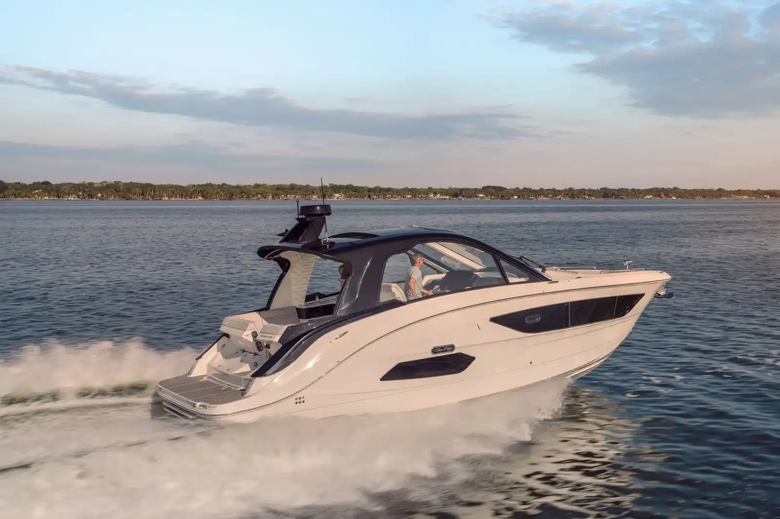
Sea Ray Sundancer 37037'8" (11.48 m)
View Specs & Review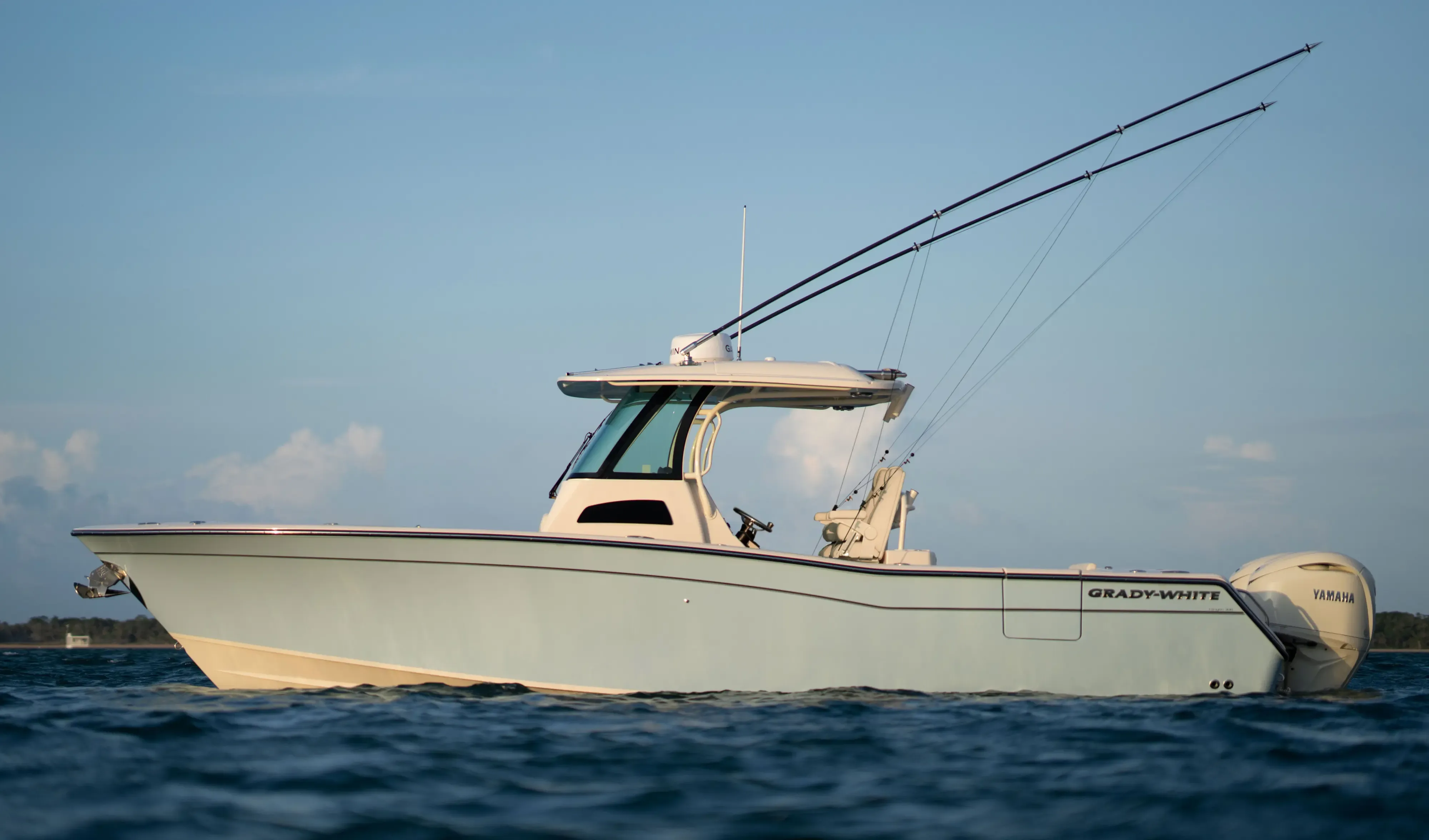
Grady White 306 Canyon30' 6"
View Specs & ReviewFrequently Asked Questions
Is Fernandina Harbor Marina open?
Yes — the city's FAQ confirms the marina is fully reopened: Southern Basin work complete and dredged to 8 feet, with 18 to 24 feet outside the wave attenuator, and the mooring field, fuel dock, dinghy dock, boat ramp and dock store all open, taking transient reservations. It sits downtown at ICW Mile 716 on the Florida/Georgia line — call VHF 16 and work 68 — with 4,000 feet of alongside dockage, published rates to 250 feet, and 20-plus restaurants within walking distance.
Which Jacksonville restaurants can I reach by boat?
Two publish outright welcomes: Whitey's Fish Camp on Doctors Lake, with its own docks and by-boat directions, and MAVI at Beach Marine — pull right up and dock and dine, in the marina's words. Marker 32 dines Palm Cove Marina, which lists transient dockage. The rest ride the city's docks: Chart House by the St. Johns Marina on the Southbank, and the Mayport landmarks — Safe Harbor Seafood, Singleton's, Sandollar, Palms Fish Camp — near Jim King Park's any-size dock. At Fernandina, the Salty Pelican faces the city marina.
Where is the yachting center of Jacksonville?
The Ortega River — "the major yachting center in the Jacksonville area," in the Coast Pilot's own words. Port 32 Jacksonville at Ortega Landing takes yachts to 140 feet with 25-foot beam, holds at least 90% of berths open to the public first-come, and puts pump-out at every slip; Lamb's Yacht Center has run its working yard and fuel dock since 1960. The price of that protection is the gate: a 9-foot closed bascule at the entrance, 45-foot fixed spans upstream, and a reported 6-foot entrance bar (1983 report).
Is the St. Johns River entrance an all-weather inlet?
It is one of the coast's genuine all-weather entrances: a deep-draft channel between two rubblestone jetties, federal project 40 to 50 feet, marked by lighted ranges, with bar pilots on station at Mayport 24/7. Respect it anyway — the ebb runs 4 knots between the jetties, the Coast Pilot warns of a dangerous current across the jetty ends about an hour after a blow from north through east to south begins, and an inshore set of a knot or more works on approaching boats. The Navy basin's turning waters are a prohibited area.
What should I know about running north to Georgia?
Three things. First, the buoy trap: from Mile 714.3 north, southbound ICW aids carry green on the right until St. Andrew Sound — the reverse of the rule — so read the chart, not the habit. Second, Kingsley Creek's railroad swing bridge shows 5 feet closed, with currents to 3 knots running normal to the openings. Third, the St. Marys entrance is deep (44-to-46-foot project) but its jetties are nearly submerged at high water, sets off the ends can exceed 5 knots in northeast winds, and Kings Bay's submarine security zones line the west side of Cumberland Sound — the ICW passes safely east of the base at Mile 707.8.
Is Jacksonville a good home port?
For an owner who wants both range and refuge, it is hard to beat: an all-weather, deep-draft entrance, fuel at the river mouth, a rebuilt downtown marina, the Ortega's yards and 140-foot slips, storm holes like Doctors Lake, and more protected cruising water than any harbor on this coast — with Fernandina and Georgia's sea islands a day trip north. The trade-offs are honest ones: real shipping traffic, real currents, and a bridge ladder to learn. Tell us how you'll run this river and we'll match the boat: TS@MintedYachts.com or +1 (404) 805-9819.
Where can visiting boats dock in downtown Jacksonville?
Met Park Marina — the city-owned marina beside EverBank Stadium, rebuilt and reopened August 12, 2026, managed by F3 Marina, with a fuel dock, water and pump-out, open to seasonal and transient boaters (office 8 a.m.–6 p.m. daily). On non-event days the Metropolitan Park wood docks next door are free, first-come, for up to 72 hours, and the Southbank's St. Johns Marina docks are open 24/7, rated for any size vessel, per the city.
Where do cruisers stop where the ICW crosses the St. Johns?
Jim King Park and Boat Ramp at Sisters Creek — the city facility at the junction, open 24/7 and rated for any size vessel, with a boat dock, pump-out and ramp. The Sisters Creek bridge at Mile 739.2 is a 65-foot fixed span with cross-currents on both flood and ebb, and the classic anchorage is the Fort George River — 15 feet reported just southeast of Daybeacon 5, off the Kingsley Plantation, with a reported 3-knot current. The park closes to the public each July for the Kingfish Tournament.