
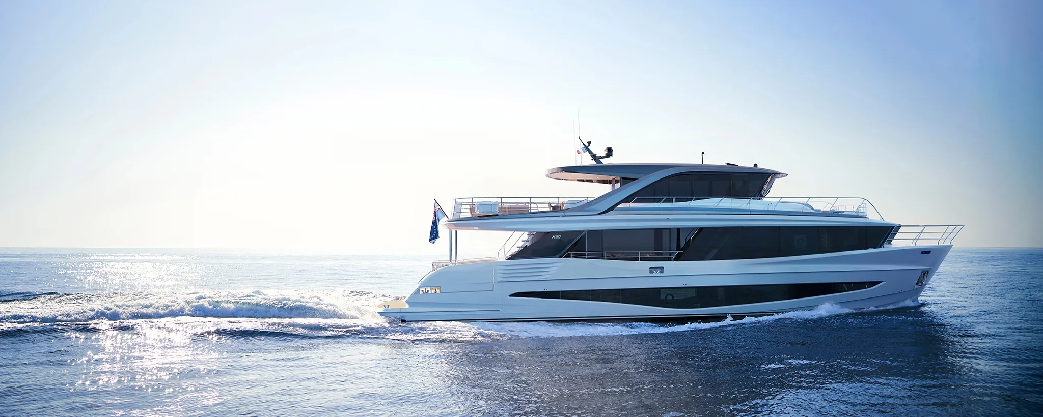
Princess X9088'11"
View Specs & ReviewClear inbound, berth downtown — the port of entry with a 375-foot dock
Yachting in Victoria
A Minted Location · Victoria, British Columbia
If you are running a big boat north from Puget Sound, Victoria is the first place in Canada that can actually take it. The Greater Victoria Harbour Authority publishes 20 to 375 feet at Wharf Street and a transient rate card that runs to an "Over 80 ft" band. Harbour authorities do not print rate bands for boats that never show up.
What Victoria is not is a refit port. The one federal drydock here — 1,200 feet long, open 24 hours a day, 365 days a year — is a commercial and naval facility, not a yacht yard. The one private yard in the Upper Harbour runs a marine railway and a climate-controlled shed, and sets haul-out capacity on the telephone rather than on a published table. A 100-foot yacht can berth in Victoria. Whether it can be hauled here is a call to 250-385-3623.
So treat Victoria as what it is: the clearance-and-berth port. You report to Canada Border Services at Raymur Point, you tie up on Wharf Street inside the Inner Harbour, and the city starts at the top of the ramp.
One correction worth stating outright, because it is the single most repeated error about this harbour. Causeway — the postcard berth in front of the Empress — is the smallest of the three harbour-authority docks, not the largest. GVHA's own words: "Causeway can only accommodate up to 60' length overall." Wharf Street is where the big boat goes.
Where to keep a yacht in Victoria
Wharf Street is the market's large-vessel berth. GVHA publishes 20 to 375 feet, year-round transient, monthly and low-season moorage from October to May, with 30 and 50 amp power and washrooms, showers and laundry on the adjacent Broughton Street Pier.
The rest of the harbour authority's inventory sorts downward from there. Ship Point publishes "slips that can accommodate vessels 60' and over" — confirm the maximum with the harbour authority when you book. Causeway caps at 60 feet. Both are reserved through the same booking system.
GVHA's published transient rates, per foot per night including overhang, plus a $2 booking fee:
| LOA band | High season (22 Jun – 21 Sep 2026) | Low season (23 Sep 2025 – 14 Jun 2026) |
|---|---|---|
| Under 30′ | $2.79 | $1.99 |
| 30′–45′ | $3.02 | $2.14 |
| 46′–60′ | $3.19 | $2.30 |
| 61′–80′ | $3.85 | $2.69 |
| Over 80′ | $5.05 | $3.57 |
Power runs from 20 amp/120–208 volt through 100 amp/480 volt three-phase where available.
Outside the Inner Harbour, Victoria International Marina in the Upper Harbour is the purpose-built large-yacht facility: 28 slips, published to 180 feet, with shore power, 1 Gb fibre, slip-side pump-out, two water connections, a crew lounge, gym and three private shower rooms. It takes yachts over 20 metres (65 feet) — that is a minimum, not a maximum. Its published wording is "accepting all Canadian vessels up to 180 feet", so call the marina before committing a US-flag boat to it.
Oak Bay Marina sits outside the harbour on the Haro Strait side and is the fuel-and-guest option there: guest moorage at $2.15 per foot per day, any size, with premium marked gasoline and diesel at the end of F Dock, daily 09:00–16:30, hail on VHF 66A. Its marina page gives "vessels 20′ – 70′" while its rate table carries a "77′ and over" band at $20.00 per foot per month — both are the operator's own figures, so confirm anything over 70 feet with the office before you go.
Westbay Marine Village in Esquimalt takes to 55 feet on all-concrete main docks with 30 and 50 amp, water and waste-water pump-out at every slip, on monthly moorage — call the office for anything shorter.
Fuel inside the harbour is at Fisherman's Wharf: regular gasoline and diesel, daily 09:00–18:00, with waste pump-out and basic marine supplies on the dock. Confirm depth and length with the wharf before bringing a large boat alongside, and note that Fisherman's Wharf carries no transient moorage — its 33 berths are designated for floating residences.
Marinas
| Name | Where | Max yacht | Slips | Fuel |
|---|---|---|---|---|
| Wharf Street Marina (GVHA)The market's large-vessel berth, published at 20 to 375 feet. 30 and 50 amp power; washrooms, showers and laundry on the adjacent Broughton Street Pier. This — not Causeway — is where a 100 ft-plus boat goes. | Inner Harbour, north of the seaplane terminal | 375 ft | — | No — fuel is at Fisherman's Wharf |
| Victoria International MarinaThe purpose-built large-yacht facility: 28 slips published to 180 feet, with shore power, 1 Gb fibre Wi-Fi, slip-side pump-out, two water connections, crew lounge, gym and three private shower rooms. It takes yachts over 20 metres (65 ft) — a minimum, not a maximum. Its published wording is "accepting all Canadian vessels up to 180 feet", so call before committing a US-flag boat. | Upper Harbour, 1 Cooperage Place | 180 ft | 28 | — |
| Ship Point Marina (GVHA)GVHA publishes slips that can accommodate vessels 60 feet and over. Confirm the maximum with the harbour authority when you book. | Inner Harbour | — | — | No |
| Causeway Marina (GVHA)The postcard berth, and the smallest of the three harbour-authority facilities. GVHA's own words: "Causeway can only accommodate up to 60' length overall." Widely and wrongly described as Victoria's superyacht dock. | Inner Harbour, in front of the Empress | 60 ft | — | No |
| Oak Bay Marina15 and 30 amp power. Posted 13 August 2026: gasoline $2.32/L, diesel $2.68/L. The marina page gives "vessels 20′ – 70′" while the rate table carries a "77′ and over" band at $20.00 per foot per month — both are the operator's own figures, so confirm anything over 70 feet with the office before you go. Also a CBSA marine reporting site. | Oak Bay, outside the harbour on the Haro Strait side | — | — | Premium grade marked gasoline and diesel — end of F Dock, daily 09:00–16:30, hail VHF 66A |
| Westbay Marine VillageAll-concrete main docks with galvanised steel or wood fingers, 30 and 50 amp, water and waste-water pump-out at every slip. Rate year 1 April 2026 to 31 March 2027. | 453 Head Street, Esquimalt | 55 ft | — | — |
Yacht clubs
| Name | Where | Max yacht | Slips | Fuel |
|---|---|---|---|---|
| Royal Victoria Yacht ClubFull reciprocal privileges give two nights free; basic reciprocal gives one day free then $5.00 per boat per day. Hail the Foreshore on VHF 9A. Reciprocal berthing is not available at the club's Tsehum Harbour or Long Harbour facilities. Also a CBSA marine reporting site. | Cadboro Bay | — | — | — |
Fuel docks
| Name | Where | Max yacht | Slips | Fuel |
|---|---|---|---|---|
| Fuel Dock at Fisherman's Wharf (GVHA)On-site waste pump-out and basic marine supplies. Confirm depth and length with the wharf before bringing a large boat alongside. This is the harbour's fuel stop rather than a place to leave the boat. | 22 Huron Street, Inner Harbour | — | — | Regular gasoline and diesel, daily 09:00–18:00 |
Figures are as each facility publishes them on its own site; blank cells mean the facility doesn't state a number. Confirm slip availability and current rates directly — or ask us to make the calls.
Cruising from Victoria
Clearing in is the first thing that happens. CBSA's own rule, from a page modified 13 March 2026: "As the operator of a boat entering Canadian waters with the intent to disembark, it is your responsibility to report to the CBSA." And: "If at any point during the transit you come to port, anchor, moor or make contact with another vessel, you must report to the CBSA immediately."
The Victoria-area clearance point for a boat is the Raymur Point CBSA Boat Dock, 146 Kingston Street — GVHA states it is operated by the Canada Border Services Agency, and that arriving vessels must "report to the Canada Customs dock for clearance prior to requesting moorage." Telephone Reporting Centre 1-888-226-7277.
"Victoria Inner Harbour" is not a marine reporting site. CBSA's Inner Harbour listing is the seaplane terminal, service code AOE/15/SEAPL. The Victoria-area marine sites in CBSA's directory are Royal Victoria Yacht Club and Oak Bay Marina, and — north in Sidney — Port Sidney, Van Isle, Tsehum Harbour and Canoe Cove.
⚠️ The minimum fine for failing to report on entry is CAN$1,000, plus possible detention, seizure or forfeiture — and it applies even when you stop only to refuel. Currency or monetary instruments totalling CAN$10,000 or more must be declared, and "all firearms, including non-restricted firearms, must always be reported."
NEXUS Marine is the advance-notice programme: members call the marine reporting number at least 30 minutes and up to four hours before arrival, and all persons on board must be NEXUS members. CANPASS Private Boat is no longer a route in — CBSA's current CANPASS pages cover corporate and private aircraft. There is no Canadian equivalent of ROAM either, so plan on the telephone rather than an app.
Going the other way, US Customs and Border Protection requires operators to report arrival immediately under 19 CFR 4.2. Three programmes provide an alternative to face-to-face inspection — CBP ROAM, NEXUS and the I-68 Canadian Border Boat Landing Permit — but boaters "must still phone in their arrival." The Small Vessel Reporting System is retired. The Puget Sound boat arrival line is 1-800-562-5943, with designated inspection ports at Friday Harbor, Point Roberts, Anacortes and Port Angeles. Vessels 30 feet and over need an annual CBP user fee decal. CBP's Puget Sound page lists I-68 and NEXUS; its national pages present ROAM as available to pleasure boaters. Carry both, and phone your arrival in regardless.
⚠️ Race Passage is the current gate, and the published numbers are not the ones most people quote. CHS station 07090, sitting at Race Rocks, gives a 2026 annual maximum of 6.94 knots flood and 7.26 knots ebb across 619 flood and 743 ebb events. The 90th percentile is 5.46 / 5.56; the median peak is a much gentler 3.63 / 4.31. So: roughly 7 knots on a big ebb, 3.5 to 4.5 on an ordinary one.
Read the right station. NOAA's "Race Rocks" is PUG1640, "Race Rocks, 4.5 mi. S of" — a mid-strait station well offshore — and its 2.21 / 3.49 knots is not what a boater feels at the rocks. Quote CHS 07090 and name it. Juan de Fuca East (CHS 07100) runs a modest 3.41 flood / 3.72 ebb.
Baynes Channel, off Oak Bay, has no current station of its own. The nearest proxy is NOAA PUG1744, "Discovery Island, 3.0 nm NE of", at 3.73 flood / 3.16 ebb — and it should be read as exactly that, a proxy. BC Parks describes that approach plainly: "Strong currents and frequent winds create dangerous conditions, including rip tides. Crossings are best made at slack tide in calm weather."
Inside the harbour, the rules are unusually strict. GVHA: "No sailing or anchoring is permitted within the harbour." Vessels must follow the Port of Victoria Traffic Scheme — "keep the yellow markers close to your port side at all times" — and hail dock staff on VHF 66A. GVHA also describes this as home to Canada's busiest water airport. Seaplanes are a live navigational consideration, not a curiosity.
Tide comes from CHS station 07120, Victoria Harbour, established 1905. Higher high water at large tide is 10.27 ft, lower low water at large tide −0.30 ft; the highest recorded level is 12.34 ft (1 January 2003) and the lowest −1.51 ft (20 June 1951). Working from those datums, plan on about 6 ft of range on a mean tide and about 10.5 ft on a large one.
- Inner Harbour — anchoring prohibited — Victoria Inner HarbourGVHA states it plainly: "No sailing or anchoring is permitted within the harbour." Vessels follow the Port of Victoria Traffic Scheme, keeping the yellow markers close to port at all times, and hail dock staff on VHF 66A. This is also home to what GVHA calls Canada's busiest water airport, so expect seaplane traffic on the water.
- Discovery Island Marine Provincial Park — Off Oak BayBC Parks is blunt: "There is no safe anchorage and no moorage in the park. The closest safe harbour is in Oak Bay." Northern Discovery Island and Chatham Island are First Nations Reserve lands, closed to the public, and trespassing is not permitted. The approach carries strong currents, frequent winds and rip tides; BC Parks advises crossing at slack in calm weather.
Service, refit & supplies
Shipyards & refit
| Name | Where | Max yacht | Dockage |
|---|---|---|---|
| Esquimalt Graving Dock (federal)A federal drydock published at 357.5 by 38.4 metres (1,200 by 135 ft), open 24 hours a day, 365 days a year, with a 705 ft north landing wharf and a 984 ft south jetty, both carrying 30 ft at low tide. It is a commercial and naval facility, booked commercially, and not a yacht refit yard — Victoria's drydock capacity is not yacht capacity. | Esquimalt | 1,200 ft | — |
| Point Hope MaritimeA marine railway and a 15,000 square foot climate-controlled assembly shed in the Upper Harbour. Haul-out capacity — tonnage, length, beam and draft — is settled on the call rather than on a published table: 250-385-3623. | Upper Harbour | — | — |
Chandleries & specialty suppliers
- Trotac Marine — 370 Gorge Road EastOver 50,000 products, and a supplier to the Royal Canadian Navy, the Canadian Coast Guard and Fisheries and Oceans Canada.
On the Victoria calendar
Victoria is a year-round moorage market with a sharp premium window of about thirteen weeks, and the operators' own calendars draw the line in the same place.
- GVHA transient high season — 22 June to 21 September 2026. Low season runs 23 September 2025 to 14 June 2026, at roughly a 30 percent discount.
- GVHA Wharf Street publishes low-season moorage October to May.
- Royal Victoria Yacht Club reciprocal berthing — April to October, on the northern-most outer slips at Cadboro Bay only.
- Westbay rate year — 1 April 2026 to 31 March 2027.
The marinas stay open all winter. Victoria discounts for the season rather than closing for it.
The Swiftsure International Yacht Race runs out of the Royal Victoria Yacht Club — the 81st edition ran in May 2026 and the 82nd is scheduled for 2027. Confirm Victoria Classic Boat Festival dates with the organiser before you plan a trip around them.
Yachts we'd shortlist for Victoria
Reviewed the same way as everything on this site — specifications verified against the builder's own numbers.
Frequently Asked Questions
What is the largest yacht that can dock in Victoria?
The Greater Victoria Harbour Authority publishes 20 to 375 feet at Wharf Street Marina, which is the market's large-vessel berth. Victoria International Marina in the Upper Harbour publishes 180 feet across 28 slips. Ship Point takes vessels 60 feet and over — confirm the maximum with the harbour authority when you book. Causeway — the berth in front of the Empress, and the one most often described as the superyacht dock — actually caps at 60 feet, in GVHA's own words: "Causeway can only accommodate up to 60' length overall."
When is the boating season in Victoria?
Victoria works year-round. The harbour authority's transient high season runs 22 June to 21 September 2026, with low season from 23 September 2025 to 14 June 2026 at roughly a 30 percent discount. Wharf Street publishes low-season moorage October to May, Westbay runs an April-to-March rate year, and the Royal Victoria Yacht Club offers reciprocal berthing April to October. The marinas do not close for winter — they discount for it.
Can a yacht be hauled out in Victoria?
Not against a published figure — it is a telephone call. The Esquimalt Graving Dock is a 1,200-foot federal drydock open around the clock, but it is a commercial and naval facility, not a yacht yard. Point Hope Maritime in the Upper Harbour runs a marine railway and a 15,000 square foot climate-controlled assembly shed, and settles tonnage, length, beam and draft on the call: 250-385-3623. Victoria is a berthing and clearance port first — if you need a lift booked against published capacity, plan it elsewhere in the region and berth here.
Is there dock-and-dine in Victoria?
Not in the sense of tying up at a restaurant — Victoria is a walk-up harbour. The Flying Otter Grill on Wharf Street, Boom + Batten at Victoria International Marina and Marina Dockside Eatery are all reached from a berth on foot, and where there is moorage it belongs to the marina rather than the restaurant. Fisherman's Wharf, the place most often assumed to be the dock-and-dine, carries no transient moorage at all: its 33 berths are designated for floating residences. Berth at Wharf Street or Ship Point and walk.
How strong are the currents at Race Passage?
The Canadian Hydrographic Service station at Race Rocks, index 07090, gives a 2026 annual maximum of 6.94 knots on the flood and 7.26 knots on the ebb, across 619 flood and 743 ebb events. But the median peak is far gentler — 3.63 flood and 4.31 ebb — so a typical crossing is 3.5 to 4.5 knots and only a big ebb approaches seven. Be careful which station you read: NOAA's "Race Rocks" station is 4.5 miles south of the rocks, mid-strait, and reads roughly half the true figure.
Where do you clear customs by boat in Victoria?
At the Raymur Point CBSA Boat Dock, 146 Kingston Street, which the harbour authority states is operated by the Canada Border Services Agency. Arriving vessels must report there for clearance before requesting moorage, and call the Telephone Reporting Centre on 1-888-226-7277. Note carefully that "Victoria Inner Harbour" in CBSA's directory is the seaplane terminal, not a boat site. Other Victoria-area marine reporting sites include Royal Victoria Yacht Club and Oak Bay Marina. The minimum fine for failing to report is CAN$1,000, and it applies even if you stop only to refuel.