
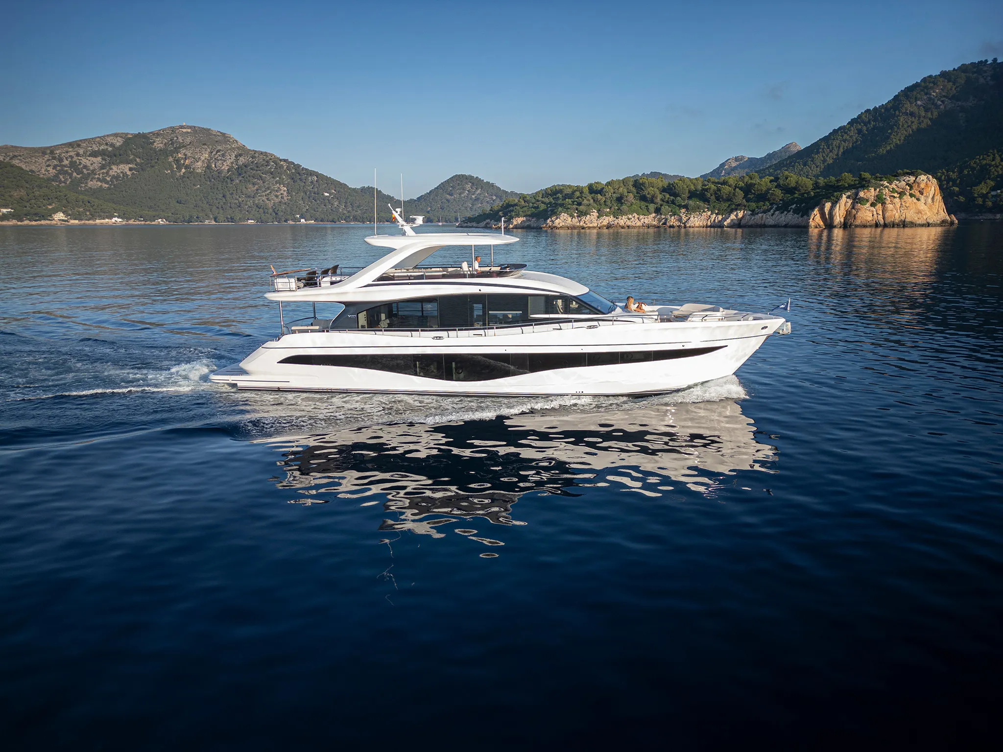
Princess Y8083'8"
View Specs & ReviewWindy Lane — the crossing that gets worse as you approach the islands
Yachting in Ventura & the Channel Islands
A Minted Location · Ventura & the Channel Islands, California
Everything you learned crossing to Catalina is backwards here, and NOAA says so in one sentence:
"During northwest weather boats crossing the channel from the mainland usually encounter heavier seas as the islands are approached. The belt of rough seas, locally known as Windy Lane, lies along the north shores of the islands and is about 6 miles wide. This sea condition is the opposite to that experienced in the crossing from Los Angeles-Long Beach to Santa Catalina Island. Strangers are cautioned that good seamanship sometimes calls for returning to the mainland rather than attempting Windy Lane when rough seas are encountered. These west winds usually begin about 1000 and grow progressively stronger until sundown."
⚠️ Read that twice. Going to Catalina, the water improves as you close the island. Going to the Channel Islands, it gets worse — for the last six miles, in the afternoon, with the wind building until dark. The boat that is fine for the Catalina crossing is the wrong boat for this one.
And the payoff is unusually good. "There are no landing permits required for the islands administered by the National Park Service." No reservations either. Five islands, open water, and almost nobody there.
Two things come with that freedom. "There are no public moorings or all-weather anchorages around the islands", and the Park recommends one person stay aboard at all times. Northeasters *"come up without warning, usually at night in clear dry weather… small boats should be prepared to seek shelter at a moment's notice."*
The two mainland harbours are not interchangeable, and this is the single most useful sentence a broker can offer here: Ventura is the service-and-visit harbour; Channel Islands is the berth-and-live harbour. A buyer keeping a 100-foot boat berths at Oxnard and hauls at Ventura. Every figure behind that is below.
Where to keep a yacht in Ventura & the Channel Islands
| Ventura Harbor | Channel Islands Harbor | |
|---|---|---|
| Owner | Ventura Port District | County of Ventura |
| Berths | 1,444 (Port District) · "about 1,500" (NOAA) | ~2,150 (County) · "over 2,400" (NOAA) |
| Reservable 80 ft+ transient | YES — to 93 ft | NO — "No reservations are taken for dock space", 10-day max |
| Largest published slip | 93 ft (operator) · 95 ft (Port District) | 126 ft |
| Fuel for a big boat | 120 ft dockside / 170 ft pier side | Gas and diesel, daily 07:00–17:00 |
| Haul-out | 200 tons (Port District) · 150 tons (NOAA) | 25-ton mobile / 60-ton fixed |
| Sewage | Pollution laws enforced | The entire harbour is a No-Discharge Zone |
In Ventura, the largest marina publishes 580 slips from 18 to 93 feet, with a maximum beam of 40 feet and maximum draft of 12 — an unusually generous beam allowance — plus renewable and ultra-low-sulfur diesel daily 07:00–17:00 and reservable transient berthing. The Port District lists 95 feet for the same facility: plan against 93 and confirm anything longer with the marina. A second marina holds 554 slips (392 concrete, 162 wooden) "just 500 feet from the ocean", with guest slips by request form and terms settled on the call. A third runs 104 slips from 35 to 80 feet plus a 90-foot public paddleboard dock. Ventura Harbor Village Marina takes transients at a flat $1.50 per foot per day, with a Courtesy Patrol on (805) 218-4888, and "does not offer live-aboard slips."
Ventura's yard is the reason to come. The Port District publishes a boatyard to 200 tons with crane and off-loading; NOAA records 150 tons for the same harbour. Plan against 150 and confirm anything heavier with the yard before you book it. A second yard publishes a travelift to 60 feet, dockside service to 100 feet, a 35-ton hoist and 26 feet of height. Fuel takes 120 feet dockside and 170 feet pier side. The launch ramp runs six lanes with about 180 spaces at $10 daily or $150 annually.
The county's oldest yacht club, founded 1938, has 91 slips and "a spacious 240-foot guest dock for members and visitors with yacht club reciprocity" — 240 feet of dock face, not a 240-foot slip.
In Channel Islands Harbor the berthing is bigger and the rules are stricter. Bahia Yacht Marina publishes 85 new wet slips from 27 to 126 feet, closest to the harbour mouth, with live-aboard on a 35-foot minimum — the largest published slip in either harbour. Two further marinas publish over 400 slips at 24–60 ft and over 380 at 25–66 ft, both with dedicated end ties to 100 feet. Another publishes transient berthing from 25 to 104 feet — but with a maximum beam of 18 feet and draft of 12, which makes it a narrow-beam marina despite the long LOA. A fifth runs 24 to 90 feet.
The County's guest docks take no reservations. "No reservations are taken for dock space", at $1.90 per foot with a $47.00 minimum, a ten-day maximum, and vessels must appear in person at the Harbormaster Dock in seaworthy condition. NOAA records guest berths for 70 craft. The County fuel dock runs 07:00–17:00 daily with gas and diesel, and no bio-diesel.
The lifts recorded in Channel Islands Harbor are a 25-ton mobile and a 60-ton fixed — call either yard for what it can take on the day. Anything heavier is a run up the coast, which is why the haul-out answer for this market is Ventura.
Two clubs publish real terms. One, founded 1960 with 400 members, offers "reciprocal guest slips up to 42 feet." Another, established 1976 with 140 slips, offers a guest dock with 30 amp for reciprocal members carrying a current home-club card, "operating year-round." A third, founded 1967, describes itself as a "self-help yacht club" and runs Wet Wednesday racing March to October.
So the buying advice is concrete: berth a 100-footer at Bahia or on an Oxnard end tie, and haul at Ventura. The two harbours are 5.8 miles apart and they do different jobs.
Marinas
| Name | Where | Max yacht | Slips | Fuel |
|---|---|---|---|---|
| Bahia Yacht MarinaEighty-five new wet slips from 27 to 126 feet — the largest published slip in either harbour, and closest to the mouth. This is where a 100-footer actually berths in this market. | Channel Islands Harbor, closest to the harbour mouth | 126 ft | 85 | — |
| Safe Harbor Ventura Isle580 slips from 18 to 93 feet, with a maximum beam of 40 feet and maximum draft of 12 — an unusually generous beam allowance for California. The Port District lists 95 feet for the same facility: plan against 93 ft and confirm anything longer with the marina. | Ventura Harbor | 93 ft | 580 | Renewable and ultra-low-sulfur diesel, 07:00–17:00 daily |
| Safe Harbor Anacapa IsleRead the beam before the length: 104 feet of LOA against an 18-foot maximum beam makes this a narrow-beam marina despite the long figure. A wide modern flybridge boat will not fit even if its length does. | Channel Islands Harbor | 104 ft | — | — |
| Channel Islands Harbor Marina · Vintage Marina · Peninsula Yacht MarinaOver 400 slips at 24–60 ft with dedicated end ties to 100 feet, over 380 at 25–66 ft with the same end-tie capability, and a third running 24 to 90 feet. The end ties are how a larger boat gets into Oxnard when Bahia is full. | Channel Islands Harbor | 100 ft | 800 | — |
| County guest docksNOAA records guest berths for 70 craft. The whole harbour is a No-Discharge Zone — "discharge of sewage, whether treated or untreated, from all vessels is prohibited." The County fuel dock runs 07:00–17:00 daily with gas and diesel, and no bio-diesel. | Channel Islands Harbor | — | 70 | — |
| Ventura West Marina · Portside · Ventura Harbor Village MarinaVentura West runs 554 slips — 392 concrete and 162 wooden — "just 500 feet from the ocean", with guest slips by request form and terms settled on the call. Portside runs 104 slips from 35 to 80 feet plus a 90-foot public paddleboard dock. Harbor Village Marina has a Courtesy Patrol on (805) 218-4888. | Ventura Harbor | 80 ft | 658 | — |
Yacht clubs
| Name | Where | Max yacht | Slips | Fuel |
|---|---|---|---|---|
| The yacht clubsThe county's oldest club, founded 1938, has 91 slips and "a spacious 240-foot guest dock for members and visitors with yacht club reciprocity" — 240 feet of dock face, not a 240-foot slip. A 1976 club has 140 slips. A 1967 club describes itself as a "self-help yacht club" and runs Wet Wednesday racing March to October. Reciprocity is settled club to club, so carry a current home-club card and call ahead. | Both harbours | 42 ft | 231 | — |
Fuel docks
| Name | Where | Max yacht | Slips | Fuel |
|---|---|---|---|---|
| Ventura fuel — 170 feet pier sideThe largest published fuel capability in either harbour, and another reason the Ventura side is the service side. | Ventura Harbor | 170 ft | — | Low-sulfur diesel; dockside to 120 ft, pier side to 170 ft. A second operation runs 05:30–17:30 |
Figures are as each facility publishes them on its own site; blank cells mean the facility doesn't state a number. Confirm slip availability and current rates directly — or ask us to make the calls.
Cruising from Ventura & the Channel Islands
The Santa Barbara Channel is 63 miles long, widening from 11 miles at the east end to 23 at the west, free of dangers, with 40 to over 300 fathoms along the recommended track. The east entrance has "a clear width of 2 miles between the 100-fathom curves." Anacapa Passage is four miles wide and free of dangers but "is seldom used and should not be attempted in thick weather as soundings give no warning of a close approach to the islands. Tide rips are strong under certain conditions."
Published distances. Ventura Harbor is 6.7 miles north of Point Hueneme; Channel Islands Harbor is 1 mile northwest of Port Hueneme and 5.8 miles southeast of Ventura Marina; Anacapa Island is 11 miles southwest of Point Hueneme; Santa Rosa is 24.5 miles southwest of Goleta Point.
Currents are variable and wind-driven, setting along the north shore at 0.5 to 1 knot and about 1 knot through the passages between the islands — treat them as a set to allow for rather than a slack you can time.
A live naval range crosses the departure track. "Continuous hazardous operations may take place… Monday through Sunday. The range extends for 180 miles in a southwest direction from Point Mugu and is up to 210 miles wide." Check status by hailing the range control on VHF-FM 11 or 16.
Weather: northeasters in autumn and winter "come up without warning, usually at night in clear dry weather… small boats should be prepared to seek shelter at a moment's notice." Fog: "During the summer heavy fogs are a common occurrence in the Santa Barbara Channel and envelop the main shore, channel and islands." And at the west end, Point Conception "has been called the Cape Horn of the Pacific… A marked change of climatic and meteorological conditions is experienced off the point, the transition often being remarkably sudden and well defined."
The access is genuinely the payoff
"There are no landing permits required for the islands administered by the National Park Service." No reservations either.
But "there are no public moorings or all-weather anchorages around the islands." The Park recommends one person stay aboard at all times, and at Santa Rosa "boaters may not use the mooring buoys in Bechers Bay. They are reserved for the NPS, the Coast Guard, and the park concessionaire." File a float plan with the harbourmaster.
Island by island, the rules differ and they matter.
- Anacapa — east landing cove, no permit. Middle Anacapa by permit and ranger escort only; West Anacapa closed except Frenchys Cove, 1 November to 31 December.
- Santa Cruz — the eastern 24 percent is Park land, open for day visits without a permit. The shoreline between Arch Point and the east boundary of Potato Harbor is closed to landing for seabirds. The western 76 percent belongs to a conservancy: a landing permit is required, a fee is charged, no overnight island use is permitted, and applicants should allow at least ten business days.
- Santa Rosa — day-use landing without permit. From 1 March to 15 September the back beaches and dunes from Skunk Point to just north of East Point are closed for snowy plover; Sandy Point is closed year-round. The island burned in 2026. The Park reopened it for day use from 1 July, cancelled campground reservations through 13 August, and notes that "some areas may remain closed or restricted while recovery and stabilization work continues" — confirm any landing you are planning with the park before you sail.
- San Miguel — the special regime. "A permit (including liability waiver) is required to visit the island," which "is owned by the U.S. Navy and open for landing only when National Park Service personnel are on the island" because of unexploded ordnance. Overnight anchorages are restricted to Cuyler Harbor and Tyler Bight, landing only on the beach at Cuyler, private boaters must email the park before departure, and no off-trail hiking is permitted.
- Santa Barbara Island — no permit, landing at the designated cove only; "the landing dock is available for unloading purposes only."
And "landing on rocks and islets is prohibited" anywhere in the park.
You are also inside a national marine sanctuary of about 1,110 square nautical miles, extending roughly six nautical miles seaward from each island. Discharge is prohibited, excepting — for a vessel under 300 gross tons — biodegradable effluent from an operable Type I or II marine sanitation device, and "vessel operators must lock all marine sanitation devices in a manner that prevents discharge or deposit of untreated sewage." Anchoring is expressly carved out of the seabed-alteration prohibition.
⚠️ The rule that bites a genuinely large yacht
Operating within one nautical mile of any island is prohibited for "any vessel of three hundred gross registered tons or more", except for fishing or kelp harvesting.
Most 100-to-150-foot yachts are well under 300 GRT. A 180-to-200-foot displacement motoryacht can exceed it — and is then excluded from the islands entirely.
Overflight: flying motorized aircraft "at less than 1,000 feet over the waters within one nautical mile of any Island" is prohibited, and failure to maintain that altitude "is presumed to disturb" — which covers a yacht-carried helicopter or drone. Personal watercraft are prohibited within park waters entirely: the tender jet-skis stay on the boat. Inside a marine reserve it is unlawful to take any resource, or even to possess fishing gear "unless such gear is stowed and not available for immediate use."
Two closures worth planning around. The Anacapa special closure protects brown pelican fledglings "from the mean high tide mark seaward to a water depth of 20 fathoms" and runs 1 January to 31 October. And the single most popular anchorage on Santa Cruz — Scorpion — sits inside a full no-take reserve of about 9.64 square miles. Anchoring is fine; fishing is not.
The anchorages, from NOAA. Smugglers Cove, Santa Cruz "affords shelter in northwest weather in 5 fathoms, sandy bottom" — and Coast Pilot recommends it over Anacapa for larger vessels "where the bottom is not so steep-to." Prisoners Harbor shelters from all winds except northeast to west; "in northeast weather the anchorage is unprotected and dangerous." Scorpion has "a rock covered 8 feet" charted in it. Anacapa's best southeast-storm anchorage is 0.2 mile north of the middle island in 9–12 fathoms. Bechers Bay, Santa Rosa offers southeast protection in about six fathoms — inside a naval operating area with anti-ship mining exercises. Cuyler Harbor, San Miguel: *"Good shelter may be had in south weather, but the holding ground is poor. In strong northwest weather the heavy swells… make the anchorage dangerous."* At Tyler Bight, "in moderate northwest weather, the winds may attain velocities up to 45 knots 0.5 mile offshore; the sea in the bight, however, is quite smooth."
Both entrances need care, and both authorities defer to the charts and Notices to Mariners for depth — read the current chart before you close either one. Ventura's entrance and sand trap "require annual maintenance dredging" because of "the down coast movement of an average of about 500,000 cubic yards of sandy material each year" — and "if this material is not dredged… the harbor entrance can become unsafe for vessel navigation." NOAA adds: "Dangerous breakers can develop in the approach area to the entrance channel in winter when the prevailing winds are from the west," advising a direct course between the outer whistle buoy and the breakwater entrance, and noting the buoys are "frequently relocated due to changing conditions." The entrance lies between two jetties behind an 1,800-foot detached breakwater; 5 mph limit; harbourmaster on VHF 16 and 12, 06:00–02:00 daily.
Channel Islands publishes: "The area SE of the entrance is subject to rapid and uncertain shoaling. Mariners should exercise caution when approaching the Harbor from the S, especially at night." NOAA flags both sides — southeast of the entrance channel and northwest of the north jetty. 5 mph, Harbor Patrol on VHF 12/16, 24 hours a day, every day, and the entire harbour is a No-Discharge Zone: "discharge of sewage, whether treated or untreated, from all vessels is prohibited."
Tides. NOAA station 9411189, Ventura, is a subordinate station and gives predictions rather than datums. The nearest station carrying datums gives a great diurnal range of 5.46 feet and a mean range of 3.72, agreeing with Santa Barbara's to within 0.07 feet. Work this coast to about 5.4 feet great diurnal and about 3.7 mean.
Finally, the oil platforms. "Offshore oil wells and oil drilling platforms… extend as much as 10 miles offshore between Point Hueneme and Point Conception." Four of them sit squarely on the Channel Islands Harbor–Anacapa track and are the ones a local skipper actually navigates around. Safety zones are set platform by platform; the governing rule weighs "any obstructions within 500 meters of the OCS facility", so give each one a wide berth and take the current zone off the chart.
- Windy Lane — Along the north shores of the islands, about 6 miles wideThe most important thing on this page, and it inverts the Catalina intuition. NOAA: "during northwest weather boats crossing the channel from the mainland usually encounter heavier seas as the islands are approached… this sea condition is the opposite to that experienced in the crossing from Los Angeles-Long Beach to Santa Catalina Island. Strangers are cautioned that good seamanship sometimes calls for returning to the mainland rather than attempting Windy Lane when rough seas are encountered." The belt runs about 6 miles wide along the north shores of the islands.
- Channel Islands National Park — no landing permits — Five islandsThe payoff. Against it: "There are no public moorings or all-weather anchorages around the islands", the Park recommends one person stay aboard at all times, and at Santa Rosa boaters may not use the Bechers Bay mooring buoys — they are reserved for the Park Service, the Coast Guard and the concessionaire. File a float plan with the harbourmaster. "Landing on rocks and islets is prohibited."
- Smugglers Cove and Prisoners Harbor, Santa Cruz — Santa Cruz IslandSmugglers Cove "affords shelter in northwest weather in 5 fathoms, sandy bottom" — and NOAA specifically recommends it over Anacapa for larger vessels, "where the bottom is not so steep-to." Prisoners Harbor shelters from all winds except northeast to west, best in 12–15 fathoms sandy; "in northeast weather the anchorage is unprotected and dangerous." Landing at either needs a conservancy permit, since the western 76% of the island is privately held with no overnight island use permitted.
- Scorpion — anchor yes, fish no — Santa Cruz IslandThe single most popular anchorage on Santa Cruz sits inside a full no-take marine reserve of about 9.64 square miles covering 3.4 miles of shoreline. Anchoring is fine; fishing is not — and inside a reserve it is unlawful even to possess fishing gear "unless such gear is stowed and not available for immediate use." NOAA also charts "a rock covered 8 feet" in the bight.
- Anacapa Island — 11 miles southwest of Point HuenemeBest southeast-storm anchorage 0.2 mile north of the middle island in 9–12 fathoms; best northwest 0.3 mile south of the east opening in 8–12. East landing cove needs no permit; Middle Anacapa is by permit and ranger escort only, and West Anacapa is closed except Frenchys Cove, 1 November to 31 December. A special closure protects brown pelican fledglings "from the mean high tide mark seaward to a water depth of 20 fathoms" and runs 1 January to 31 October.
- San Miguel — the special regime — The westernmost island"A permit (including liability waiver) is required to visit the island", which "is owned by the U.S. Navy and open for landing only when National Park Service personnel are on the island" because of unexploded ordnance. Private boaters must email the park before departure, and no off-trail hiking is permitted. At Cuyler Harbor: "Good shelter may be had in south weather, but the holding ground is poor. In strong northwest weather the heavy swells… make the anchorage dangerous." At Tyler Bight, winds may reach 45 knots half a mile offshore while the sea in the bight stays smooth.
- Bechers Bay, Santa Rosa — Santa Rosa IslandSoutheast protection in about six fathoms over sand, inside a naval operating area with anti-ship mining exercises. From 1 March to 15 September the back beaches and dunes from Skunk Point to just north of East Point are closed for snowy plover, and Sandy Point is closed year-round. The island burned in 2026: the Park reopened it for day use from 1 July and notes some areas may remain closed while recovery continues, so confirm any landing you are planning with the park before you sail.
- The 300-ton rule — Within one nautical mile of any islandThe rule that bites a genuinely large yacht. Operating within one nautical mile of any island is prohibited for "any vessel of three hundred gross registered tons or more", except for fishing or kelp harvesting. Most 100-to-150-foot yachts are well under 300 GRT — but a 180-to-200-foot displacement motoryacht can exceed it, and is then excluded from the islands entirely. Two related rules: overflight below 1,000 feet within a mile of any island "is presumed to disturb", which covers a yacht-carried helicopter or drone, and personal watercraft are prohibited in park waters outright.
- The Point Mugu Sea Range and the oil platforms — Across the departure track"Continuous hazardous operations may take place… Monday through Sunday. The range extends for 180 miles in a southwest direction from Point Mugu and is up to 210 miles wide." Offshore oil platforms "extend as much as 10 miles offshore between Point Hueneme and Point Conception" — four of them sit squarely on the Channel Islands Harbor to Anacapa track. Safety zones are set platform by platform; the governing rule weighs "any obstructions within 500 meters of the OCS facility", so give each one a wide berth and take the current zone off the chart.
- Both harbour entrances — Ventura and Channel Islands entrancesBoth authorities defer to the charts and Notices to Mariners for depth, so read the current chart before you close either one. Ventura's entrance needs annual dredging against "an average of about 500,000 cubic yards of sandy material each year", and "if this material is not dredged… the harbor entrance can become unsafe for vessel navigation." NOAA: "Dangerous breakers can develop in the approach area to the entrance channel in winter when the prevailing winds are from the west." At Channel Islands: "The area SE of the entrance is subject to rapid and uncertain shoaling" — and NOAA flags the northwest side of the north jetty too.
Service, refit & supplies
Shipyards & refit
| Name | Where | Max yacht | Dockage |
|---|---|---|---|
| Ventura Harbor BoatyardThe haul-out answer for this whole market. The Port District publishes a boatyard to 200 tons with crane and off-loading; NOAA records 150 tons for the same harbour. Plan against 150 tons and confirm anything heavier with the yard. Either way it is the reason a 100-footer berthed in Oxnard comes to Ventura for work. | Ventura Harbor | — | — |
| Derecktor VenturaA travelift to 60 feet, dockside service to 100 feet, a 35-ton hoist and 26 feet of height. Between it and the 200-ton yard, Ventura carries the service capacity for both harbours. | Ventura Harbor | 100 ft | — |
| The Channel Islands boatyardsThe lifts recorded for the harbour are a 25-ton mobile and a 60-ton fixed. Call either yard for what it can take on the day, and plan anything heavier as a 5.8-mile run to Ventura. That is why the buying advice here is specific: berth at Oxnard, haul at Ventura. | Channel Islands Harbor | — | — |
On the Ventura & the Channel Islands calendar
Both harbours run year-round, and the operators' own hours prove it — there is no seasonal rate card in either. Fuel docks run daily 07:00–17:00 in both harbours, with one marine fuel operation open 05:30–17:30. The County guest-dock card is a single flat daily rate with no high or low tiering. Ventura Harbor Village transients pay a flat $1.50 per foot per day. The launch ramp is open around the clock. One club describes itself as "operating year-round" with a pool "heated year round."
The one seasonal window on the calendar is a club's Wet Wednesday series, March to October.
Dated events — Channel Islands Harbor:
- Concert on the Sea — 12 September 2026, a "water-based music event for boaters, kayakers, and paddleboarders"
- Chowderfest, the 7th — 19 September 2026
- Central Coast British Car Club Show, the 35th — 27 September 2026
- Ponies by the Sea — 11 October 2026
- Parade of Frights (5th) and Pumpkin Paddle (2nd) — 24 October 2026
- Reindeer Paddle (2nd) — 6 December 2026
- Parade of Lights, 60th annual — 12 December 2026, 19:00–21:00
- Concerts by the Sea, summer Saturdays 16:00–18:00
Ventura Harbor Village:
- Summer Whale Watching — 14 August to 30 September 2026
- 50th Annual Parade of Lights & Fireworks — Friday 18 and Saturday 19 December 2026, with a judged boat parade, a carnival on the Main Lawn and a fireworks finale each evening
- Summer Sun DJ Sessions, Steel Drum Sundays and Seaside Movie Nights through the season
Race and regatta dates are set by the organising clubs — confirm them with the organiser.
Yachts we'd shortlist for Ventura & the Channel Islands
Reviewed the same way as everything on this site — specifications verified against the builder's own numbers.
Frequently Asked Questions
What is Windy Lane?
A belt of rough seas about six miles wide lying along the north shores of the Channel Islands — and the single most important thing to understand about crossing here. NOAA states that during northwest weather, boats crossing from the mainland usually encounter heavier seas as the islands are approached, and adds explicitly that this sea condition is the opposite to that experienced crossing from Los Angeles or Long Beach to Catalina. The west winds usually begin about 10am and grow progressively stronger until sundown. NOAA also cautions that good seamanship sometimes calls for returning to the mainland rather than attempting Windy Lane when rough seas are encountered.
Is there dock-and-dine at Ventura or Channel Islands Harbor?
Barely, and the one published arrangement is aimed at paddlers. The Ventura Port District publishes that a marina dock in front of a harbour restaurant offers paddlers complimentary tie-up for visiting Harbor Village restaurants and shops, adding that electric boats or other vessels may contact the marina's Courtesy Patrol for complimentary day use. Its transient boaters page adds a two-hour limit. No restaurant in either harbour keeps a guest dock of its own, so dining here works from a berth: take a transient slip — $1.50 per foot per day at Ventura Harbor Village, or $1.90 per foot with a $47 minimum at the County guest docks — and walk.
Are there moorings at the Channel Islands?
No public ones. The Park states plainly that there are no public moorings or all-weather anchorages around the islands, and recommends one person stay aboard at all times. At Santa Rosa, boaters may not use the mooring buoys in Bechers Bay — they are reserved for the Park Service, the Coast Guard and the park concessionaire. NOAA recommends Smugglers Cove on Santa Cruz over Anacapa for larger vessels because the bottom is not so steep-to, and warns that at Cuyler Harbor on San Miguel the holding ground is poor and heavy northwest swells make the anchorage dangerous.
Where should you keep a large boat — Ventura or Channel Islands Harbor?
Berth at Channel Islands and haul at Ventura. Channel Islands Harbor has the biggest published slip in the market at 126 feet, plus two marinas with dedicated end ties to 100 feet, and the lifts recorded there are a 25-ton mobile and a 60-ton fixed. Ventura has the heavy service: a boatyard published at 200 tons by the Port District and recorded at 150 tons by NOAA, a second yard offering dockside service to 100 feet, and fuel taking 120 feet dockside and 170 feet pier side. The two harbours are 5.8 miles apart and do different jobs.
Is there a size limit for yachts at the Channel Islands?
Yes, and it is a tonnage rather than a length. Sanctuary regulations prohibit operating within one nautical mile of any island for any vessel of 300 gross registered tons or more, except for fishing or kelp harvesting. Most 100-to-150-foot yachts sit well under 300 GRT, but a 180-to-200-foot displacement motoryacht can exceed it and is then excluded from the islands entirely. Two related rules: flying a motorized aircraft below 1,000 feet within a mile of any island is presumed to disturb wildlife, which covers a yacht-carried drone or helicopter, and personal watercraft are prohibited in park waters outright.
Do you need a permit to visit the Channel Islands by boat?
Not for the islands the National Park Service administers — the Park states there are no landing permits required and no reservations either. But the exceptions matter. The western 76 percent of Santa Cruz Island belongs to a conservancy that requires a landing permit, charges a fee, permits no overnight island use and asks for at least ten business days' notice. San Miguel requires a permit and liability waiver, is Navy-owned because of unexploded ordnance, and is open for landing only when Park Service personnel are present. Middle Anacapa is by permit and ranger escort only, and West Anacapa is closed except Frenchys Cove in November and December.