
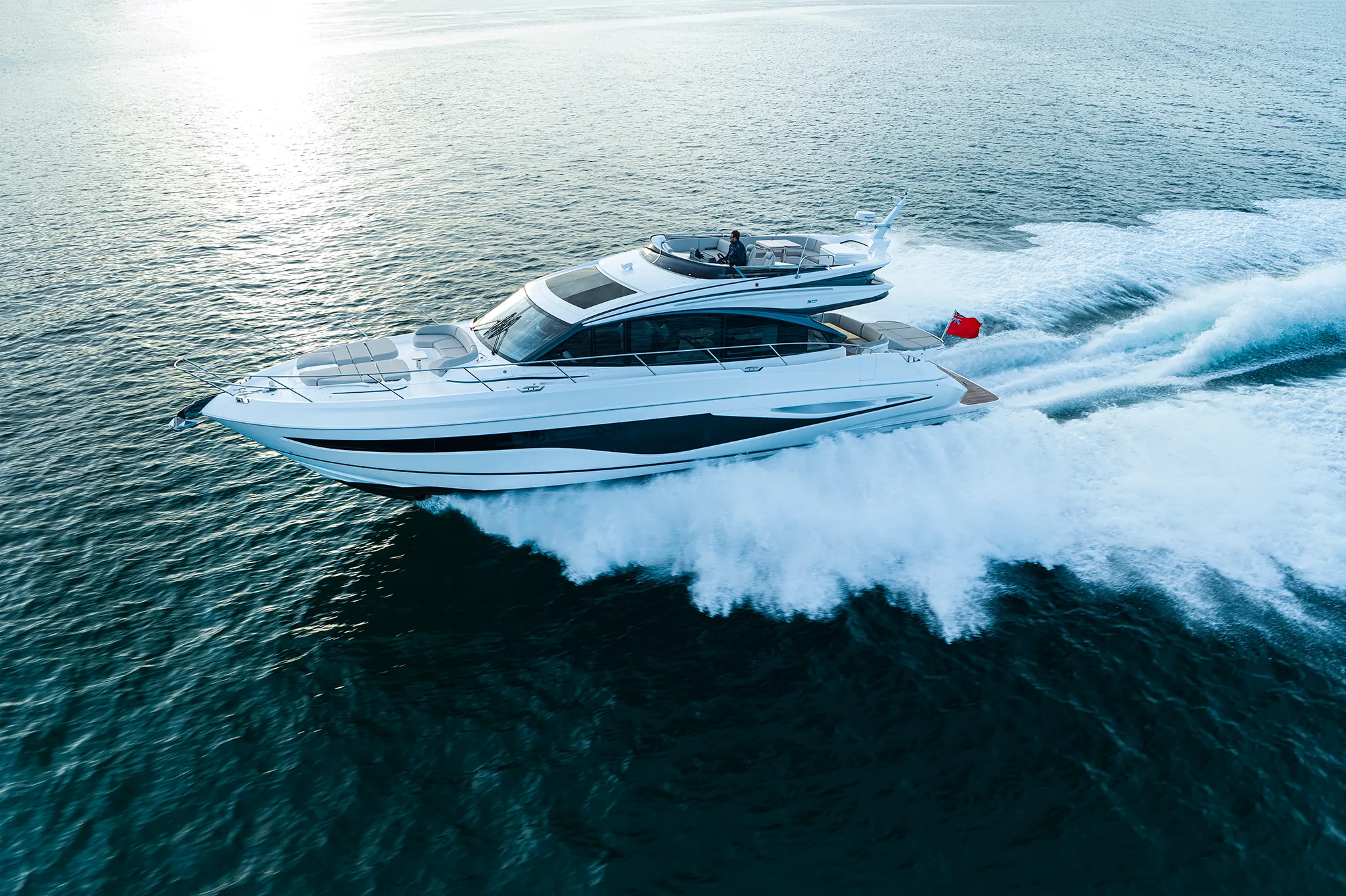
Princess S6567'7"
View Specs & ReviewThe slip conveys with the boat, and the waiting list is closed
Yachting in Santa Barbara
A Minted Location · Santa Barbara, California
In Santa Barbara, the berth is functionally an appurtenance of the hull. That is not a figure of speech — it is City policy, and it is the single most important thing a buyer here needs to understand.
The City states the problem plainly: "Currently Santa Barbara Harbor slips are fully occupied and our slip permit waiting lists are CLOSED to new applicants." The 2020 Harbor Commission policy sets out three tiers of list, and the Waterfront Department settles where you would sit on them.
And it publishes the way in. From the adopted transfer policy: "The permittee of a slip may transfer the Slip Permit to a new or changed vessel owner upon the sale or transfer of an equity ownership interest in a vessel" — application within 15 days of sale, fees within 15 days, and "the owner must bring an operable vessel to the Administration Dock for verification of length." Transfer fees run $600 at 40 to 45 feet, $800 at 50, and $925 at 60.
So in a harbour where the list is closed, buying the right boat is the only practical route to a Santa Barbara berth.
Two limits apply to brokerage slips, and they are worth knowing before you assume one can be held for you: "No yacht brokerage may validly hold permits to more than 15 slips at any given time in the Santa Barbara Harbor. No more than 30 yacht brokerage slips shall be assigned at any time." And: "Use of any yacht brokerage slip for overnight stays is illegal at all times and under all circumstances." One more line to know: "No Slip Permit may be transferred after the death of a sole slip permittee."
Three constraints define the rest of the market. Seventy feet is the service ceiling — above it, haul-out leaves the county entirely, so a 90-foot owner can berth in Santa Barbara but cannot service there. One hundred feet is a regulatory line, not just a berth line. And the entrance is a call to the harbormaster rather than a number you plan against.
Which makes the 60-to-70-foot segment this harbour's genuine sweet spot.
Where to keep a yacht in Santa Barbara
Santa Barbara Harbor is run by the City's Waterfront Department across 252 acres of managed tidelands. The slip count is published as 1,133 by California's Division of Boating and Waterways and as "about 1,200" by NOAA.
Maximum length carries two published figures too. California's registry publishes "Maximum Boat Length: 100", while the City's own Waterfront Services page describes guest berthing for "vessels 20' to 170' in length." The City's largest assigned category is the 100-foot berth. Read it conservatively: 100 feet to own, up to 170 feet to visit.
The City's assigned-berth rate schedule is also the only published slip-size distribution it puts out, and it is worth having in full. Fees are assessed monthly "per foot of boat or slip length, whichever is longer":
| Berth | $/ft/month | Berth | $/ft/month | |
|---|---|---|---|---|
| 20 ft | $12.67 | 50 ft | $16.31 | |
| 30 ft | $13.89 | 60 ft | $17.71 | |
| 40 ft | $15.12 | 70 ft | $19.22 | |
| 43 ft | $15.48 | 80 ft | $20.85 | |
| 45 ft | $15.71 | 90 ft | $22.62 | |
| 100 ft | $24.53 |
A 100-foot berth runs $2,453 a month; an 80-foot berth $1,668.
Visitor berthing is where Santa Barbara is unusually generous for California, and the terms are published in full. Recreational under 65 feet pays $2.00 per foot for nights 1–14 and $4.00 for 15–28. Recreational over 65 feet pays $4.00 per foot for nights 1–14 and $8.00 for 15–28. *"The maximum stay at the visitor base rate is 14 cumulative days. The daily rate doubles on the fifteenth day. After 28 days, the vessel must vacate the Harbor for at least 5 consecutive days."* Staying past 28 nights costs $100 to $250 per night depending on vessel size.
A 100-foot yacht pays $400 a night for a fortnight. Santa Barbara genuinely accommodates large transients — unusually so for this coast. Visitor berthing is first come, first served with no reservations, and you register at the Harbor Patrol Accommodation Dock.
Other published fees: liveaboard permit $143 a month, mooring permit $400 a year, slip permit waiting list $50 a year, and a $100 processing fee.
Seventy feet is the service ceiling, and it is the county's too
The harbour's haul-out facility publishes a Travelift Model 35BFM at 77,000 lb — 38.5 tons — with a maximum LOA of 70 feet and a maximum beam of 18 feet, draft not stated. It is described as the only haul-out facility in Santa Barbara County.
NOAA publishes smaller figures for the same harbour — "can handle craft up to 25 tons and 50 feet" — and a separate "small floating drydock… can lift craft up to 20 tons." Plan against the smaller pair and confirm what the yard can take on the day before you book a date around it.
Either way: above 70 feet, haul-out leaves the county. A 90-foot owner can berth in Santa Barbara and cannot service there.
Fuel is available at two points — a harbour fuel dock selling gasoline and diesel, open to all vessels, and the City Pier, which sells diesel, gasoline, ice and water and carries a hoist with a 2-ton maximum lift. Confirm fuel-dock hours with Harbor Patrol on 805-564-5530 or VHF-FM 16 before you plan a fill around them.
The yacht club, established 1872, is the second-oldest on the West Coast of North America. It takes reciprocal clubs or Bridge invitation, reservable up to 30 days ahead, and dockage is settled with the club on that call.
Marinas
| Name | Where | Max yacht | Slips | Fuel |
|---|---|---|---|---|
| Santa Barbara Harbor (City Waterfront Department)"Currently Santa Barbara Harbor slips are fully occupied and our slip permit waiting lists are CLOSED to new applicants." 252 acres of managed tidelands. The slip count is published as 1,133 by the state registry and as "about 1,200" by NOAA. Maximum length carries two published figures: the state gives 100 ft, while the City's own services page describes guest berthing for "vessels 20' to 170' in length." Read it conservatively — 100 ft to own, up to 170 ft to visit. After 28 days a vessel must vacate for at least five consecutive days, and staying past that costs $100–$250 per night depending on size. | Santa Barbara | 170 ft | 1,133 | Yes |
| The slip permit transfer — the way in"The permittee of a slip may transfer the Slip Permit to a new or changed vessel owner upon the sale or transfer of an equity ownership interest in a vessel", and "the owner must bring an operable vessel to the Administration Dock for verification of length." Transfer fees: $600 at 40, 43 and 45 ft, $800 at 50 ft, $925 at 60 ft — the published table stops at 60. In a harbour where the waiting list is closed, buying the right boat is the practical way to obtain a berth. One limit to know before you plan an estate around it: "No Slip Permit may be transferred after the death of a sole slip permittee." | Santa Barbara Harbor | — | — | — |
| The brokerage slip limitsWorth knowing before assuming a brokerage can hold a berth for a buyer: "No yacht brokerage may validly hold permits to more than 15 slips at any given time in the Santa Barbara Harbor. No more than 30 yacht brokerage slips shall be assigned at any time." | Santa Barbara Harbor | — | — | — |
| The assigned berth rate ladderThe City's FY26 schedule, and the only published slip-size distribution it puts out: 20 ft $12.67 · 30 ft $13.89 · 40 ft $15.12 · 45 ft $15.71 · 50 ft $16.31 · 60 ft $17.71 · 70 ft $19.22 · 80 ft $20.85 · 90 ft $22.62 · 100 ft $24.53 per foot per month. A 100 ft berth runs $2,453 a month; an 80 ft berth $1,668. Liveaboard permit $143/month, mooring permit $400/year, waiting list $50/year, processing fee $100. | Santa Barbara Harbor | 100 ft | — | — |
Yacht clubs
| Name | Where | Max yacht | Slips | Fuel |
|---|---|---|---|---|
| Santa Barbara Yacht ClubEstablished 1872 — the second-oldest yacht club on the West Coast of North America. Dockage terms and racing dates are settled with the club directly. | Santa Barbara Harbor | — | — | No |
Fuel docks
| Name | Where | Max yacht | Slips | Fuel |
|---|---|---|---|---|
| City PierSells diesel, gasoline, ice and water, and carries a hoist with a 2-ton maximum lift. Its "touch and go" tie-up is the harbour's only official short-stop dockage — a service berth rather than a restaurant amenity. A second harbour fuel dock sells gasoline and diesel and is open to all vessels; confirm hours for either with Harbor Patrol on 805-564-5530 or VHF-FM 16. | Santa Barbara Harbor | — | — | Diesel, gasoline, ice and water |
Figures are as each facility publishes them on its own site; blank cells mean the facility doesn't state a number. Confirm slip availability and current rates directly — or ask us to make the calls.
Cruising from Santa Barbara
⚠️ THE ENTRANCE SHOALS, AND IT HAS PUT BOATS AGROUND AT NIGHT
This harbour is a sand trap by design, and the entrance changes with the weather. Get the depth for your draft from the harbormaster on 805-564-5530 or VHF-FM 16 before you commit to the channel — it is a call, not a chart figure.
NOAA Coast Pilot is emphatic: "The channel is marked by lighted buoys which are frequently relocated due to changing conditions. The entrance and harbor are subject to rapid shoaling. The harbormaster advises that the entrance channel has a tendency to shoal after southeast storms. Mariners should contact the harbormaster on VHF-FM channel 16 for channel conditions and assistance in entering."
And there is a specific, documented night-arrival trap: *"The long sandbar north of the breakwater light is inconspicuous on a high-tide night, but the masts of boats moored in the harbor are quite visible over the breakwater. The harbormaster reports that these circumstances have caused several groundings on the sandbar when strangers making for the harbor at night failed to identify the breakwater light, failed to see the sandbar, but sighted the masts in the harbor and steered toward them, consequently going hard aground on the sandbar. The shoreline of the sandbar is subject to continual change."*
Identify the breakwater light. Do not steer for the masts.
The reason for all of it is the sand. The breakwater interrupts a south-flowing littoral drift, so the harbour must be pumped out continuously — not routine maintenance, but the condition of its existence. The City works with the Army Corps to keep the federal channel open on roughly $3 million a year, with "a goal to dredge a minimum of 120,000 cubic yards per dredge cycle" and "typically two dredge cycles per year." A recent fall/winter cycle, run 10 to 16 January, removed "approximately 75,000 cubic yards of sand." The Coastal Commission's concurrence covers "annual removal of up to 600,000 cubic yards… to re-establish authorized channel depths."
Tide gives you very little help. NOAA station 9411340: MHHW 8.53 · MHW 7.78 · MSL 5.92 · MLW 4.11 · MLLW 3.14. Great Diurnal Range 5.39 feet, mean range 3.66. A 5.39-foot range against an actively shoaling entrance gives a deep-draft yacht only a few feet of relief on the bar — this is a dredging problem, not a tide-timing problem.
POINT CONCEPTION — where this market's authority lives
Coast Pilot: "Point Conception has been called the Cape Horn of the Pacific because of the heavy northwest gales encountered off it during the passage through Santa Barbara Channel. A marked change of climatic and meteorological conditions is experienced off the point, the transition often being remarkably sudden and well defined. When the northwesterly winds are strong they blow down the canyons between Point Conception and Capitan and cause heavy offshore gusts."
The point sits 118 miles northwest of Point Fermin, a bold headland 220 feet high, with its light 133 feet above the water. Channel-wide, Coast Pilot records gales and seas of 12 feet or more. Just west it worsens: off Point Arguello *"sea fog becomes a persistent and frequent navigational hazard… Point Arguello is considered by mariners to be one of the most dangerous areas along the coast."* From June to October, visibility there drops below half a mile on 12 to 20 days a month.
Inside the harbour the picture inverts completely, and this is the point of the page. *"Winds are often calm at Santa Barbara. Winds of 3 knots or less occur 18 percent of the time or more year round and 25 to 40 percent of the time from September through March."* Local fog "plagues the harbor most often from August through November, when it reduces visibilities to less than 0.5 mile on 4 to 7 days per month."
A genuinely benign local sailing area sitting immediately east of one of the most notorious headlands in North America. The channel is protected; the corner is not.
⚠️ THE OIL PLATFORM SAFETY ZONES AND THE 100-FOOT LINE
Four federal safety zones sit about 13 miles west of Goleta Point — three platforms with 500-metre (about 1,640 ft) zones, and a storage and treatment mooring with a 1,108-metre (about 3,635 ft) zone.
The rule: "No vessel may enter or remain in this safety zone except for the following: (1) An attending vessel, (2) a vessel under 100 feet in length overall not engaged in towing, or (3) a vessel authorized by the Commander, Eleventh Coast Guard District."
A 90-foot yacht may transit these zones freely. A 110-foot yacht may not. For anyone buying across the 100-foot mark, that is a concrete, checkable consequence.
And the number converges across three independent official sources: assigned berths stop at 100 feet, the state registry publishes 100 feet as the harbour maximum, and federal regulation stops exempting vessels at exactly 100 feet LOA.
Also worth charting: "oil well production heads covered 6 fathoms or more and submerged pipelines to shore extend as much as 3 miles offshore between Goleta Point and Point Conception", with temporary drilling platforms that "may be moved periodically." A 100-yard security zone applies to any cruise ship within 3 nautical miles of the harbour breakwater light.
Crossing to the Channel Islands puts you in a national marine sanctuary. Discharging any material is prohibited, with exceptions for fish and chumming material in lawful fishing. For vessels under 300 gross tons, biodegradable effluent from approved Type I or II marine sanitation devices may be discharged — and operators must lock all MSDs to prevent discharge of untreated sewage. Motorized personal watercraft are prohibited within one mile of each island in both the National Park and the Sanctuary. The codified text is at 15 CFR Part 922 Subpart G. Coast Pilot also records the newly established Chumash Heritage National Marine Sanctuary.
Anchoring is restricted and the terms are specific. "Anchoring inside the harbor is usually prohibited by the harbormaster." A seasonal anchorage runs April to October east of Stearns Wharf, alongside 45 permitted moorings at $400 a year. "Anchorage is prohibited within 300 feet east of Stearns Wharf." And a line aimed squarely at this page's readers: "Large vessels should anchor OUTSIDE the anchorage and mooring areas in better holding ground." The harbormaster "desires advanced requests for permission to anchor", and it is unlawful to tie up anywhere in the harbour without permission from Harbor Patrol. Further west, Cojo Anchorage 1.5 miles east of Point Conception offers protection from moderate west and northwest winds in five to ten fathoms over a hard sandy bottom.
- The entrance — confirm the depth before you commit — The federal channelThe entrance and harbour are subject to rapid shoaling, and the channel tends to shoal after southeast storms, so the working depth is a call rather than a chart figure. NOAA's advisory: "The channel is marked by lighted buoys which are frequently relocated due to changing conditions. The entrance and harbor are subject to rapid shoaling." Get the number for your draft from the harbormaster on the day you arrive.
- The sandbar north of the breakwater light — North of the breakwater lightA documented night-arrival trap, in NOAA's own words: "The long sandbar north of the breakwater light is inconspicuous on a high-tide night, but the masts of boats moored in the harbor are quite visible over the breakwater. The harbormaster reports that these circumstances have caused several groundings on the sandbar when strangers making for the harbor at night failed to identify the breakwater light, failed to see the sandbar, but sighted the masts in the harbor and steered toward them, consequently going hard aground. The shoreline of the sandbar is subject to continual change." Identify the breakwater light and steer to it.
- Seasonal anchorage and moorings, east of Stearns Wharf — East of Stearns Wharf"Anchoring inside the harbor is usually prohibited by the harbormaster." "Anchorage is prohibited within 300 feet east of Stearns Wharf." And a line aimed squarely at larger boats: "Large vessels should anchor OUTSIDE the anchorage and mooring areas in better holding ground." The harbormaster desires advance requests for permission to anchor, and it is unlawful to tie up anywhere in the harbour without permission from Harbor Patrol — settle both on the call.
- The oil platform safety zones and the 100-foot line — About 13 miles west of Goleta PointThree platforms carry 500-metre (about 1,640 ft) safety zones and a storage mooring carries 1,108 metres (about 3,635 ft). The rule: "No vessel may enter or remain in this safety zone except for… a vessel under 100 feet in length overall not engaged in towing, or a vessel authorized by the Commander, Eleventh Coast Guard District." A 90 ft yacht transits freely; a 110 ft yacht does not. The number converges across three independent official sources: assigned berths stop at 100 ft, the state registry publishes 100 ft, and federal regulation stops exempting at exactly 100 ft.
- Point Conception — the Cape Horn of the Pacific — 118 miles northwest of Point FerminCoast Pilot: "Point Conception has been called the Cape Horn of the Pacific because of the heavy northwest gales encountered off it… A marked change of climatic and meteorological conditions is experienced off the point, the transition often being remarkably sudden and well defined." Channel-wide, gales and seas of 12 feet or more. Just west, off Point Arguello, visibility drops below half a mile on 12 to 20 days a month from June to October, and it is "considered by mariners to be one of the most dangerous areas along the coast." Inside the harbour the picture inverts: winds of 3 knots or less occur 25 to 40 percent of the time from September through March.
Service, refit & supplies
Shipyards & refit
| Name | Where | Max yacht | Dockage |
|---|---|---|---|
| Harbor Marineworks — the 70-foot ceilingA Travelift Model 35BFM at 77,000 lb — 38.5 tons — with a maximum LOA of 70 feet and a maximum beam of 18 feet; draft not stated. Described as the only haul-out facility in Santa Barbara County. NOAA publishes smaller figures for the same harbour — "can handle craft up to 25 tons and 50 feet" — plus a separate "small floating drydock… can lift craft up to 20 tons." Plan against the smaller pair and confirm what the yard can take on the day. Either way, above 70 feet haul-out leaves the county: a 90 ft owner can berth here and cannot service here. | Santa Barbara Harbor | 70 ft | Haul-out by arrangement; 24-hour emergency service |
Chandleries & specialty suppliers
- The harbour trades — Santa Barbara HarborA national chandlery, a City-run marine centre and classroom (bookable at $75 an hour to a $500 maximum), a sailing centre, and the maritime museum in the former Naval Reserve Building. A second dry dock is listed on the City's own Harbor Directory Map; terms come from Harbor Patrol on 805-564-5530.
On the Santa Barbara calendar
Santa Barbara is year-round, and the rate card shows it. The City's FY26 schedule carries no seasonal rate distinction whatsoever — assigned berths, visitor rates and liveaboard permits are flat, twelve months a year. The two genuinely seasonal items sit in the same schedule: catamaran beach storage at "$400.00/season" and the seasonal anchorage east of Stearns Wharf, April to October.
Harbor Patrol is on 24-hour duty year-round, monitoring VHF-FM 16, and a Coast Guard rescue vessel is stationed at the city pier with a Marine Safety Detachment nearby.
The weather record supports it too: calm is most frequent September through March, and fog peaks August through November. There is no closed season.
Dated events:
- Semana Nautica Summer Sports Festival — 4 to 19 July 2026, the 87th edition: ocean swimming races, professional beach volleyball, lifeguard competitions and the Fourth of July run.
- Santa Barbara Harbor & Seafood Festival — Saturday 17 October 2026, 10:00–17:00, on Harbor Way, and free. The City describes the 23rd annual festival, timed with the opening of lobster season, featuring "fresh, regional seafood in addition to live music, maritime education, free boat rides, children's activities, vessel tours, merchant goodies, and more."
Race and regatta dates are set by the organising club — confirm them with the club directly.
Yachts we'd shortlist for Santa Barbara
Reviewed the same way as everything on this site — specifications verified against the builder's own numbers.
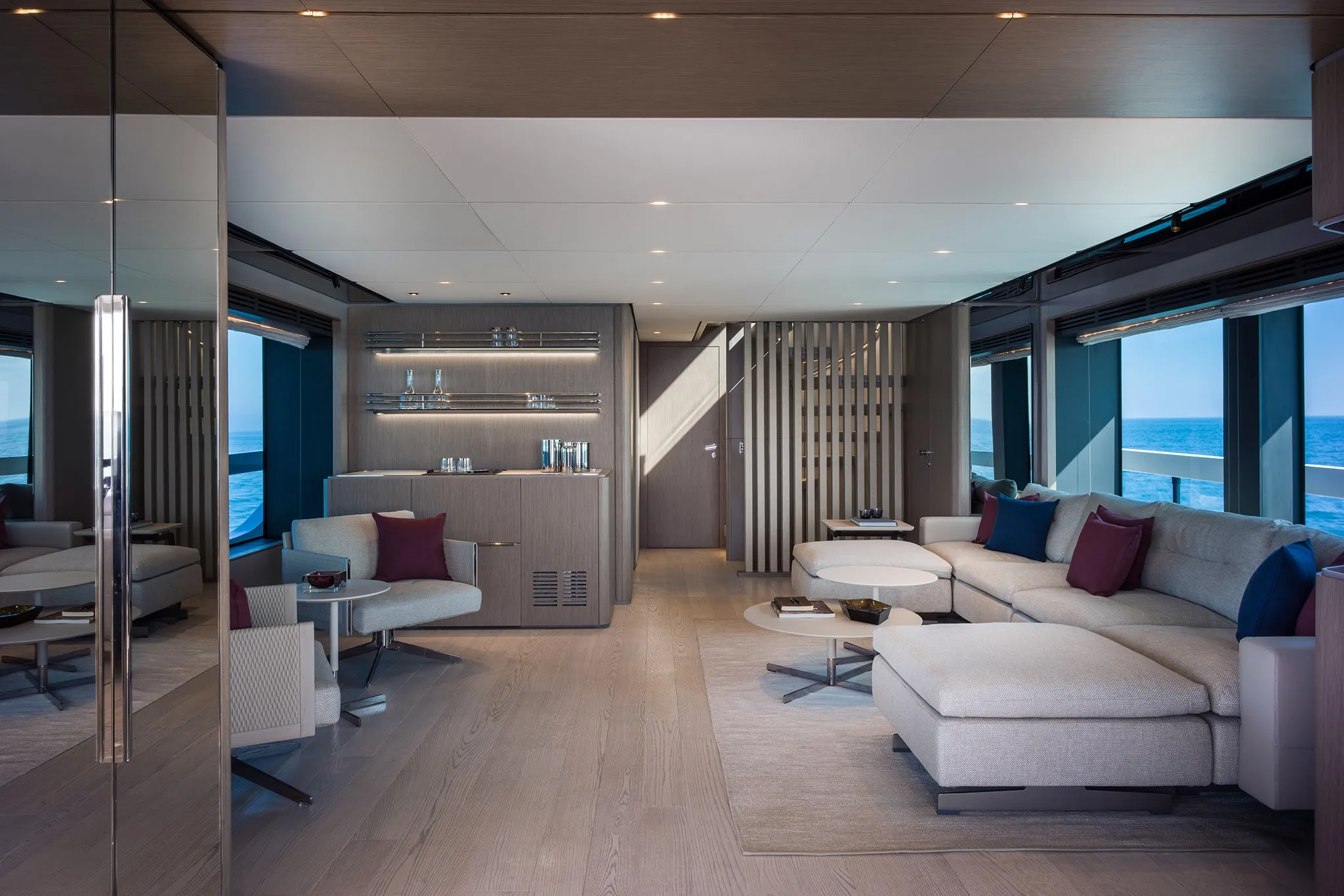
Ferretti Infynito 9088' 5" (26.95 m)
View Specs & Review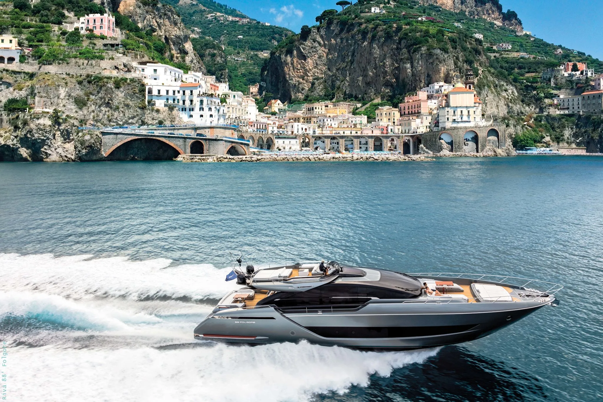
Riva 88' Folgore88' 4" (26.92 m)
View Specs & ReviewFrequently Asked Questions
What is the largest yacht that can berth in Santa Barbara?
Read it as 100 feet to own and up to 170 feet to visit. California's registry publishes a maximum boat length of 100 feet, and the City's largest assigned berth category is the 100-foot berth at $24.53 per foot per month — $2,453 a month. The City's own Waterfront Services page describes guest berthing for vessels 20 to 170 feet in length, so plan a permanent berth against 100 feet and take anything larger up with the Waterfront Department. Visitor rates for recreational vessels over 65 feet are $4.00 per foot for nights one to fourteen, so a 100-footer pays $400 a night — which makes Santa Barbara unusually accommodating to large transients for California.
Can a large yacht be hauled out in Santa Barbara?
Only up to 70 feet, and that is the whole county. The harbour's haul-out facility publishes a Travelift at 77,000 pounds — 38.5 tons — with a maximum LOA of 70 feet and a maximum beam of 18 feet, and it is described as the only haul-out facility in Santa Barbara County. NOAA publishes smaller figures for the same harbour, at 25 tons and 50 feet, plus a separate small floating drydock lifting to 20 tons, so confirm what the yard can take on the day before you book a date around it. Either way, above 70 feet haul-out leaves the county — a 90-foot owner can berth in Santa Barbara but cannot service there.
Is there dock-and-dine in Santa Barbara?
Not in the usual sense — dining here works from a berth and a short walk rather than from a guest dock. Every harbour restaurant is reached on foot from a slip or a car park, including the venues on the City's own Harbor Directory Map and the Stearns Wharf restaurants, where anchorage is prohibited within 300 feet of the wharf. The one official tie-up is the City Pier's "touch and go" at $0.50 per foot, which is a service berth rather than a restaurant amenity. Take a visitor berth, register at the Harbor Patrol Accommodation Dock, and walk — the whole harbour is walkable from there.
Why does 100 feet matter so much in Santa Barbara?
Because it is a regulatory line as well as a berth line, and the two coincide. Four federal safety zones sit about 13 miles west of Goleta Point around oil platforms and a storage mooring, with 500-metre and 1,108-metre radii. The rule permits an attending vessel, a vessel authorised by the Coast Guard district commander, or a vessel under 100 feet in length overall not engaged in towing. So a 90-foot yacht may transit those zones freely and a 110-foot yacht may not. The same number appears as the City's largest assigned berth and as the state registry's published maximum.
How do you get a slip in Santa Barbara Harbor?
By buying a boat that already has one. The City states that slips are fully occupied and the slip permit waiting lists are closed to new applicants. The route in is the transfer: the permittee of a slip may transfer the permit to a new owner upon the sale or transfer of an equity ownership interest in the vessel, with application within 15 days of sale and the owner bringing an operable vessel to the Administration Dock for verification of length. Transfer fees run $600 at 40 to 45 feet, $800 at 50 and $925 at 60. In practice the berth is an appurtenance of the hull.
How deep is the entrance to Santa Barbara Harbor?
It is a call to the harbormaster rather than a fixed number — the entrance shoals fast enough that the depth belongs to the day you arrive. NOAA publishes that the channel buoys are frequently relocated due to changing conditions, that the entrance and harbour are subject to rapid shoaling, and that the channel tends to shoal after southeast storms, and its advice is to contact the harbormaster for channel conditions and assistance in entering. The City and the Army Corps dredge the federal channel on roughly two cycles a year to hold it open. Call 805-564-5530 or hail VHF-FM 16 before you commit to the entrance.