
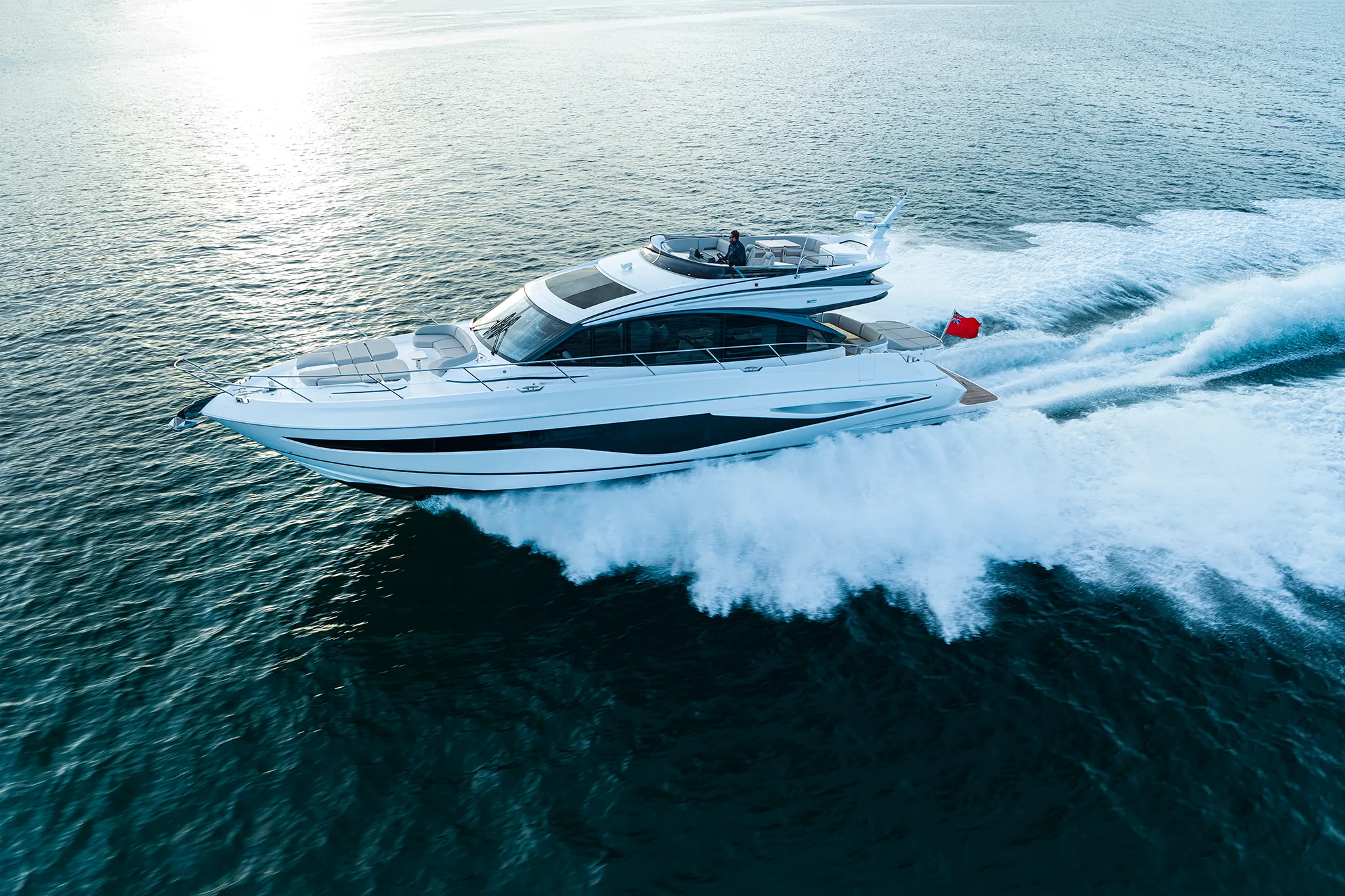
Princess S6567'7"
View Specs & ReviewForty to seventy feet works beautifully. Above eighty, the boat lives across the Bay.
Yachting in San Francisco
A Minted Location · San Francisco, California
Here is the question nobody answers honestly: where does a serious boat actually live in San Francisco?
Between 40 and 70 feet, the answer is excellent. South Beach Harbor puts 700 concrete-dock slips beside the ballpark with year-round occupancy. The San Francisco Marina holds 727 berths at Marina Green, some of them occupied since before the 1906 earthquake, with a fuel dock in the basin. Pier 39 runs 300 slips at Fisherman's Wharf. A well-found 50-footer has real choices here.
Above 80 feet, the berths run out. South Beach's transient limit is 50 feet. Pier 39's own inventory tops out at a 60-foot slip that is currently unavailable. The largest berth published in the city is St. Francis Yacht Club's 125 feet — and there, "if your draft is greater than 8 feet you will need to plan your arrival in accordance with the tides." The city's one full-service boatyard settles travelift tonnage, maximum length, beam and draft on the telephone, so call the yard before you plan a haul-out around a date.
So write San Francisco as what it is: a magnificent cruising ground with a constrained home port. Above 80 feet the boat berths across the Bay and comes into the city for the day. That is how the market works, and knowing it before you buy is worth more than a brochure.
Two more things to know before you plan a week here. There is exactly one fuel dock on the entire city waterfront, at GasHouse Cove. And there are only two anchorages a recreational owner can use — Aquatic Park Cove and Clipper Cove — with Aquatic Park open to sail and non-motorized boats only.
Where to keep a yacht in San Francisco
South Beach Harbor, at Pier 40 by the ballpark, is the Port's own marina — "700 slips with concrete docks, a recreational and commercial Guest Dock, Pier 40 Maritime Center and South Beach Park." The Port calls it a high-traffic marina with year-round occupancy. Guests may stay up to 14 days, booking up to two calendar months ahead. Under three hours is $30; over three hours is $1.50 per foot per day with a $42 minimum; vessels over 50 feet pay $3.00 per foot per day. Cancel inside 24 hours and there is a 50 percent fee. Fuel is at GasHouse Cove, not here.
The San Francisco Marina at Marina Green is the city's largest, with 727 berths across its East and West Harbours, including 15 end ties for guests, free pump-out stations, and a commercial fuel dock in the basin. West Harbour prices the season into the card — "June through October $4/ft LOA per night; November through May $2/ft LOA per night." Guest berthing is overnight only, no day rates, with reservations a maximum of 30 days ahead.
Size the guest end ties before you book. The marina page gives them as "guest berthing vessels up to 90 feet LOA"; the facility-details page for the same harbour gives "up to 50 feet LOA." Plan against 50 feet (15 m) and confirm anything larger with the harbour office — the guest page separately notes "limited availability for 40 foot vessels or larger."
Pier 39 Marina runs 300 slips at Fisherman's Wharf. Its parent site lists the West Harbor at "boats up to 60 feet" and the East Harbor at "boats up to 85 feet"; the marina's own inventory tops out at a 60′ × 20′ slip currently unavailable, and the rentals actually available run 36 to 50 feet. Book against 50 feet and confirm anything larger with the marina. Guest docking runs March to mid-October with a 24-hour advance minimum and no same-day booking: day stay $25 (in at 08:00, out by 15:00), overnight $50. "We do not offer guest docking during the winter months."
Hyde Street Harbor, also the Port's, is a commercial fishing harbour first: "Recreational boats may berth for up to 10 days if space is available", at $2.18 per foot per day plus a 10 percent environmental surcharge.
Treasure Island Yacht Harbor in Clipper Cove lists slips from 15 to 81 feet at $1.00 per foot per day with a $30 minimum — and the harbour is under construction through late 2027, with only cruise-ins available in the meantime.
There is exactly one fuel dock on the city waterfront
GasHouse Cove, in the East Harbor near Fort Mason — 100 feet of cement dock plus 20 of wooden, taking vessels to 135 feet, gasoline and diesel, open to all. Monday to Saturday 09:00–17:00, Sunday 10:00–16:00. Prices posted 21 July 2026: 87 unleaded $7.75 a gallon, diesel $6.95.
The Port confirms it from the other end of the city — its South Beach FAQ names the closest fuel dock as "Gashouse Cove near Fort Mason." South Beach and Pier 39 sell no fuel, and every other fuel dock the Port names is across the Bay. The Port's commercial fishing page does list "fuel, ice and supplies … available in the harbor" at Fisherman's Wharf — fill at GasHouse Cove and treat anything at the Wharf as a bonus.
The clubs hold the largest berths in the city, and the terms are strict. St. Francis Yacht Club states "we can accommodate boats up to 125 feet LOA" across five docks totalling about 850 feet. Reservations are mandatory, reciprocal visitors need a letter of introduction and are capped at "10 days of tie-ups during a calendar year" at $2.00 per foot per day with no free nights. Members pay $1.00 per foot to 70 feet and $1.50 above 71, capped at 30 days a year — though "winter months don't count." And "if your draft is greater than 8 feet you will need to plan your arrival in accordance with the tides."
Golden Gate Yacht Club and South Beach Yacht Club work by telephone rather than by published terms. Guest dock availability, size limits and rates are settled on the call, so ring ahead before planning around either.
The yard is a phone call too. The city's one full-service yard describes itself as "the only full service boatyard and chandlery in San Francisco", operating since the 1950s, with repair docks 1 to 6. Travelift tonnage, maximum LOA, beam and draft are agreed with the yard rather than set out on a page — telephone before you plan a haul-out around a date. Its chandlery is the only one inside the city.
Marinas
| Name | Where | Max yacht | Slips | Fuel |
|---|---|---|---|---|
| South Beach Harbor (Port of San Francisco)The Port's own marina: "700 slips with concrete docks, a recreational and commercial Guest Dock, Pier 40 Maritime Center and South Beach Park", described as a high-traffic marina with year-round occupancy. The best-placed berth in the city for someone who wants to walk into town. | Pier 40, beside the ballpark | 50 ft | 700 | No — the Port names GasHouse Cove as the closest fuel dock |
| San Francisco Marina — East Harbor (Gashouse Cove)"The entire facility has 727 berths… free pump-out stations and a commercial fuel dock", including 15 end ties for guests. Size those end ties before you book: the marina page gives them as "up to 90 feet LOA" and the facility-details page for the same harbour gives "up to 50 feet LOA". Plan against 50 feet (15 m) and confirm anything larger with the harbour office. | Marina Green / Fort Mason | — | 727 | Yes — a commercial fuel dock in the basin |
| San Francisco Marina — West HarborThe original basin, with vessels berthed here "since before the 1906 earthquake." One of the few operators in the market that prices the season straight into its card. | Marina Green | — | — | No |
| Pier 39 Marina300 slips in the middle of Fisherman's Wharf, and no guest docking in winter: "We do not offer guest docking during the winter months." Sizes are worth confirming before you book — the parent site lists the West Harbor at boats up to 60 feet and the East Harbor up to 85, while the marina's own inventory tops out at a 60′ × 20′ slip currently unavailable and the rentals actually available run 36 to 50 feet. | Fisherman's Wharf | — | 300 | — |
| Hyde Street Harbor (Port of San Francisco)A working commercial fishing harbour that takes recreational boats when there is room — call the harbour office before planning around it. | Fisherman's Wharf | — | — | The Port's commercial fishing page lists fuel, ice and supplies in the harbor; its South Beach FAQ names GasHouse Cove as the city's closest fuel dock — fill at GasHouse Cove |
| Treasure Island Yacht HarborSlips listed from 15 to 81 feet. The harbour is under construction through late 2027, with only cruise-ins available in the meantime, so treat any plan around it as provisional and phone first. | Clipper Cove | 81 ft | 107 | — |
Yacht clubs
| Name | Where | Max yacht | Slips | Fuel |
|---|---|---|---|---|
| St. Francis Yacht Club"We can accommodate boats up to 125 feet LOA" across five docks totalling about 850 feet — the largest published city berth outside the commercial wharves. Members pay $1.00/ft to 70 ft and $1.50 above, capped at 30 days a year, though "winter months don't count." "If your draft is greater than 8 feet you will need to plan your arrival in accordance with the tides." | 700 Marina Boulevard | 125 ft | — | — |
| Golden Gate Yacht Club · South Beach Yacht ClubBoth clubs settle visiting-yacht arrangements on the telephone rather than on their websites. Guest dock availability, size limits and rates come from the call, so ring ahead before you plan around either. | 1 Yacht Road and Pier 40 | — | — | — |
Fuel docks
| Name | Where | Max yacht | Slips | Fuel |
|---|---|---|---|---|
| GasHouse Cove Fuel DockThe only fuel dock on the city waterfront — 100 feet of cement dock plus 20 feet of wooden, taking vessels to 135 feet. Monday to Saturday 09:00–17:00, Sunday 10:00–16:00. Prices posted 21 July 2026: 87 unleaded $7.75/gal, diesel $6.95/gal. Every other fuel dock the Port names is across the Bay, so fill here before you leave the city front. | East Harbor, near Fort Mason | 135 ft | — | Gasoline and diesel; open to all |
Figures are as each facility publishes them on its own site; blank cells mean the facility doesn't state a number. Confirm slip availability and current rates directly — or ask us to make the calls.
Cruising from San Francisco
The bar is the hero content, and Coast Pilot 7 says it better than anyone.
*"San Francisco Bar, a semicircular shoal with depths less than 36 feet, is formed by silt deposits carried to the ocean by the Sacramento and San Joaquin River systems… Potatopatch Shoal, the north part of the bar on Four Fathom Bank, has depths from 24 to 28 feet."*
⚠️ Coast Pilot files the rest of it under Warning:
*"Very dangerous conditions develop over the bar whenever large swells, generated by storms far out at sea, reach the coast… This piling up of the water over the shoals is worsened during times when the tidal current is flowing out (ebbing) through the Golden Gate. Outbound tidal current is strongest about 4 hours after high water at the Golden Gate Bridge and attains a velocity in excess of 6 knots at times… Steep waves to 20 or 25 feet have been reported in the area."*
*"The most dangerous part of the San Francisco Bar is considered to be Four Fathom Bank. Bonita Channel, between the shoal and the Marin coast, can also become very dangerous during large swell conditions. The safest part of the bar is the Main Ship Channel through the center of the bar. But even that area can be extremely dangerous when the tidal current is ebbing."*
The timing rule that matters: breakers on the bar are most common with a west long-period swell during maximum ebb through the Golden Gate. Coast Pilot adds that vessels favouring Potatopatch Shoal too closely have reported a set toward it, and that "Bonita Channel should not be used by large vessels."
Two figures exist for the ebb, and both are NOAA's. The harmonic current predictions for 2026 top out near 3.8 knots; Coast Pilot states the outbound current "attains a velocity in excess of 6 knots at times." Plan on the larger one.
| Station | Depth | 2026 max flood | 2026 max ebb |
|---|---|---|---|
| Golden Gate Bridge, 0.46 nm E (SFB1203) | 30 ft | 3.26 kt | −3.36 kt |
| Golden Gate Bridge, 0.88 nm NE (SFB1202) | 21 ft | 3.75 kt | −3.47 kt |
| Point Bonita, 0.95 nm SSE (SFB1220) | 17 ft | 2.87 kt | −3.84 kt |
| San Francisco Bar, N of ship channel (SFB1221) | 5 ft | 1.27 kt | −2.32 kt |
| Alcatraz Island, 0.5 mi N (SFB1211) | 6 ft | 2.19 kt | −2.83 kt |
| Raccoon Strait (SFB1212) | 19 ft | 2.09 kt | −2.47 kt |
Coast Pilot also warns that "strong currents due to heavy spring runoffs have been reported along the San Francisco waterfront between pier 39 and pier 94" — which is the entire city berthing frontage.
AIR DRAFT — the route consequence is the story, not the Gate figure
Bridge Clearance Golden Gate 231 ft at the centre of the channel span (NOAA); 220 ft per the Bridge District — plan against 220 Bay Bridge, west spans 204 to 220 ft midspan Bay Bridge east span, main navigation (Yerba Buena–Oakland) 136 ft Richmond–San Rafael, east channel 135 ft (west fixed span 185) ⚠️ Westbound under the Gate you have 220 to 231 feet. Turn east toward Oakland and the binding constraint drops to 136. Turn north past Richmond and it is 135. Any sailing yacht above roughly 130 feet of air draft is Central-Bay-and-out-the-Gate only. Coast Pilot adds that two movable maintenance platforms in the main navigation span and one in the southern span reduce vertical clearance by approximately 12 feet.
Wind and fog, and the summer is not the easy season. Coast Pilot: *"the most prominent gap in the coastal ranges is the Golden Gate and it is here the onshore winds funnel inland with the least amount of resistance… The strongest afternoon and evening summer sea breezes occur along the route from the Golden Gate to the Central Valley, specifically past Alcatraz and the southern end of Angel Island, Point Blunt, east to Berkeley."* And the line that should settle any argument: "Afternoon and evening wind speeds frequently reach 20 to 25 knots… In fact, small craft advisory conditions occur nearly every day in summer through this area and wind speeds sometimes reach 30 knots locally."
Fog "reduces visibility to one-half mile or less", is most widespread from late night until a few hours after sunrise, usually clears in the Bay by midday but often stays over the coastal waters all day, and "can remain entrenched along the coast for days, sometimes weeks, at a time." Coast Pilot's practical note: *"Fog is prevalent in the Golden Gate; radar is a great aid here."* Seasonally, spring is the windiest, autumn is "most tranquil" with gales "almost nonexistent from August through October", and winter brings the biggest seas.
Tide: NOAA 9414290, epoch 1983–2001 — MHHW 11.82 · MHW 11.21 · MSL 9.10 · MLW 7.11 · MLLW 5.98. Great Diurnal Range 5.84 feet, mean range 4.09.
Anchoring: two places, and one takes sail only. The federal general anchorages under 33 CFR 110.224 are written around commercial shipping: "Deep-draft vessels shall take precedence over vessels of lighter draft in the deeper portions of all anchorages", the Captain of the Port may order lighter vessels to move, and "no person may use these anchorages for any purpose other than the purpose stated in these anchorage regulations." Any vessel anchoring outside an established anchorage must notify San Francisco Vessel Traffic Service immediately. China Basin is a no-anchorage zone, and offshore of the bar "anchoring offshore is strictly forbidden" except for engine casualty or severe weather.
Aquatic Park Cove takes sail and non-motorized boats only. The Park Service states: "Only non-motorized boats and sail/auxiliary boats are allowed in Aquatic Park Cove." It is permit-only, sunset to sunrise, five consecutive nights maximum and 30 a year, with a mandatory one-week break between stays, VHF 83A, tenders limited to 5 hp, and "all vessels over 40′ in length or 8′ in draft require park approval prior to entering the Cove."
Clipper Cove at Treasure Island is the other: recreational vessels only, permit required beyond 24 hours, "the maximum allowable term… is 96 hours (4 days)", and no new permit for 21 days after one expires. It is a 5 mph no-wake zone.
Living aboard at anchor is not an option here: the regional planning agency treats a vessel used for residential purposes as fill, and holds that such vessels "should be allowed only in recreational or houseboat marina berths."
- Aquatic Park Cove (National Park Service) — San Francisco Maritime National Historical ParkSail and non-motorized boats only: "Only non-motorized boats and sail/auxiliary boats are allowed in Aquatic Park Cove." Tenders are limited to 5 hp, and "all vessels over 40′ in length or 8′ in draft require park approval prior to entering the Cove."
- Clipper Cove (Treasure Island) — Treasure IslandPermits are issued "to recreational vessels only." A 5 mph no-wake zone. Together with Aquatic Park, this is what a recreational owner can anchor in around San Francisco.
- Federal general anchorages (33 CFR 110.224) — San Francisco BayWritten around commercial shipping: "Deep-draft vessels shall take precedence over vessels of lighter draft in the deeper portions of all anchorages", the Captain of the Port may order lighter vessels to move, and "no person may use these anchorages for any purpose other than the purpose stated in these anchorage regulations." Any vessel anchoring outside an established anchorage must notify Vessel Traffic Service immediately; two submarine pipeline areas cross General Anchorage 9; China Basin is a no-anchorage zone; and offshore of the bar, "anchoring offshore is strictly forbidden" except for engine casualty or severe weather.
Service, refit & supplies
Shipyards & refit
| Name | Where | Max yacht | Dockage |
|---|---|---|---|
| San Francisco Boat WorksDescribes itself as "the only full service boatyard and chandlery in San Francisco", operating since the 1950s, with repair docks 1 to 6. Travelift tonnage, maximum LOA, beam and draft are agreed with the yard on the telephone — call before you plan a haul-out, and before you assume a big boat fits. | 835 Terry Francois Boulevard | — | — |
Chandleries & specialty suppliers
- SF Boat Works Chandlery — 835 Terry Francois BoulevardBundled with the yard, and the only chandlery inside the city. Provision here, or plan a run across the Bay or down the Peninsula for anything bigger than a counter order.
- Pier 40 Maritime Center — Pier 40Named by the Port Commission as a component of South Beach Harbor, at Pier 40 alongside the guest dock and South Beach Park. Ask the harbor office what is running when you book a berth.
On the San Francisco calendar
The season is written into the rate cards. Pier 39 runs guest docking March to mid-October, and none in winter. The San Francisco Marina prices it directly — $4 per foot June to October, $2 per foot November to May. South Beach Harbor is year-round, and so is the GasHouse Cove fuel dock. At St Francis, winter months do not count against the member tie-up cap.
Dated events:
- Rolex Big Boat Series, the 62nd — 16 to 20 September 2026, out of St Francis Yacht Club
- San Francisco Fleet Week — 4 to 12 October 2026, with the air show, a Parade of Ships and ship tours; Fleet Fest at Fisherman's Wharf on 10 and 11 October
- Opening Day on the Bay — Sunday 26 April
The Pacific Cup runs in even-numbered years and entries are open — confirm the start dates with the organiser, as with the Master Mariners Regatta.
Construction is a season constraint of its own, and it runs for years
SF Rec & Park's Marina Improvement and Remediation Project is a $190 million redevelopment of both harbours at Marina Green. Design ran 2025–2026, construction begins in 2027 — East Harbor mid-2027, marina work mid-2028 — with opening between 2028 and 2030. Phone the harbour office before you commit to a berth in any of those years.
Separately, Treasure Island's marina is under construction through late 2027.
Anyone buying a boat that needs a San Francisco berth in the next four years should treat both of those as live and phone before committing.
Yachts we'd shortlist for San Francisco
Reviewed the same way as everything on this site — specifications verified against the builder's own numbers.
Frequently Asked Questions
Where can you buy fuel by boat in San Francisco?
At exactly one dock. GasHouse Cove, in the East Harbor near Fort Mason, has 100 feet of cement dock plus 20 feet of wooden, takes vessels to 135 feet, and sells gasoline and diesel to all comers — Monday to Saturday 09:00 to 17:00 and Sunday 10:00 to 16:00. The Port confirms it from the other side of the city, naming Gashouse Cove as the closest fuel dock to South Beach. South Beach Harbor and Pier 39 sell no fuel, and every other fuel dock the Port names is across the Bay, so fill here before you leave the city front.
Where can you anchor in San Francisco?
Two places. Aquatic Park Cove is permit-only, sunset to sunrise, five consecutive nights maximum and 30 a year — and the Park Service allows only non-motorized boats and sail or auxiliary boats, so a motoryacht goes elsewhere. Clipper Cove at Treasure Island takes recreational vessels with a permit beyond 24 hours, to a maximum of 96 hours, with no new permit for 21 days afterwards. The federal general anchorages exist but give deep-draft vessels precedence and restrict use to the stated purpose, and any vessel anchoring outside an established anchorage must notify Vessel Traffic Service immediately.
Is summer the best time to boat in San Francisco Bay?
No, and Coast Pilot is blunt about why. The strongest afternoon and evening summer sea breezes funnel from the Golden Gate past Alcatraz and Angel Island east to Berkeley, frequently reaching 20 to 25 knots — and small craft advisory conditions occur nearly every day in summer through that area, sometimes reaching 30 knots. Fog reduces visibility to half a mile or less and is most widespread from late night until a few hours after sunrise. Autumn is described as the most tranquil season, with gales almost nonexistent from August through October.
Can you keep a large yacht in San Francisco?
Between 40 and 70 feet, comfortably — South Beach Harbor has 700 slips with year-round occupancy, the San Francisco Marina has 727 berths at Marina Green, and Pier 39 runs 300 at Fisherman's Wharf. Above 80 feet the berths run out. South Beach's transient limit is 50 feet, Pier 39's available rentals run 36 to 50, and the largest berth published in the city is 125 feet at a yacht club that requires a reservation and warns that drafts over 8 feet must plan arrival around the tides. Above 80 feet, San Francisco is a cruising ground and the boat lives across the Bay.
How dangerous is the San Francisco Bar?
NOAA Coast Pilot is unusually direct about it. Very dangerous conditions develop over the bar whenever large swells reach the coast, and the piling up of water over the shoals is worsened when the tidal current is ebbing through the Golden Gate. The outbound current is strongest about four hours after high water at the bridge and attains a velocity in excess of six knots at times, with steep waves to 20 or 25 feet reported. Four Fathom Bank is considered the most dangerous part; the Main Ship Channel is the safest, but even that can be extremely dangerous on an ebb. Breakers are most common with a west long-period swell during maximum ebb.
What is the air draft under the Golden Gate Bridge?
231 feet at the centre of the channel span according to NOAA Coast Pilot, or 220 feet according to the Bridge District's own figure — plan against 220, and note that Coast Pilot adds movable maintenance platforms in the navigation spans reduce vertical clearance by approximately 12 feet. But the number that actually constrains a route is elsewhere: turn east toward Oakland and the main navigation span of the Bay Bridge east crossing gives 136 feet, and the Richmond–San Rafael east channel gives 135. Any sailing yacht above roughly 130 feet of air draft is Central-Bay-and-out-the-Gate only.