
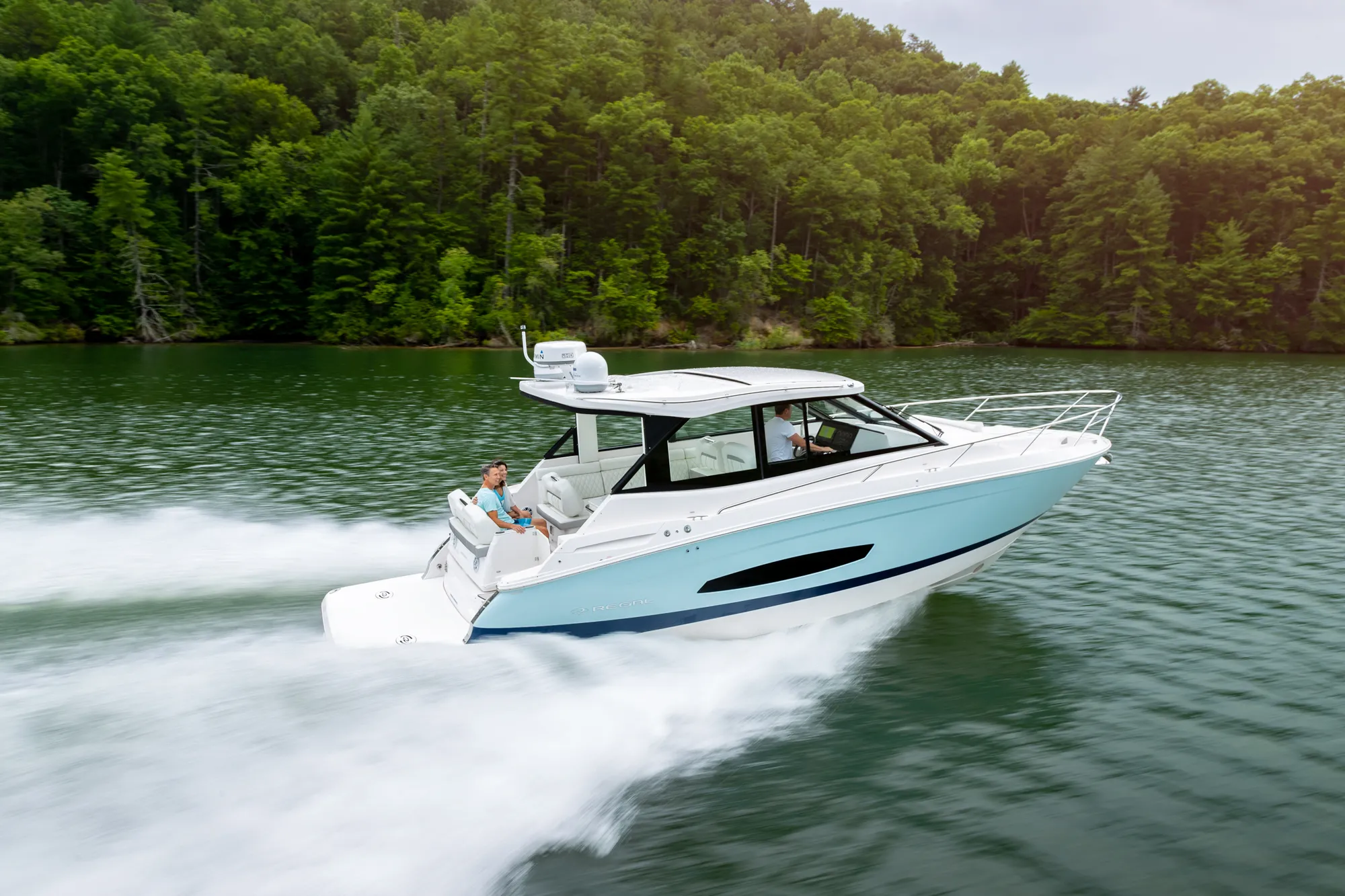
Regal 36 Grande Coupe37' 4"
View Specs & ReviewIndian Shores to Palm Harbor — the boat-only beaches
Yachting in Clearwater & Dunedin
A Minted Location · Clearwater & Dunedin, Florida
If your ideal beach is one no road reaches, this coast built its reputation on exactly that: Caladesi Island's three miles of sand are, in the ferry operator's own words, accessible only by boat, and the state park's C-Dock holds 26 day-use slips for owners who arrive on their own hulls. Behind the barrier islands runs a boater's main street — Clearwater Pass under a 74-foot fixed span, nothing but fixed high-rise bridges between the Gulf and downtown, and the city's 126-slip Clearwater Harbor Marina at Coachman Park with a free daytime side-tie on G dock.
Minted Yachts works this water from Indian Shores to Ozona, and everything below comes from each facility's or agency's own published information — the same standard behind every yacht review on this site.
Straight talk matters here in 2026: the recent hurricanes hit these marinas hard, and two of the three municipal basins are mid-rebuild. The other side of that coin is a waterfront being built brand-new — and a downtown flagship that is open, published-rate, and taking transients today.
Where to keep a yacht in Clearwater & Dunedin
Clearwater dockage in 2026 is one open flagship and two rebuilds. Downtown, the city's Clearwater Harbor Marina at Coachman Park is fully in business: 126 first-come slips for boats 30 to 55 feet, 12 designated transient slips plus 1,556 linear feet of side-tie, overnight dockage at $3.50 a foot — and a free daytime side-tie on G dock, 8 a.m. to 9 p.m. with a four-hour limit, that turns downtown lunch runs into a habit. Across the water, Clearwater Beach Marina is mid-way through a two-phase dock renovation with no transient or day docks during the work (the charter fleet runs on), and Dunedin's 192-slip municipal basin is closed for its own storm recovery. Private facilities carry the load meanwhile: Marker 1's 150 wet and lift slips at the Dunedin Causeway, the high-and-dry houses on The Narrows, and the fuel docks at Ozona. Figures below are what each facility publishes about itself.
Marinas
| Name | Where | Max yacht | Slips | Fuel |
|---|---|---|---|---|
| Clearwater Harbor MarinaThe downtown flagship: 126 first-come slips for 30–55 ft boats regardless of residency, a designated Clean & Resilient Marina with security, showers, laundry and pump-out, beside the Cleveland Street district — ICW access at the 74-ft fixed Memorial Causeway span. | Downtown Clearwater — Coachman Park, 206 Pierce St | 55 ft | 126 | — |
| Clearwater Beach MarinaThe beach basin is being rebuilt new — the charter and tour fleet runs on from new Coronado Drive slips, 24-hour security stays, no drawbridge separates the marina from the Gulf, and it keeps its designated Clean Marina flag; the Coast Pilot puts the harbormaster on VHF 16 (727-462-6954). | Clearwater Beach — 25 Causeway Blvd, at the turning basin | — | — | Temporary fuel dock during the rebuild — ValvTect gas & diesel when running; the new fuel dock is not yet operational |
| Dunedin Municipal MarinaDunedin's basin at the foot of Main Street — 192 slips (170 recreational, 9 commercial, 6 day docks, 6 municipal, 1 ADA) behind two protective moles, with 5 ft reported on the approach and 4 ft alongside (2006 report) — rebuilding toward its next chapter on the same downtown waterfront. | Downtown Dunedin — 51 Main St, east of GIWW Mile 139.3 | — | 192 | — |
| Marker 1 MarinaLoggerhead's basin at the causeway to Honeymoon Island — 150 wet and lift slips to 60 ft plus 331 dry-stack racks to 45 ft, reached by a marked channel east from GIWW Mile 141.8 with 6 ft reported (2006 report); the Coast Pilot notes a 10-ton lift and hull, engine and electronic repairs — the corridor's main service point. | Dunedin — 343 Causeway Blvd, foot of the Dunedin Causeway | 60 ft | 150 | Fuel dock on site |
| Largo Intercoastal MarinaServing boaters since 1961 on The Narrows — two fully enclosed storage buildings plus two covered areas. The Coast Pilot notes berths, fuel, wet and dry storage, lifts to 30 tons and hull, engine and radio repairs among the marinas opposite Indian Rocks Beach at Mile 128.8 — the region's biggest published haul-out capacity. | Largo — 12458 145th Lane, on The Narrows | — | — | Fuel dock on site |
| Harbourside Marina at Holiday Inn HarboursideThe resort basin on the ICW at the Indian Rocks Beach bridge, part of the Holiday Inn Harbourside complex beside Jimmy Guana's restaurant — the one overnight-resort tie-up option between Belleair and Clearwater Beach. | Indian Rocks Beach — 401 2nd St, on the ICW at the IRB bridge | — | — | — |
| Home Port MarinaOzona's gated full-service basin: covered and uncovered wet slips, secure high-and-dry barns, ship store and night watchman, a Florida Clean Marina participant — with Ozona Blue Grilling Co. and a pool on the property. | Ozona / Palm Harbor — 135 Orange St | — | — | 90-octane non-ethanol only — no diesel carried |
| Ozona Fish CampThe family-owned fish camp of the sound — live and frozen bait, rod-and-reel repair, 24-hour storage access and a Clean Marina participant; the Coast Pilot charts its dredged channel east from GIWW Mile 143.4 with a lift to 4 tons. | Ozona / Palm Harbor — 286 Shore Dr, on St. Joseph Sound | — | — | Non-ethanol fuel dock |
| Belleair Causeway Boat RampPinellas County's flagship ramp for Clearwater Harbor and Sand Key — 108 trailer spaces, 98 car spaces, a fishing pier and an on-site bait house, beneath the 75-ft fixed Belleair Causeway span at GIWW Mile 131.8. | Belleair Bluffs — 3900 W. Bay Dr, under the causeway | — | — | — |
| Island Estates & City Public Boat SlipsClearwater's small-boat safety net, straight from the city's boating page — public slips “located behind Island Way Grill,” rec-center day dockage on the beach, and a round-the-clock launch at Seminole Street. | Island Estates & Clearwater Beach — city day dockage | — | — | — |
Yacht clubs
| Name | Where | Max yacht | Slips | Fuel |
|---|---|---|---|---|
| Clearwater Yacht ClubHistory dating back to 1911 on the Clearwater Pass side of the beach — a fully upgraded marina with dockmaster services, dining rooms, tiki deck and pool, minutes from the Gulf through the 74-ft pass. | Clearwater Beach — 830 S. Bayway Blvd, near Clearwater Pass | — | — | — |
| Dunedin Boat ClubEstablished 1929 — one of the oldest sailing clubs in the state, more than 350 members strong, now fundraising to rebuild its hurricane-lost clubhouse on the same marina site the Coast Pilot has long charted a boat club on. | Dunedin Municipal Marina — the south mole | — | — | — |
| Clearwater Community Sailing CenterThe approachable on-ramp to this market's sailing life: a 501(c)(3) nonprofit with a fleet of over 50 boats for public and member use — sailboats, kayaks, windsurfers and paddleboards, lessons for all ages, summer camps and youth race teams. | Sand Key — 1001 Gulf Blvd, across from Sand Key Park | — | — | — |
Figures are as each facility publishes them on its own site; blank cells mean the facility doesn't state a number. Confirm slip availability and current rates directly — or ask us to make the calls.
Cruising from Clearwater & Dunedin
The pass. Clearwater Pass is the region's all-weather Gulf inlet — a dredged, well-marked channel between Sand Key and Clearwater Beach Island, junctioning with the GIWW at Mile 135.5, crossed by the fixed Sand Key bridge with 74 feet of clearance. Tidal current in the pass averages about 1.2 knots, and Coast Guard Station Sand Key stands a mile south. A dredged side channel runs north to the turning basin at the west end of Clearwater Memorial Causeway, where the harbormaster assigns berths (VHF 16, 727-462-6954).
The inside route. The GIWW here is a 9-foot, 100-foot-wide federal project — channels may shoal several feet between dredgings, so current controlling depths come from the Army Corps. From the south, The Narrows enters at Mile 125.5: about 4.5 miles of tight water where rocks covered at high water flank the west side near the south end — favor the east bank — under the SR-688 bascule at Mile 128.2 (21 feet closed, VHF 9). Then it opens into Clearwater Harbor, seven miles of mostly shoal water where the marked channels run 5 to 14 feet and some sections are quite crooked; in 1972 pilings of a former pier were reported near Mile 134.2 by Belleview Island. The bridges are the good news: Belleair Causeway is fixed at 75 feet (Mile 131.8) and Memorial Causeway fixed at 74 feet (Mile 135.9) — no opening schedule anywhere from The Narrows to downtown. One caveat at the beach: the fixed span over Mandalay Channel just north of the municipal marina basin clears 14 feet at its center, capping air draft on the inside route up Clearwater Beach Island.
North to the islands. Dunedin Pass was reported shoaled to 1 foot and closed to navigation in 1984 — it is not a usable inlet. Hurricane Pass, between Caladesi and Honeymoon islands, carried 3 to 5 feet with local knowledge per a 1982 report, and the flats west and north of Honeymoon Island were reported shoaled to bare in 1991 — so run the inside via St. Joseph Sound and the Dunedin Causeway bascule (24 feet closed, VHF 9, Mile 141.9). Five miles off the sound the current floods north at 0.4 knot and ebbs south at 0.6.
Caladesi. The park basin hides inside Seven Mouth Creek on the island's northeast side, west of GIWW Mile 141.1, behind a privately marked channel with 4 feet reported (2006 report). Day use only for now: 26 C-Dock slips plus a T-Dock, $6 per boat, 8 a.m. to sunset — no power, water or overnight stays while the park works through its hurricane damage.
- Caladesi Island State Park — St. Joseph Sound — basin west of GIWW Mile 141.1The region's boat-only prize: three miles of beaches the ferry operator says are accessible only by boat, behind a Clean Marina-recognized park basin inside Seven Mouth Creek — privately marked channel, 4 ft reported (2006 report). Day use reopened and the ferry resumed June 29, 2026.
- Honeymoon Island & Hurricane Pass — End of the Dunedin Causeway — northern St. Joseph SoundThe causeway-end island where the Caladesi ferry departs daily — daybeacons mark Hurricane Pass between the two islands, a private-buoyed fish haven lies about 4.5 miles west of the pass, and the sound's current floods north at 0.4 knot, ebbs south at 0.6.
On the Clearwater & Dunedin calendar
Sunsets at Pier 60 — the nightly festival on Clearwater Beach, running two hours before to two hours after sunset, weather permitting, with local artisans and street performers in Pier 60 Park — over 29 years and counting, by the festival's own account.
The Caladesi ferry rhythm — the ferry runs daily between Honeymoon Island and Caladesi Island, a 20-minute ride the concessionaire calls fun for a reason; service resumed June 29, 2026 as the park reopened for day use.
Dunedin Boat Club — racing, cruising, fishing, paddling and education programs since 1929, one of the oldest sailing clubs in the state with more than 350 members, rebuilding its hurricane-lost clubhouse on the marina's south mole.
Clearwater Community Sailing Center — the public on-ramp on Sand Key: a fleet of over 50 boats for public and member use, lessons for all ages, summer camps and youth race teams, Tuesday through Sunday.
Yachts we'd shortlist for Clearwater & Dunedin
Reviewed the same way as everything on this site — specifications verified against the builder's own numbers.
Frequently Asked Questions
Is Clearwater Beach Marina open to transient boaters?
Not during the rebuild. The city's page states the docks are in an extensive two-phase renovation with no transient or day docks available, a temporary fuel dock being installed (ValvTect gas and diesel when running), and the charter and tour fleet fully operational from new Coronado Drive slips. The same page cites full completion as August 2026 in one place and July 2026 in another — so call the marina office at (727) 562-4955, option 2, for current status. There's no drawbridge between the marina and the Gulf.
Is Clearwater a good home port?
For an owner who wants Gulf access without drawbridge arithmetic, it's hard to beat: a 74-foot fixed pass, fixed 74- and 75-foot spans over the whole harbor run, a downtown municipal marina with published transient rates, and Caladesi's boat-only beaches twenty-odd waterway miles from Indian Shores. The honest caveats: two municipal basins are mid-rebuild through 2026, and the thin water outside the channels demands chart discipline. Tell us how you'll use this water and we'll match the boat: TS@MintedYachts.com or +1 (404) 805-9819.
Which Clearwater-area restaurants can I reach by boat?
Salt Rock Grill in Indian Shores says it in its own words — visit by land or by sea — with waterfront seating on the Intracoastal. Island Way Grill has a city-sourced answer: Clearwater's Island Estates public boat slips are located directly behind the restaurant. Olde Bay Café sits over the Dunedin Marina and stays open through the basin's rebuild, per the city — check local dockage options meanwhile. At Clearwater Beach, Crabby's Dockside and Marina Cantina front the city marina, which has no transient docks until its renovation wraps — planned for summer 2026, per the city's page.
What are the bridge clearances around Clearwater and Dunedin?
The through-route is generous: Clearwater Pass's Sand Key bridge is fixed at 74 feet, the Belleair Causeway fixed at 75 (GIWW Mile 131.8) and the Memorial Causeway fixed at 74 (Mile 135.9) — no openings to schedule from The Narrows to downtown. The exceptions: the SR-688 bascule at Mile 128.2 (21 feet closed) and the Dunedin Causeway bascule at Mile 141.9 (24 feet closed), both answering VHF channel 9, and the 14-foot fixed span over Mandalay Channel just north of the Clearwater Beach basin. All per Coast Pilot 5 (09 AUG 2026 edition).
Where can visiting boats dock in Clearwater?
Downtown, at the city's Clearwater Harbor Marina beside Coachman Park: 126 first-come slips for boats 30 to 55 feet regardless of residency, with 12 designated transient slips plus 1,556 linear feet of side-tie. Overnight transient dockage runs $3.50 a foot ($17.50 a foot weekly, $53.27 monthly), and the G dock offers a free daytime side-tie from 8 a.m. to 9 p.m. with a four-hour limit. It's a designated Clean & Resilient Marina with security, showers, laundry and pump-out, off the 74-foot fixed Memorial Causeway span.
Can I take my own boat to Caladesi Island?
Yes — that's the point of it. The state park reopened for day use effective June 29, 2026: C-Dock is open with 26 day-use slips plus a T-Dock for a larger vessel, $6 per boat, 8 a.m. to sunset, 365 days a year. No power or water on the dock and no overnight marina stays while Hurricane Helene repairs continue. The approach is a privately marked channel into Seven Mouth Creek west of GIWW Mile 141.1 with 4 feet reported (2006 report). The ferry from Honeymoon Island runs daily if you'd rather ride — the island's three miles of beaches are otherwise accessible only by boat.
Which Gulf passes are usable north of Clearwater Pass?
Treat Clearwater Pass as the inlet, full stop. Dunedin Pass was reported shoaled to 1 foot and closed to navigation in 1984, and that report still stands in the current Coast Pilot. Hurricane Pass, between Caladesi and Honeymoon islands, carried 3 to 5 feet with local knowledge per a 1982 report — daybeacon-marked, shifting, local-knowledge water. And the flats west and north of Honeymoon Island were reported shoaled to bare in 1991. Bound north, run inside through St. Joseph Sound and the Dunedin Causeway bascule instead.
Is the Dunedin Marina open?
The marina itself is closed due to extensive hurricane damage — basin, boat ramp, day docks and fishing pier — with no transient slips available, per the city's marina page. The same page notes the commercial charter businesses and Olde Bay Café are open. The basin holds 192 slips in normal times: 170 recreational, 9 commercial, 6 day docks, 6 municipal and 1 ADA. The Harbormaster is at 727-298-3030 for current status; nearby, Marker 1 Marina on the Dunedin Causeway remains the area's full-service private basin.