
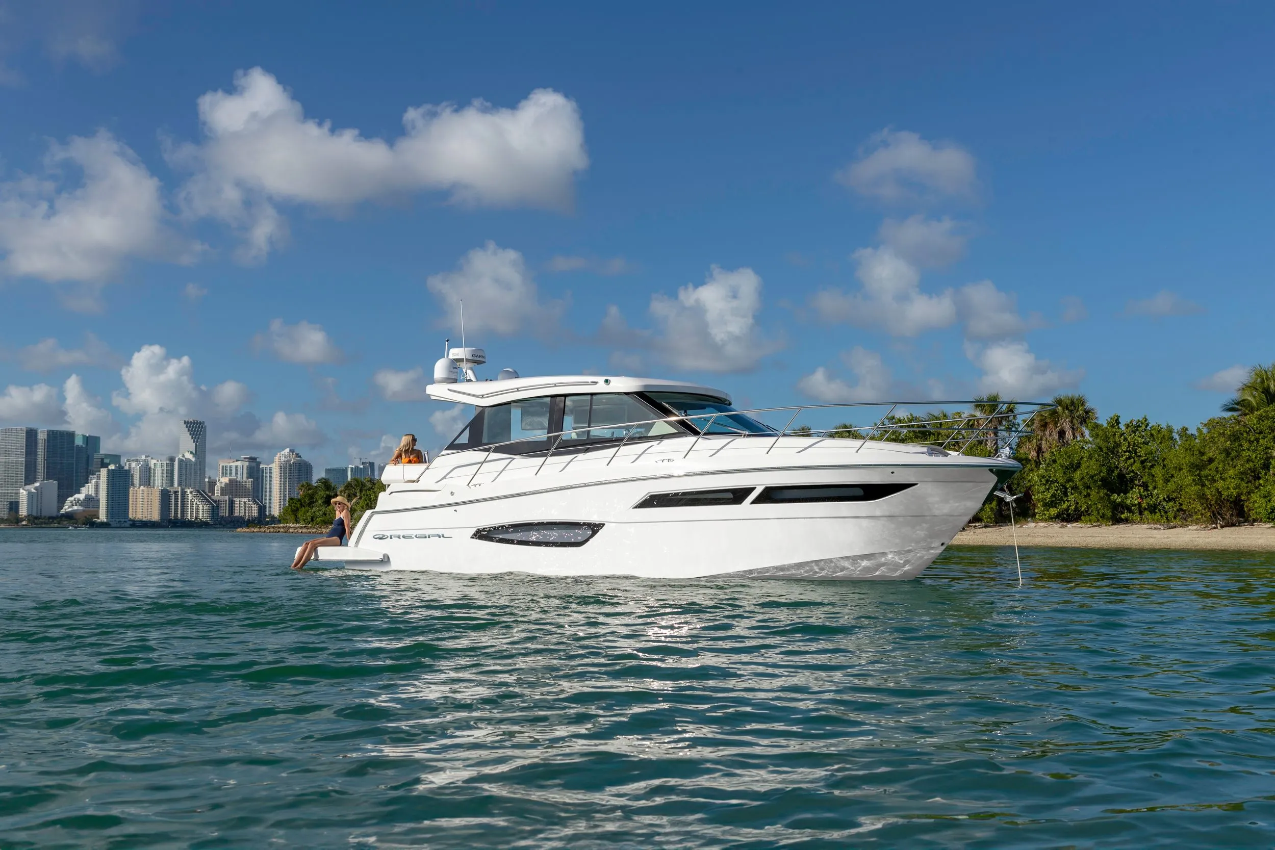
Regal 38 Grande Coupe38' 1"
View Specs & ReviewSarasota Bay from Big Pass to the Manatee River
Yachting in Sarasota & Bradenton
A Minted Location · Sarasota & Bradenton, Florida
If the plan is sandbar weekends, dinner you arrive at by water, and a bay that stays boatable when the Gulf turns rough, Sarasota Bay was drawn for you — a barrier-island lagoon with three passes to open water and a downtown marina that publishes its welcome. Marina Jack anchors the bayfront with 298 wet slips for vessels to 150 feet, more than 85 mooring balls off Island Park, and a promise most harbors can't make: 90 percent of its slips are open to the public first-come, first-served.
Minted Yachts works this coast from Big Pass to the Manatee River, and everything below comes from each facility's or agency's own published information — the same standard behind every yacht review on this site.
For an owner, this market is really three waters: Sarasota's cultured bayfront, where the slips, the moorings and the restaurants share one address; the keys — Longboat, Anna Maria and the 1880s fishing village of Cortez — where the sandbars and the fish houses live; and the Manatee River, a reach the Coast Pilot calls well protected from all directions. Pick your water, and the boat follows.
Where to keep a yacht in Sarasota & Bradenton
Dockage here sorts into three clusters. The downtown bayfront is Marina Jack's — 298 wet slips to 150 feet, more than 25 lifts, the mooring field and the region's principal fuel dock, reached by a dredged channel that reported 12 feet in 2013. Out on the keys, the Longboat Key Club Moorings runs 291 resort slips for vessels to 150 feet behind a 24-hour guard gate, Bird Key's private club holds the mid-bay position, and Safe Harbor Siesta Key runs the valet dry-storage fleet at Stickney Point. And the Manatee River is the region's sheltered row: Twin Dolphin's walled harbor at downtown Bradenton, Riviera Dunes' 219-slip basin averaging 18 feet, Regatta Pointe's transient slips to 100 feet, and Pier 77's bridge-free shot at the Gulf. Figures below are what each facility publishes about itself.
Marinas
| Name | Where | Max yacht | Slips | Fuel |
|---|---|---|---|---|
| Marina JackThe bayfront's anchor since 1968 — 298 wet slips to 150 feet, more than 25 lifts for boats to 53 feet, 30/50/100-amp power and the region's principal fuel dock; the Coast Pilot reported 12 feet in the dredged approach and 10 alongside the turning basin in 2013. | Downtown Sarasota — the Bayfront, east of Golden Gate Point | 150 ft | 298 | Hi-flow diesel & 90-octane rec gas; pump-out on all three sides of the fuel dock, plus in-slip pump-out |
| Longboat Key Club MooringsThe keys' resort basin: 291 slips for vessels to 150 feet behind a 24-hour manned guard gate, with pool, tennis and dining privileges for slip holders and a claimed Florida Clean Marina designation. | Longboat Key — bay side, near New Pass | 150 ft | 291 | Fuel dock with diesel, gas & pump-out |
| Safe Harbor Siesta KeyThe south bay's dry-storage and service house — a full yard covering canvas, electrical, electronics, engines, fiberglass, hydraulics, welding and paint, with Mercury, Power-Pole and Yamaha certifications. | Siesta Key — Old Stickney Point Rd, south bay | — | — | ValvTect marine gas, high-speed pumps, daily 7:30–4:30 |
| Safe Harbor Pier 77The bridge-free berth nearest the passes: wet slips to 45 feet, dry storage 20–40 feet (max 35 tons) in a building rated to withstand 150 mph winds, gated docks, pump-out and two restaurants on site. | Bradenton — Anna Maria Sound / Palma Sola | 45 ft | — | ValvTect gas & diesel, ethanol-free 90 octane, daily 8–5 |
| Twin Dolphin MarinaDowntown Bradenton's basin: a walled harbor on the Manatee River within walking distance of PIER 22, Old Main Street and the Riverwalk — slip figures aren't published on its reachable pages, so call the office for yours. | Downtown Bradenton — south bank of the Manatee River | — | — | — |
| Riviera Dunes MarinaThe hurricane-hole of the river, by its own billing — 219 wet slips for vessels 35 to 110 feet in a deep sheltered basin, with dockside pump-out for slip holders. | Palmetto — protected basin off the Manatee River's north bank | 110 ft | 219 | Gas & diesel |
| Safe Harbor Regatta PointeThe full-amenity river marina — ship's store, bathhouses, pool and fitness, with three waterfront restaurants on the property and unrestricted mast height below the bridges. | Palmetto — north bank of the Manatee River | 100 ft | — | ValvTect gas & diesel, non-ethanol 90 octane; fuel dock daily 8–5 |
Yacht clubs
| Name | Where | Max yacht | Slips | Fuel |
|---|---|---|---|---|
| Sarasota Yacht ClubThe bay's private club between downtown and the keys, with reciprocity through the Florida Council of Yacht Clubs — dockage specifics direct from the club. | Sarasota — John Ringling Blvd, near St Armands & Lido | — | — | — |
| Bird Key Yacht ClubThe 1960 club on its own island between downtown and the causeway — 42 slips for vessels 28 to 52 feet, with lifts for 28-foot boats. | Bird Key — mid-bay, off the Ringling Causeway | 52 ft | 42 | — |
| Sarasota Sailing SquadronThe community sailing club of the bay — instruction, racing and youth programs from its City Island grounds, with the Labor Day Regatta as its signature event. | City Island — Ken Thompson Parkway, overlooking New Pass | — | — | — |
Figures are as each facility publishes them on its own site; blank cells mean the facility doesn't state a number. Confirm slip availability and current rates directly — or ask us to make the calls.
Cruising from Sarasota & Bradenton
The passes. All three carry Coast Pilot warnings, and locals treat that as the region's entrance exam. Big Sarasota Pass, between Siesta and Lido keys, is marked by private daybeacons — the approach over the bar and the channel through the pass are subject to continual changes, and the Coast Pilot advises extreme caution; flood sets north at an average 1.5 knots, ebb south at 1. New Pass shoals too, and its buoys are shifted so often to mark best water that they are not charted — local knowledge advised — with a 23-foot bascule over the pass (bridgetender on VHF 9, 941-355-7107). Longboat Pass is the one with a federal project behind it: a 1975 authorization for a 12-foot MLLW entrance channel and a 10-foot inner channel, 100 feet wide, with WCIND as local sponsor — yet its entrance still changes continually, shoaling arcs west and south off Anna Maria Island's south end, and its currents are the strongest of the three (flood 1.8 knots east, ebb 1.6 west) under a 17-foot bascule.
The waterway and the bridge ladder. The federal project for the waterway through the bay is 9 feet deep and 100 feet wide, and the Coast Pilot warns channels may shoal several feet between maintenance dredgings. South to north: Blackburn Point swing bridge, 9 feet, at Mile 63.1; Stickney Point bascule, 18 feet, at Mile 68.6; Siesta Drive bascule, 25 feet, at Mile 71.6; Ringling Causeway, the run's only fixed span, 65 feet vertical and 100 horizontal at Mile 73.6; Cortez bascule, 22 feet, at Mile 87.2; Anna Maria Island bascule, 24 feet, at Mile 89.2 — then Tampa Bay at Mile 92.0. Anything over 65 feet of air draft routes around Ringling by way of a pass.
The bay. The Coast Pilot describes Sarasota as a year-round community and winter resort with several marinas, boatyards and yacht basins; Hudson Bayou (5 feet reported, 1982) and Whitaker Bayou (about 4 feet reported, 2001) both provide excellent shelter for small craft. This is also manatee water: FWC Slow Speed All Year zones ring City Island, New Pass, the Ringling shorelines, Bird Key and the Lido edges of Big Pass, Pansy Bayou is No Entry All Year, and marked corridors in Roberts Bay carry 25 and 35 MPH zones — FWC's own caveat is to abide by the regulations as posted on the water.
Cortez and Anna Maria Sound. The sound joins Sarasota Bay to Tampa Bay, flood currents off Cortez setting north-northwest at about 0.6 knot with a weak ebb. Cortez itself is the region's soul — a commercial-fishing village documented since the 1880s, its historic district on the National Register since 1995, with the Coast Pilot noting fish wharves at the east end of the bridge where party boats moor, a yard at the west end with lifts to 77 tons (6 feet reported alongside, 2015) and the Coast Guard station nearby. The Florida Maritime Museum, run by Manatee County's Historical Resources Department, is temporarily closed for a building rehabilitation — check its site before planning a visit.
The Manatee River. The Coast Pilot's line is the recommendation: the river is well protected from all directions and affords good storm anchorage for small boats. Centerline controlling depths reported 6.5 feet (1995) to Daybeacon 31 near Rocky Bluff, then 4 feet to the I-75 bridge; the Bradenton municipal pier reported 9 feet alongside in 2011. Twin Dolphin, Regatta Pointe and Riviera Dunes all lie below the 41-foot fixed U.S. 41 bridge, so its clearance only matters if you continue upriver. A special anchorage sits on the north side just east of McKay Point (33 CFR 110.74a), and at the river's mouth the National Park Service designates De Soto Cove — where Hernando de Soto's army made landfall in 1539 — a temporary anchorage for small pleasure boats, with loud motors and excessive wake prohibited.
- Sarasota Bay Mooring Field — Sarasota bayfront — off Island Park, run by Marina JackThe managed hook for the bayfront: dinghy docks behind Marina Jack II and at the tiki bar dock, shower and laundry access, freshwater at the fuel or dinghy dock, and a pump-out vessel that works the field daily.
- Big Sarasota Pass sandbar — Between Siesta Key and Lido KeyThe classic Sarasota raft-up, earned with local knowledge: private daybeacons mark a channel in continual change, flood runs north at 1.5 knots average, and FWC Slow Speed All Year zones fringe the Lido, Bird Key and Siesta shorelines.
- Jewfish Key & the Longboat Pass sandbar — Inside Longboat Pass, between Longboat Key and Anna Maria IslandThe north-bay raft-up under the 17-foot Longboat Pass bascule — the pass entrance changes continually with shoaling arcs off both keys, and the strongest currents of the three passes (flood 1.8 knots, ebb 1.6), so set the hook with respect.
- Otter Key & the Lido pocket — Behind Lido Key, off New PassThe sheltered lunch hook behind Lido — the sourced rules are the story here: slow-speed manatee zones ring City Island, New Pass and the Lido shorelines, and Pansy Bayou next door is closed to entry except residents.
- De Soto National Memorial — The Cove — De Soto Point — mouth of the Manatee River, BradentonA national-park lunch hook where Hernando de Soto's army made landfall in 1539 — the Cove Beach on the point's south side is sheltered from most currents and waves, and hand-carried kayaks may launch from the park beaches.
On the Sarasota & Bradenton calendar
The Labor Day Regatta — the Sarasota Sailing Squadron's signature regatta, sailed from its City Island grounds overlooking New Pass; dates and notices of race on the Squadron's own regattas page.
The Cortez waterfront calendar — the Florida Maritime Museum anchors the historic district's story but is currently closed for a necessary building rehabilitation, per its own site; watch its pages for the reopening before building a shore day around it.
Yachts we'd shortlist for Sarasota & Bradenton
Reviewed the same way as everything on this site — specifications verified against the builder's own numbers.
Frequently Asked Questions
Which Sarasota-area restaurants can I reach by boat?
The ones that publish it: Dry Dock Waterfront Grill on Longboat Key lists Marker 6 via boat; in Cortez, Swordfish Grill posts Mile Marker 49 by boat and Tide Tables answers at Mile Marker 48; Riverhouse sits at the end of the Regatta Pointe pier with the marina's 18-to-100-foot transient slips; and the Bradenton Beach City Pier pairs a first-come public day dock with the Anna Maria Oyster Bar on the pier itself. Marina Jack's three bayfront venues stand over its own 298-slip marina, and its public slips also serve O'Leary's next door.
Where can I dock on the Manatee River?
Three basins, all below the 41-foot fixed U.S. 41 bridge so its clearance never touches you. Twin Dolphin Marina is the downtown Bradenton stop — a protected, walled harbor within walking distance of PIER 22 and the Riverwalk. Riviera Dunes in Palmetto publishes 219 wet slips for vessels 35 to 110 feet in a sheltered basin averaging 18 feet deep. And Safe Harbor Regatta Pointe takes transients from 18 to 100 feet with 8 feet of draft and unrestricted height. The Coast Pilot calls the river well protected from all directions — good storm anchorage for small boats.
What are the bridge clearances through Sarasota Bay?
South to north on the waterway, per the Coast Pilot: Blackburn Point swing bridge 9 feet (Mile 63.1), Stickney Point bascule 18 feet (Mile 68.6), Siesta Drive bascule 25 feet (Mile 71.6), Ringling Causeway fixed at 65 feet (Mile 73.6), Cortez bascule 22 feet (Mile 87.2) and the Anna Maria Island bascule 24 feet (Mile 89.2). Off the waterway, New Pass's bridge closes at 23 feet and Longboat Pass's at 17. Ringling is the only span that never opens — more than 65 feet of air draft routes to the Gulf through a pass instead.
Where do boats anchor and raft up around Sarasota?
The sandbar culture lives at the passes — the Big Sarasota Pass bar between Siesta and Lido keys, and the Jewfish Key flats inside Longboat Pass — both fringed by FWC Slow Speed All Year manatee zones, so come off plane early. Behind Lido, the Otter Key pocket is the sheltered lunch hook, with Pansy Bayou beside it closed to entry. Off the bayfront, Marina Jack runs 85-plus storm-rated moorings with a daily pump-out vessel, and at the Manatee River's mouth the National Park Service designates De Soto Cove a temporary anchorage for small pleasure boats.
Which pass should I use between Sarasota Bay and the Gulf?
The one you have current local knowledge for — the Coast Pilot flags all three. Big Sarasota Pass is marked by private daybeacons and its channel is subject to continual changes, with extreme caution advised. New Pass shoals, and its buoys are shifted so often to mark best water that they are not charted. Longboat Pass carries the only federal project — a 1975 authorization for a 12-foot MLLW entrance channel and 10-foot inner channel, 100 feet wide — yet its entrance still changes continually, and its currents are the strongest of the three: flood 1.8 knots, ebb 1.6.
What is Cortez, and can I visit it by boat?
Cortez is one of the last working commercial-fishing villages on Florida's Gulf coast — fishing since the 1880s, with its historic district on the National Register of Historic Places since 1995. It sits on Anna Maria Sound at waterway Mile 87.2, under the 22-foot Cortez bascule; the Coast Pilot notes fish wharves at the bridge's east end and a yard with lifts to 77 tons at the west end (6 feet reported alongside, 2015). Two fish houses print their arrival by mile marker — Swordfish at 49, Tide Tables at 48. The Florida Maritime Museum is temporarily closed for a building rehabilitation.
Is Sarasota Bay a good home port?
For a bay-and-pass boater, it's one of the best-organized on this coast: a downtown marina with published first-come public access, a protected waterway behind the barrier keys, three routes to the Gulf and a storm-friendly river next door. The trade-offs are honest ones — every pass demands current local knowledge, the 65-foot Ringling span caps air draft on the inside run, and the manatee zones set the pace near shore. Tell us how you'll use the bay and we'll match the boat: TS@MintedYachts.com or +1 (404) 805-9819.
Where can I dock in downtown Sarasota?
Marina Jack, in the bight just east of Golden Gate Point. The marina publishes 298 wet slips for vessels to 150 feet, more than 25 boat lifts for boats to 53 feet, and more than 85 mooring balls — with 90 percent of the slips open to the public first-come, first-served. Shore power runs 30 to 100 amp single and three phase, the fuel dock pumps hi-flow diesel and 90-octane recreational gas with pump-out on three sides, and the Coast Pilot reported 12 feet in the dredged approach and 10 feet alongside the turning basin in 2013.