
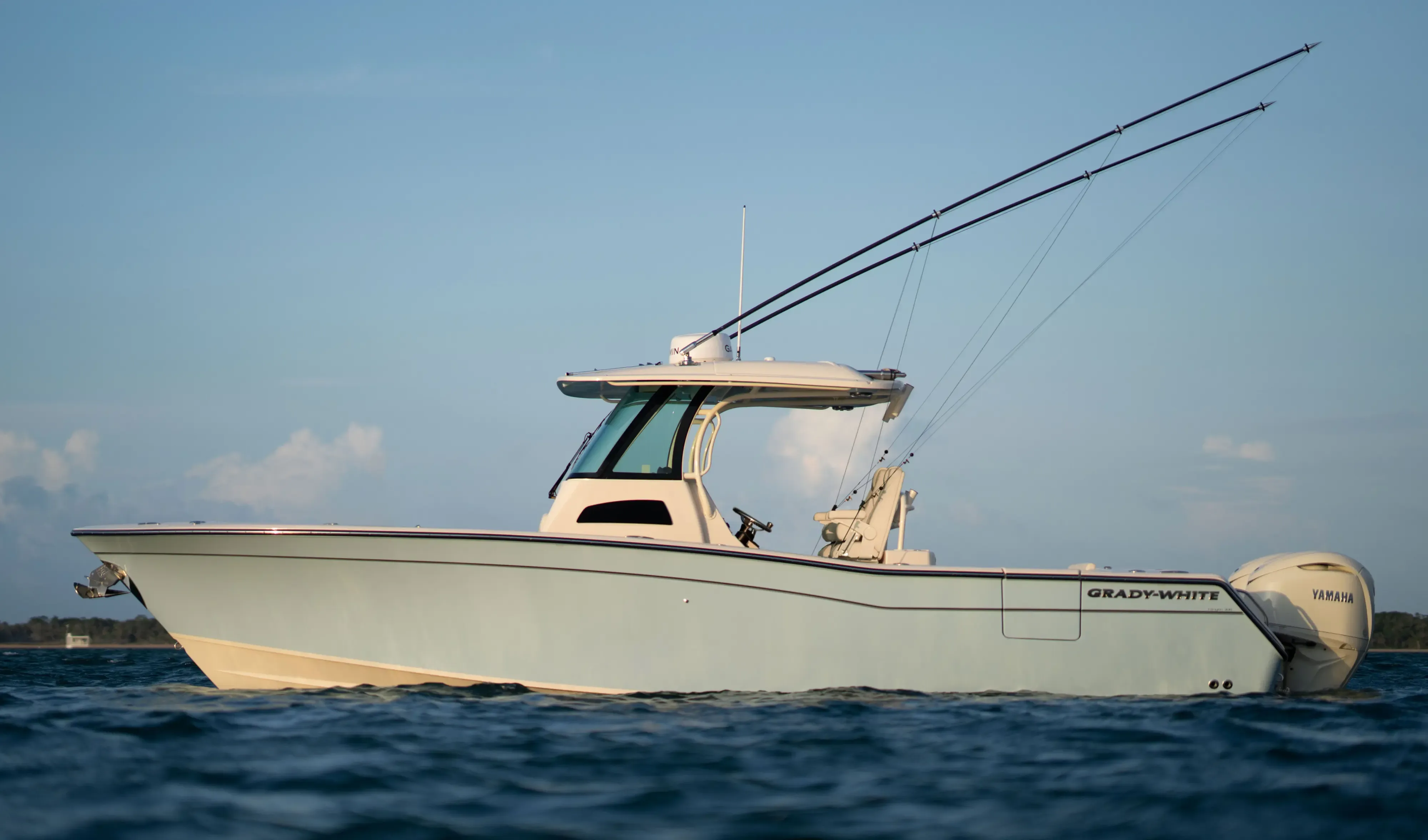
Grady White 306 Canyon30' 6"
View Specs & ReviewSixteen feet six inches — the number that decides which boats live here
Yachting in Santa Cruz
A Minted Location · Santa Cruz, California
A 60-foot slip in Santa Cruz will take a 70-foot boat. It will not take 17 feet of beam. That single number decides more about who can keep a boat in this harbour than anything else.
Here it is, from the Port District's own ordinances:
| Slip | Maximum boat length | Maximum beam |
|---|---|---|
| 40′ | 47′ | 13′6″ |
| Wide 45′ | 47′ | 16′0″ |
| 50′ | 58′ | 16′6″ |
| 60′ | 70′ | 16′6″ |
Sixteen feet six inches is the ceiling on both the 50-foot and the 60-foot slips. A very large share of modern 60-to-75-foot flybridge motoryachts are wider than 17 feet. In Santa Cruz a boat can be short enough and still not fit — and you find that out at the slip, not on a listing page.
There is one escape hatch, and it is narrow and discretionary: "certain dock areas are recognized to be situated in such a manner as to allow for even larger boats than listed. For these special areas as determined by the Harbormaster, prior written application must be made… and approval granted."
This is a sailing harbour. The calendar is one-design and dinghy racing, the biggest slip takes 70 feet, and the beam ceiling is exactly what you would expect a sailing harbour to have.
And you cannot plan a visit here. Guest berthing is first come, first served, reservations are not accepted, and the entrance shoals from November through May.
Plainly: a 60-to-70-foot yacht can be kept in Santa Cruz. It cannot be visited on a schedule.
Where to keep a yacht in Santa Cruz
Santa Cruz Harbor is a Port District facility, and it is where a boat lives here. It calls itself "a year-round harbor of safe refuge coupled with visitor berthing", with "over 800 permanent slips" by its own count; Coast Pilot gives "slips and end-ties for about 1,200 small craft", and the District's 2009 plan approximately 920 berths and dory ties.
Guest berthing is first come, first served, and reservations are not accepted. Rates are $1.50 per foot for recreational vessels ($42 minimum), $1.75 for multihulls ($52 minimum), and $2.25 per foot beyond 14 days ($63 minimum), with a two-week limit, 110V/20–30A power, rafting permitted and noon checkout. Guest-berth dimensions are settled on arrival rather than posted, so hail the Harbor Patrol on VHF 16 before you count on one for a big boat. The harbour speed limit is absolute: "No vessel in the harbor waters shall exceed 5 miles per hour under any circumstances."
A permanent 50- or 60-foot slip is a long wait, and the lists say how long. The July 2026 South Harbor waiting lists show the 50-foot list headed by an applicant dated 29 September 2000, and the 60-foot list containing applicants dated 5 January 1979 and 29 July 1981. Ten names on each. Plan a big boat here as a berth you acquire, not a berth you visit.
The fuel dock sells gasoline at $6.38 a gallon and diesel at $6.59 (commercial $6.18 and $6.39), updated 23 June 2026. Monday to Friday 08:00–16:00, Saturday and Sunday 07:00–16:00, hailing the attendant on VHF channel 9.
The boatyard is a DIY yard, open daily 09:00–18:00, publishing "haulouts to 50-metric tons" on "its new 50-metric ton Marine Travelift" — about 55 US short tons. Coast Pilot, edition 9 August 2026, gives the yard "a 40-ton mobile lift." Plan against the smaller figure, and confirm your length, beam and draft with the yard before you book. Haul-out runs $13.00 per foot for a monohull two-strap ($300 minimum) up to $19.00 for a multihull four-strap, with lay days at $1.50 per foot rising to $5.00 beyond 31 days.
The yacht club, founded in 1928, is trailer-boat scale rather than yacht scale — it owns "a 2.5 ton hoist located between D and E docks on the west side of the Santa Cruz Harbor" plus electric tugs for trailered boats, and has no club docks. Visitor and reciprocal arrangements are made by telephone.
Support around the harbour is genuinely good for a small port. The Harbor Patrol runs the county's marine search-and-rescue units — a 2013 20-foot Zodiac and a 2022 36-foot Moose Boat — offering emergency vessel towing and pump-out, with a commercial towing operator covering Santa Cruz, Moss Landing, Monterey and Pillar Point on 24-hour dispatch. There is a long-established marine electronics specialist of more than 35 years and an outboard service offering dockside service plus pickup and delivery.
The Municipal Wharf takes landings, not berths. NOAA describes it as "over 0.4 mile long with 26 feet alongside at its outer end… few vessels land except fishing boats", with "considerable surge." A small-boat hoist sits on the pier.
Moorings at Capitola are arranged by telephone. The operator monitors VHF channel 11, and rates, maximum LOA and season dates are settled on that call.
Marinas
| Name | Where | Max yacht | Slips | Fuel |
|---|---|---|---|---|
| Santa Cruz Harbor (Port District)The ceiling is beam, not length. The District's own ordinance table caps both the 50 ft and 60 ft slips at 16′6″ of beam, while the 60 ft slip takes 70 ft of length. A great many modern 60–75 ft flybridge motoryachts exceed 17 ft. Berth count runs "over 800 permanent slips" (District), "about 1,200 small craft" (Coast Pilot) and approximately 920 (the District's 2009 plan). Speed limit 5 mph, absolute. Entrance light at Walton Lighthouse, 36°57.38′N 122°00.05′W. | Woods Lagoon, between Point Santa Cruz and Soquel Point | 70 ft | 800 | Yes — see the fuel dock below |
| Santa Cruz Municipal WharfNOAA describes it as "over 0.4 mile long with 26 feet alongside at its outer end… few vessels land except fishing boats", with "considerable surge." A small-boat hoist is on the pier. | Off the beach, west of the harbour | — | — | — |
Yacht clubs
| Name | Where | Max yacht | Slips | Fuel |
|---|---|---|---|---|
| Santa Cruz Yacht ClubEstablished 1928, and trailer-boat scale rather than yacht scale: it owns "a 2.5 ton hoist located between D and E docks on the west side of the Santa Cruz Harbor" plus electric tugs for trailered boats, and has no club docks. | Santa Cruz Harbor | — | — | — |
Fuel docks
| Name | Where | Max yacht | Slips | Fuel |
|---|---|---|---|---|
| Santa Cruz Harbor Fuel DockOpen year-round, unlike much of the harbour's seasonal amenity layer. Weekend hours start an hour earlier than weekdays, which is worth knowing if you are leaving on the morning tide. | Santa Cruz Harbor | — | — | Gasoline $6.38/gal; diesel $6.59/gal (commercial $6.18 and $6.39), updated 23 June 2026 |
Figures are as each facility publishes them on its own site; blank cells mean the facility doesn't state a number. Confirm slip availability and current rates directly — or ask us to make the calls.
Cruising from Santa Cruz
The entrance is the defining constraint of this harbour, and the Port District does not hide it.
"Sand, which moves downcoast through the process of littoral drift, becomes trapped in the harbor entrance channel", and "shoaling conditions caused by littoral sand drift produce dangerous and unpredictable breaking wave formations at the harbor's entrance."
The District dredges the channel between 1 November and 1 May every year. The 2025–26 season began 25 November 2025, running "Monday – Thursday, with maintenance performed on Fridays", with coarse material permitted through 30 April 2026 and fine-grained north-harbour material through 28 February — concluding 29 April 2026.
Design depth is −22 feet MLLW for the entrance channel per the District's Dredge Management Plan and −20 feet MLLW per USACE, with the inner harbour at −8 to −10 feet. USACE also describes maintenance of two jetties, 850 and 1,125 feet long, an entrance channel 100 feet wide and 900 feet long, an inner harbour channel 150 feet wide, and a turning basin 300 feet wide and 207 feet long. Storm damage in December 2022 and January 2023 cost the west jetty armour stone and damaged the concrete cap.
What is actually in the channel matters more than the design depth. The live entrance sounding dated 21 July 2026 — depth corrected to 0 ft MLLW, one-foot contours — shows the dredged fairway carrying roughly 13 to 20 feet with isolated pockets to 22–24, and 6 to 10 feet immediately outside the fairway margins. That is the picture two and a half months after the dredge season ended and four months before the next one begins.
⚠️ THE WORST CASE, IN THE PORT DIRECTOR'S OWN WORDS
A notice signed 4 February 2024: "WARNING - Shoaled Conditions At The Harbor Entrance … Recent storm events and heavy sea conditions continue to challenge the Port District's dredging operation. Currently, the federal navigation channel is shallow, with shoaling extending across the entrance and breaking waves expected to occur at all tides. Mariners are advised to NOT transit the entrance at this time for their safety and the safety of their vessel."
The historic precedent is in the District's own plan: from 1965 to 1977 "the harbor would typically close due to shoaling sometime after November and stay closed until approximately March 30." Multi-phase dredging contracts were introduced from 1976 specifically so that "entrance closures would be kept to a minimum."
NOAA's guidance is unambiguous: *"The Santa Cruz harbormaster advises that extensive shoaling occurs at the harbor entrance from November through May. Persons unfamiliar with the area should contact the harbormaster's office prior to entering the harbor; a radio guard on VHF-FM channel 16 is maintained 24 hours a day… The Santa Cruz harbormaster further recommends that mariners without local knowledge should not attempt to enter the harbor during periods of high ground swells."* A patrol boat monitors channel 16 and will guide vessels in on request.
⚠️ There is a hard air-draft limit inside: "The least clearance for the bridges between the north and south basins is 18 feet." A flybridge yacht is shut out of the north harbour regardless of anything else. The Murray Street Bridge seismic retrofit runs a full closure from 10 June to September 2026, reopening one-way eastbound, with intermittent partial channel closures beneath the bridge since 4 August 2025 — though "access to the north harbor will remain open at all times."
The binding problems for a 60-to-80-foot yacht are not depth. A boat drawing 5 to 7 feet has water. The problems are width — a federal channel only 100 feet wide and 900 feet long, a tight current-swept slot in a swell — breaking seas over the shoal, and seasonality.
Exposure outside is an open roadstead. Coast Pilot: Monterey Bay is "a broad 20-mile-wide open roadstead", and "Santa Cruz Anchorage provides good shelter in north weather, but in northwest weather a heavy swell is likely to sweep into the anchorage. In south weather there is no protection in the harbor; vessels must run for Monterey or Moss Landing Harbor or take refuge in Santa Cruz Municipal small-craft harbor." Good anchorage can be had anywhere off the pier in five fathoms over sand.
Excellent shelter inside, an open roadstead outside, and an entrance whose hazard peaks in exactly the season the swell does.
The runs. Across to Monterey is about 20 nautical miles, with Moss Landing mid-bay as the third refuge. Compulsory pilotage applies in Monterey Bay east of the Territorial Sea line between Point Santa Cruz and Point Pinos, for foreign-registry vessels and US vessels under enrollment without a federal licensed pilot aboard. North, Pigeon Point is 22.5 miles and Pillar Point a further 20 — roughly 42 to 43 nautical miles to Pillar Point, which is itself 18 miles south of San Francisco. Pillar Point takes transients at anchor: "There are only private mooring floats in the harbor so transients must anchor." Its entrance is 200 yards wide at about 20 feet, with rocks and reefs extending southeast for over a mile from Pillar Point.
So the shape of the cruising ground is this: Santa Cruz is one leg of a three-harbour bay, with a 40-plus-mile open-coast passage to the next harbour north, where transients anchor rather than berth.
Tide comes from the next station down the bay. The local station, 9413745, is subordinate and carries only offsets against its reference, so work from Monterey, 9413450, epoch 1983–2001, referenced to MLLW: MHHW 5.34 · MHW 4.64 · MSL 2.83 · MLLW 0.00. Great Diurnal Range 5.34 feet, mean range 3.54.
Why that matters: a 5.34-foot range is the entire tidal cushion available over an entrance whose fairway margins read 6 to 10 feet even in July.
You are inside Monterey Bay National Marine Sanctuary here — 6,094 square statute miles, anchoring permitted, personal watercraft restricted to designated zones, and a 1,000-foot minimum overflight altitude. One jurisdictional nuance from the District's own plan: "The Harbor entrance, including the rubble-mound jetties, lie outside of the Sanctuary; however the dredge disposal pipelines and disposal areas, are located within the Sanctuary."
- Capitola moorings — Capitola, east of Soquel PointA mooring field off Capitola, run on the telephone rather than online: rates, maximum LOA, buoy count and season dates are all settled on that call.
- Santa Cruz Anchorage — Between Point Santa Cruz and Soquel PointNOAA: "Good anchorage can be had anywhere off the pier in 5 fathoms, sand bottom" — with the crucial qualifier that it "provides good shelter in north weather, but in northwest weather a heavy swell is likely to sweep into the anchorage. In south weather there is no protection in the harbor; vessels must run for Monterey or Moss Landing Harbor."
Service, refit & supplies
Shipyards & refit
| Name | Where | Max yacht | Dockage |
|---|---|---|---|
| Santa Cruz Harbor Boatyard"Haulouts to 50-metric tons" on "its new 50-metric ton Marine Travelift" — about 55 US short tons; NOAA Coast Pilot, edition 9 August 2026, gives the yard "a 40-ton mobile lift." Plan against the smaller figure, and confirm length, beam and draft with the yard before you book. Monohull two-strap $13.00/ft ($300 min) to multihull four-strap $19.00/ft; lay days $1.50/ft rising to $5.00 beyond 31 days. | Santa Cruz Harbor | — | DIY yard, open daily 09:00–18:00 |
Chandleries & specialty suppliers
- Santa Cruz Harbor Patrol — Santa Cruz HarborThe county's marine search-and-rescue units — a 2013 20-foot Zodiac and a 2022 36-foot Moose Boat — offering emergency vessel towing and pump-out. A patrol boat monitors VHF channel 16 and will guide vessels into the harbour on request, which matters more here than in most places.
- Marine electronics and engine service — Lake Avenue and Brommer StreetA marine electronics specialist "in the marine electronics business for over 35 years" and "one of the largest dealers… in the country" for the major brands, plus an outboard and engine service offering dockside service in Santa Cruz along with pickup and delivery for portable outboards, Monday to Friday 08:00–17:00.
- 24-hour commercial towing — Santa Cruz, Moss Landing, Monterey and Pillar PointTwenty-four-hour dispatch covering all four Monterey Bay-area harbours. Worth having in the phone before transiting an entrance that the Port Director has, on occasion, advised mariners not to attempt at all.
On the Santa Cruz calendar
The dredge defines the calendar. The entrance is worked 1 November to 1 May every year, and NOAA independently describes extensive shoaling from November through May. The comfortable, unqualified season is roughly May through October — about six months.
But the racing season is longer than the boating season proper. Wednesday Night Sailboat Races "begin for the season in March (with Daylight Savings), and run through fall ending in October," 18:30–20:00 — eight months on the water. That tells you what kind of harbour this is more clearly than any brochure: this is a sailing town, and the calendar is one-design and dinghy racing plus community festivals rather than boat shows and rendezvous.
Dated, from the club and the District:
- Año Nuevo Race — 1 August 2026
- Day on the Monterey Bay Regatta, the 34th — 9 August 2026
- The Saltwater Market — 15 August 2026, 12:00–16:00
- Fall One Design #1 — 15 August 2026
- Friday Evening Dinghy Racing — 21 August 2026
- MBYRA #4 Double Angle — 22 August 2026
- Fall SCORE Series #1 — 23 August 2026
- Tuesday Night Racing, weekly through at least 1 September
- Lighted Boat Parade — Saturday 5 December 2026, 17:30
The seasonal split shows up in the shore businesses too. The water taxi starts 2 May. One harbour restaurant publishes winter hours and states it "serves Breakfast and Lunch with Dinner service offered in the Summertime." The fuel dock and the boatyard, by contrast, run year-round.
The Thursday beach barbecues, the Halloween harbour event and the one-design national championship recur without fixed dates — set them with the club or the District when you plan around them.
Yachts we'd shortlist for Santa Cruz
Reviewed the same way as everything on this site — specifications verified against the builder's own numbers.
Frequently Asked Questions
How deep is the Santa Cruz Harbor entrance?
The design depth is −22 feet MLLW per the Port District's Dredge Management Plan and −20 feet MLLW per USACE. What is actually in the channel matters more: the live sounding dated 21 July 2026, which is close to the best case of the year, showed the dredged fairway carrying roughly 13 to 20 feet with isolated pockets to 22–24, and only 6 to 10 feet immediately outside the fairway margins. With a great diurnal range of 5.34 feet, that is the entire tidal cushion available. The federal channel is also only 100 feet wide and 900 feet long, and it shoals between November and May.
What size boat fits in Santa Cruz Harbor?
The ceiling is beam, not length, and that is the most useful thing to know about this harbour. The Port District's own ordinance table gives the 60-foot slip a maximum boat length of 70 feet and a maximum beam of 16 feet 6 inches — and the 50-foot slip carries the same 16'6" beam limit. A great many modern 60-to-75-foot flybridge motoryachts are wider than 17 feet, so a boat can be short enough for Santa Cruz and still not fit. There is one discretionary escape hatch: certain dock areas can take larger boats by prior written application to the Harbormaster.
Can a flybridge yacht get into the north harbour at Santa Cruz?
No. NOAA states that the least clearance for the bridges between the north and south basins is 18 feet, which shuts a flybridge yacht out of the north harbour regardless of its length, beam or draft. Note also that the Murray Street Bridge seismic retrofit runs a full closure from 10 June to September 2026, reopening one-way eastbound, with intermittent partial channel closures beneath the bridge since August 2025 — though access to the north harbour is stated to remain open at all times.
Is there dock-and-dine in Santa Cruz?
Not in the usual sense — you berth first and then walk, or take the water taxi. The Port District runs a free inner-harbour water taxi on weekends and holidays through the summer, plus Thursday evenings during the beach barbecues, stopping at X-1 Gate, AA Dock and the Launch Ramp. The 2026 season began 2 May. Take a berth, and then you are ferried to dinner.
Can you reserve a guest berth in Santa Cruz?
No. The Port District states that guest berthing is on a first-come, first-served basis and reservations are not accepted. Rates are $1.50 per foot for recreational vessels with a $42 minimum, $1.75 for multihulls, and $2.25 per foot beyond 14 days, with a two-week limit. Guest-berth dimensions are settled on arrival rather than posted, so hail the Harbor Patrol on VHF 16 before you count on one for a big boat. Permanent slips effectively never turn over — the July 2026 waiting list for 60-foot slips still contains applicants dated 1979 and 1981. A 60-to-70-foot yacht can be kept in Santa Cruz; it cannot be visited on a schedule.
How dangerous is the Santa Cruz Harbor entrance?
Seriously enough that the Port Director has advised mariners not to transit it at all. A February 2024 notice warned that the federal navigation channel was shallow with shoaling across the entrance and breaking waves expected at all tides. The District dredges every year between 1 November and 1 May because littoral sand drift produces dangerous and unpredictable breaking wave formations at the entrance, and NOAA states that extensive shoaling occurs from November through May and that mariners without local knowledge should not attempt entry during high ground swells. From 1965 to 1977 the harbour would typically close after November and stay closed until about 30 March.