
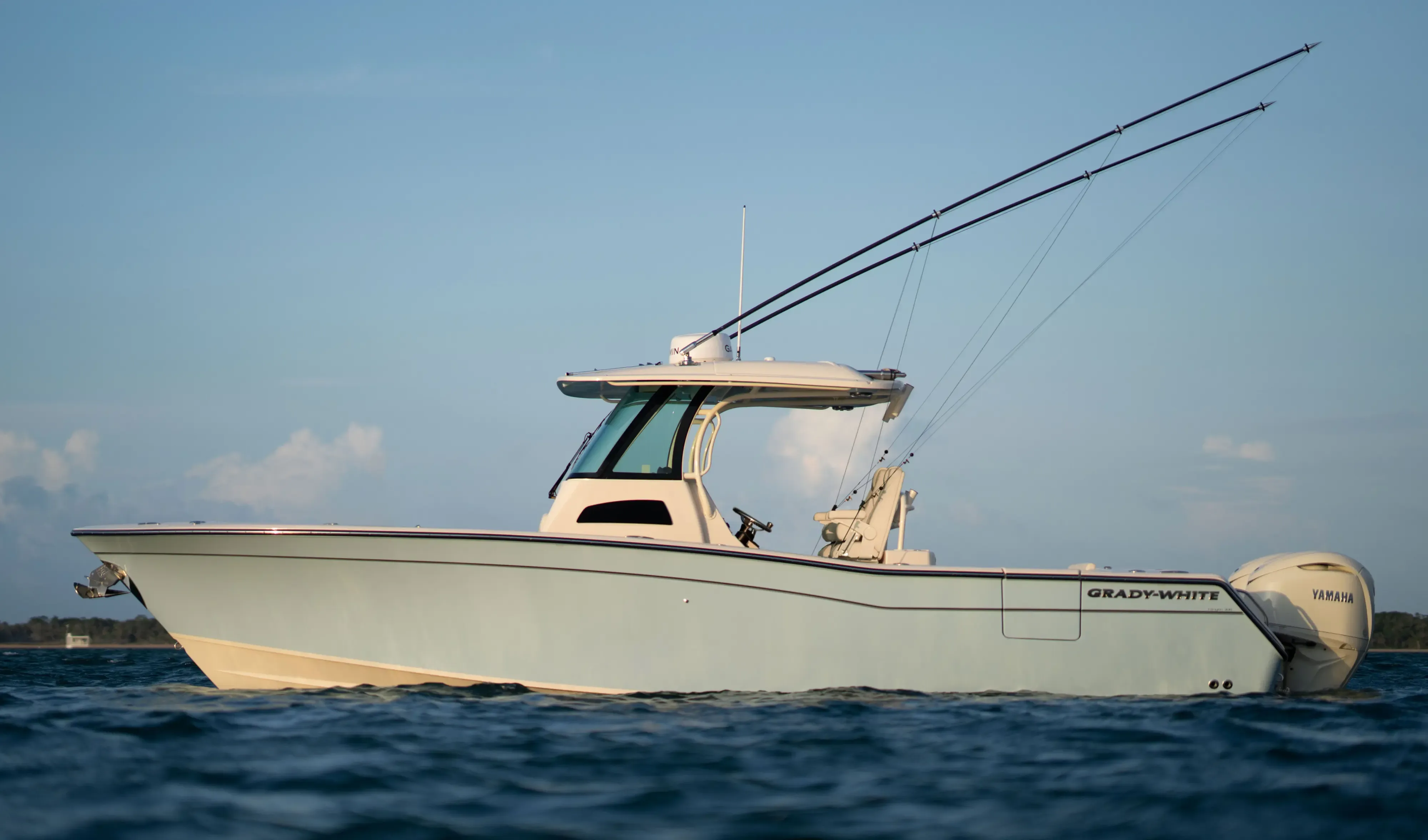
Grady White 306 Canyon30' 6"
View Specs & ReviewThe all-weather doorway — Fort Pierce Inlet to Vero Beach
Yachting in Fort Pierce
A Minted Location · Fort Pierce, Florida
When your passage plan says leave on the tide — any month, any weather window — Fort Pierce is the inlet you build the plan around. The city that runs the marina calls it the best all-weather inlet on the East Coast, and the numbers behind the reputation are federal: a 30-foot authorized entrance channel between two rubblestone jetties, a 28-foot inner channel and turning basin, and lighted ranges the whole way in. Fort Pierce is also a customs station, which is why boats coming home from the islands make their landfall here.
Minted Yachts works this inlet from the downtown slips to Vero's mooring field, and everything below comes from each facility's or agency's own published information — the same standard behind every yacht review on this site.
For an owner, the market runs in three clusters: the city's own 1937 marina on the downtown waterfront, the working inlet district along Seaway Drive and Taylor Creek — with Derecktor's 1,500-ton hoist at the port — and Vero Beach, the famous cruiser stop from Mile 966.5 to Mile 951.9 up the Intracoastal. Sportfish leave from here; passage-makers stage here. Pick your cluster, and the boat follows.
Where to keep a yacht in Fort Pierce
Fort Pierce dockage sorts into three clusters. Downtown is the Fort Pierce City Marina — city-run since October 28, 1937, entered off a marked channel just south of the South Bridge, with published transient rates and two restaurants on its own docks. The inlet district puts you closest to the Atlantic: Pelican Yacht Club's 93 slips between markers 11 and 13, Safe Harbor Harbortown's full-service basin and 150-ton lifts on Taylor Creek, and Taylor Creek Marina's 450-plus dry racks. And thirteen-odd miles north, Vero Beach City Marina and its managed mooring field are the most famous cruiser stop on this stretch of the ICW — with Loggerhead's 161-slip protected harbor across the river. Figures below are what each facility publishes about itself.
Marinas
| Name | Where | Max yacht | Slips | Fuel |
|---|---|---|---|---|
| Fort Pierce City MarinaCity-run since October 28, 1937, entered off a marked channel just south of the South Bridge — approach reported at 6.0 ft controlling (2004–2005 report), with the Coast Pilot warning of strong crosscurrents and an 85-ft power cable. Its two official sources cite different radio watches — the city page says VHF 16 and 17, the Coast Pilot says 9 and 16 (772-464-1245) — so hail both. Official IGFA weigh station, restaurants on the docks, monthly $43.50/ft. | Downtown Fort Pierce — west shore of the Indian River, ICW Mile 966.5 | — | — | Two fueling stations — diesel in slip, 89/90-octane non-ethanol gas |
| Safe Harbor HarbortownThe full-service basin on Taylor Creek: wet slips 25 to 100 ft, travel lifts to 150 tons with hydraulic trailers, dry storage to 120 ft open and covered, and the yard trades — fiberglass, electrical, engine, canvas, rigging — plus a pool and Skippers Cove Bar & Grill on the water. | Taylor Creek — north side of Fort Pierce harbor, 1936 Harbortown Dr | 100 ft | — | ValvTect gas & diesel, fuel dock 7–5 daily |
| Taylor Creek MarinaThe dry-stack house nearest the inlet, now flying the Suntex flag, with a ship store on site — the Coast Pilot credits it with berths, pump-out, wet and dry storage and hull, engine and electronic repairs, on a reported 6.5 ft alongside (2010 report) off the marked Taylor Creek channel. | Taylor Creek — 1600 N 2nd St, just inside the entrance | — | — | Marine-grade fuel; the Coast Pilot lists gasoline & diesel |
| Vero Beach City MarinaThe famous cruiser stop between Fort Pierce and the north — every slip open to the public, with laundromat, showers, lounge, mail service and free bus to town. The marked channel east of the waterway carries a reported 6.0 ft controlling (2007 report) to the turning basin; monthly $18.00/ft, annual $16.00/ft. | Vero Beach — Bethel Creek off ICW Marker 139, Mile 951.9 | — | — | Gas, diesel & pump-out on the 70-ft fuel dock — 8 to 10 ft approaches |
| Loggerhead Marina at Vero BeachThe protected harbor inside the Grand Harbor community — 161 wet slips for vessels to 120 ft overall, with pool and hot tub, captain's lounge, store, boat lifts and security behind the gate. | Vero Beach — Grand Harbor, west side of the Indian River | 120 ft | 161 | Fuel dock on site |
Yacht clubs
| Name | Where | Max yacht | Slips | Fuel |
|---|---|---|---|---|
| Pelican Yacht ClubThe closest full marina to the inlet — its own page counts 93 slips while the Coast Pilot notes about 92 open berths on a reported 6 ft (2006 report); Sunset Cove Restaurant, the Crow's Nest Bar, pool and fitness center inside the gate. | South side of the inlet entrance channel — 1120 Seaway Dr, markers 11–13 | — | 93 | 90-REC gasoline & diesel with multi-tank filling |
| Fort Pierce Yacht ClubThe downtown social and boating club, with reciprocity for traveling YCA burgees per its membership page. | Fort Pierce — Indian River Drive | — | — | — |
| Vero Beach Yacht ClubThe private club next door to the City Marina — 24 slips with full power and water for boats to 42 ft, and reciprocity that makes Vero an even easier stop for club burgees. | Vero Beach — 3601 Rio Vista Blvd, next to the City Marina | 42 ft | 24 | — |
Figures are as each facility publishes them on its own site; blank cells mean the facility doesn't state a number. Confirm slip availability and current rates directly — or ask us to make the calls.
Cruising from Fort Pierce
The inlet. The federal project is the backbone: a 30-foot authorized entrance channel, 28 feet through the inner channel and turning basin, two rubblestone jetties and lighted ranges — with the Coast Pilot's standing caution that depths vary considerably between dredging operations, so consult the current USACE surveys. Respect the water movement: tidal currents run about 3 knots in the inlet and 4 to 6 knots through the cut, a southeasterly breeze against the ebb makes the entrance rough, and conditions are generally worse in winter — though summer squalls and ebb tides build hazardous water fast. Shoaling works southward from the north side just inside the jetties, abeam Coon Island, and in the turning basin; pilots advise only vessels drawing less than 19 feet into the port (21 feet at high-water slack). The Coast Guard station sits on the south side of the entrance — local conditions at 772-464-6100 — and Fort Pierce is a customs station. Inside: slow speed from Dynamite Point east of the ICW, idle speed west of it, and a manatee zone near the yacht basin.
Bridges and the ICW. The North Bridge over the inlet's inner reach is fixed at 37 feet — mast height decides your route. On the waterway, the North Causeway bascule at Mile 964.8 opens with 26 feet at center, and the South Bridge at Mile 965.8 is fixed at 65 feet with a strong cross-current — the Coast Pilot says to maintain headway to stay off the fender system — and an 85-foot power cable just south. The City Marina channel opens immediately south of that bridge, with a reported controlling depth of 6.0 feet (2004–2005 report). Anchoring is regulated: 96 hours within the city of Fort Pierce, 14 days within the county.
Fuel and haul-out — the passage-maker's checklist. Diesel comes to the slip at the City Marina, which also pumps 89- and 90-octane non-ethanol gas from two fueling stations. Safe Harbor Harbortown's ValvTect gas and diesel dock runs 7 to 5 daily, Pelican Yacht Club fuels 90-REC and diesel right by the inlet, and Vero's 70-foot fuel dock carries 8 to 10 feet on its approaches. For the yard bill: Derecktor's 1,500-ton mobile hoist at the port is the largest in the country by its own account — its page states 500 feet and 28 feet of draft as yard capability while the Coast Pilot states hauls to 250 feet, so call the yard with your specs — Harbortown lifts to 150 tons with dry storage to 120 feet, and Cracker Boy Boat Works runs the DIY yard on Taylor Creek.
The Vero run. Mile 966.5 to Mile 951.9, under 65-foot fixed bridges at Miles 953.2 and 951.9 with 85-foot power cables at Miles 953.2 and 954.9 and a manatee zone off the Vero Beach powerplant. At the Barber Bridge a marked channel leads east about 0.3 mile to the marina's turning basin — reported controlling depth 6.0 feet (2007 report). Bethel Creek holds the designated special anchorage (33 CFR 110.73(b)) beside the managed mooring field, where the rules are pure cruiser culture: vessels to 50 feet, rafting up to three boats per mooring October through April, and one vessel per mooring, first-come, when a hurricane threatens.
- Vero Beach City Marina Mooring Field — Bethel Creek — north of the marina, Vero BeachThe managed field the city has run since 1988 (expanded 1997) — annual underwater inspections, anchor shackles replaced yearly, chains every third year regardless of condition, with dinghy dock, showers and laundry for mooring guests; hurricanes revert it to one vessel per mooring, first-come.
- Bethel Creek special anchorage — Vero Beach — about 0.8 mile northeast of town, off the mooring fieldThe Coast Pilot's designated anchorage just inside the channel to the mouth of Bethel Creek, adjoining the managed mooring field — mind Fort Pierce's own limits farther south: 96 hours inside the city, 14 days inside the county.
- Fort Pierce Inlet State Park — North side of the inlet — on the end of the north jettyThe wild side of the inlet: the state park on the north jetty with the half-mile beach and the inlet fishing, per its own page — no docks or marina facilities stated, so it's a beach-and-anchor day, not a slip.
Service, refit & supplies
Shipyards & refit
| Name | Where | Max yacht | Dockage |
|---|---|---|---|
| Derecktor Fort PierceThe megayacht refit yard on the 28-ft port channel: a 1,500-ton Cimolai mobile hoist — the largest in the U.S. by Derecktor's account — over eight acres of concrete apron and a 40,000 sq ft covered building, with machine, wood, electrical and pipe shops. Its two official sources differ on the top end — Derecktor states 500 ft and 28 ft draft as yard capability, the Coast Pilot states hauls to 250 ft — so call the yard; the Coast Pilot adds shore power to 480V 3-phase and a tarmac serving 12 vessels at once. | Port of Fort Pierce — west of the turning basin | — | Service dockage — two bulkhead docks, 330 and 450 ft |
| Cracker Boy Boat WorksThe owner's yard on Taylor Creek — do-it-yourself refits welcomed, and the local distributor for Interlux and Awlgrip products; its site publishes no lift or LOA figures, so bring your specs to the phone. | Taylor Creek — 1602 N 2nd St | — | DIY-friendly yard — build, repair, maintain, in its own words |
On the Fort Pierce calendar
The weigh station — the Fort Pierce City Marina is an official IGFA weigh station, which tells you what the inlet is for: the sportfish fleet clears the jetties at first light and the scales are waiting downtown.
Little Jim's calendar — waterfront dining and live music at the 1944 Navy guard shack turned bait shop on the North Causeway, the city marina family's oldest tradition, bar and kitchen open daily.
Vero's rafting season — October through April the city's mooring field allows up to three boats per ball, the sociable custom southbound crews plan whole passages around; the city has run the field since 1988.
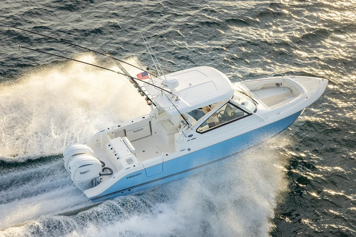
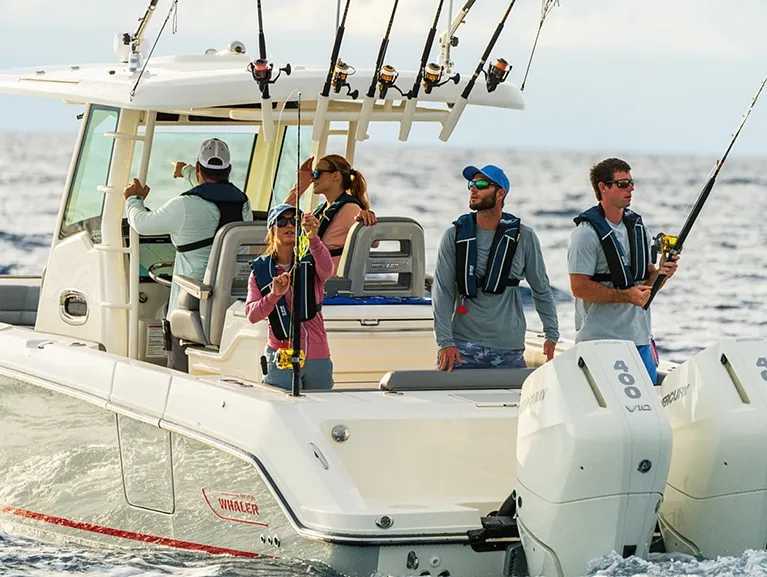
Yachts we'd shortlist for Fort Pierce
Reviewed the same way as everything on this site — specifications verified against the builder's own numbers.
Frequently Asked Questions
How does the Vero Beach mooring field work?
It's city-run in Bethel Creek, established 1988: transient moorings are $23.36 a day, Extended Stay runs $370.56 a month plus a $50 facilities fee for up to six consecutive months, and policy caps moored vessels at 50 feet. From October through April up to three boats may raft per mooring — the sociable Vero custom — and mooring guests get the dinghy dock, showers and laundry. Reserve through the marina 48 hours ahead on VHF 16, working channel 66A.
Where can I anchor around Fort Pierce and Vero Beach?
Two rules first: anchoring is limited to 96 hours inside the city of Fort Pierce and 14 days inside the county, per the Coast Pilot. At Vero Beach the designated special anchorage lies about 0.8 mile northeast of town just inside the Bethel Creek channel, governed by 33 CFR 110.73(b), directly adjoining the city's managed mooring field — which, at $23.36 a day with maintained tackle, is the easy answer for most crews.
Is Fort Pierce Inlet really an all-weather inlet?
It has the strongest claim on this coast — the city that runs the marina calls it the best all-weather inlet on the East Coast, and the federal project behind it is a 30-foot authorized entrance channel with a 28-foot inner channel and turning basin, jettied and lit with ranges. The Coast Pilot's caveats still apply: currents of 4 to 6 knots through the cut, a rough entrance when southeast wind meets the ebb, and shoaling inside the jetties that makes local knowledge worth having.
Which Fort Pierce restaurants can I reach by boat?
The City Marina makes it simple: Cobb's Landing and Crabby's Dockside are on the city's own on-site list, Little Jim Bait & Tackle joins them from the North Causeway, and a lunch/dinner slip is $10 for up to three hours. Skippers Cove sits inside Safe Harbor Harbortown with transient slips to 100 feet. In Vero, Riverside Café invites you to arrive by boat outright. The Seaway Drive landmarks — Chuck's, On the Edge, Square Grouper, Manatee Island, plus 12A Buoy on Taylor Creek — publish no patron docks, so check local dockage options and berth downtown.
Where can I dock in downtown Fort Pierce?
The Fort Pierce City Marina — city-run since October 28, 1937, on the downtown waterfront at ICW Mile 966.5. Published transient rates are $3.50 per foot per day for vessels 25 to 67 feet and $3.90 for 68 feet and up or catamarans over 19 feet of beam, with monthly dockage at $43.50 per foot. Diesel comes to the slip, two stations pump non-ethanol gas, and a lunch/dinner slip costs $10 for up to three hours. The entrance channel opens just south of the South Bridge.
Is Fort Pierce a good home port?
For an owner who actually crosses the inlet, it's one of the best cases on the coast: a jettied 30-foot federal entrance the city bills as the best all-weather inlet on the East Coast, a customs station for the run home from the islands, published city rates downtown, the country's largest mobile hoist at the port, and Vero's mooring field a day-hop north. The trade-offs are honest ones — real currents in the cut and shoaling that rewards local knowledge. Tell us how you'll use the inlet and we'll match the boat: TS@MintedYachts.com or +1 (404) 805-9819.
Where can a boat fuel up between Fort Pierce and Vero Beach?
Four documented stops. The Fort Pierce City Marina runs two fueling stations with diesel delivered in the slip and 89- and 90-octane non-ethanol gasoline. Safe Harbor Harbortown pumps ValvTect gas and diesel daily 7 to 5 on Taylor Creek. Pelican Yacht Club fuels 90-REC gasoline and diesel closest to the inlet, between markers 11 and 13. And Vero Beach City Marina's 70-foot fuel dock carries gas, diesel and pump-out on approaches of 8 to 10 feet.
Where do large yachts haul out at Fort Pierce?
Derecktor Fort Pierce, at the port west of the turning basin — its 1,500-ton Cimolai mobile hoist is the largest in the U.S. by the yard's own account, over eight acres of concrete apron with two bulkhead docks of 330 and 450 feet. Its two official sources differ on the top end — Derecktor states 500 feet and 28 feet of draft as yard capability while the Coast Pilot states hauls to 250 feet — so call the yard with your specs. Safe Harbor Harbortown lifts to 150 tons on Taylor Creek.