
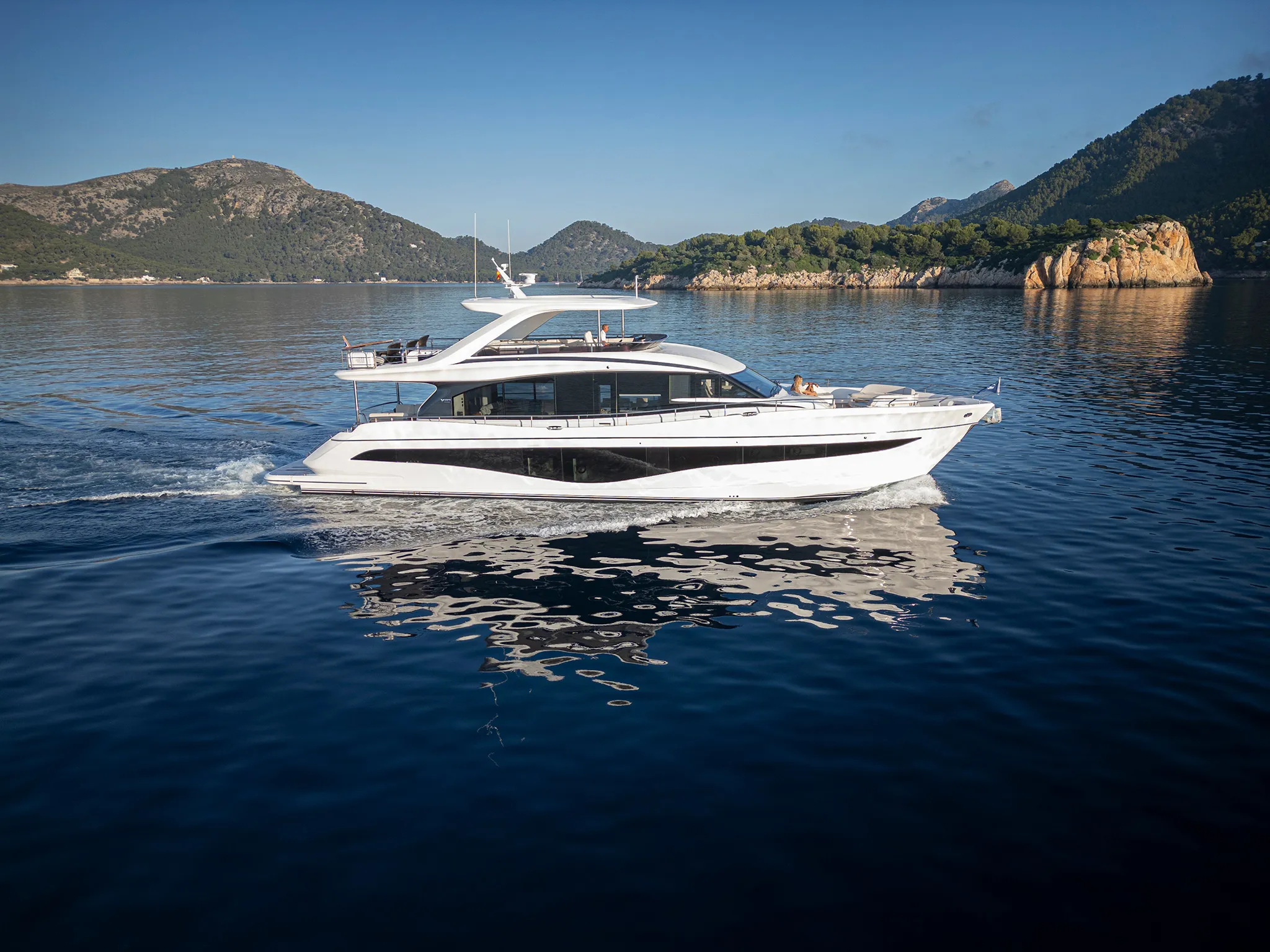
Princess Y8083'8"
View Specs & ReviewTiming Desolation Sound — the rapids decide, not the boat
Yachting in Desolation Sound
A Minted Location · Desolation Sound, British Columbia
Desolation Sound is the warmest saltwater swimming north of Mexico, and the price of admission is a clock. Every route in and out runs through a set of tidal rapids, and the good ones give you about an hour of usable slack. Miss it and you wait six hours; force it and you are in 12 knots of water with standing waves and whirlpools. Timing is the whole skill here.
The marine park is wilderness, and it is equipped like wilderness. Across 8,449 hectares BC Parks provides no mooring buoys, no stern-tie rings or chains, no potable water, no fuel and no dock of any kind. The only buoys in Desolation Sound proper are no-anchoring markers protecting eelgrass at Williams and Copplestone Islands. Campfires are not permitted anywhere in the park, and sewage discharge is prohibited in-park. You arrive self-sufficient.
The commercial docks sit around the edge, not inside. Gorge Harbour on Cortes publishes 250 feet against 1,800 feet of dock, year-round, with fuel. Coast Marina in Campbell River publishes 170 feet. Dent Island Lodge, right at the rapids, has 100-amp power and no fuel at all, saying so plainly: "We do not sell gas."
And the tide is not a detail. Prideaux Haven's 2026 predicted range is 18.6 feet, Gorge Harbour's is 18.8. Nearly nineteen feet of vertical is what makes stern-tying non-negotiable and drives every scope calculation you will do here.
Where to keep a yacht in Desolation Sound
There is no dockage inside the marine park. Everything below sits around the edge of the cruising ground, and the pattern is worth naming: the biggest boats go to Cortes Island and Campbell River; the rapids-side lodges have the power; the public docks are small, cheap and first-come.
Gorge Harbour Marina Resort on Cortes Island is the largest facility here — 250 feet, with 1,800 feet of dock (its own page says "Over 550 Metres"), diesel and ethanol-free gas year-round, propane at the store, and VHF 66A. It is owned by the Klahoose First Nation and open all year. Rates: spring (1 May – 24 June) $1.85 per foot per day; summer $2.25 under 80 feet and $3.50 over; winter (1 Oct – 30 Apr) $1.35 per foot, or $12 per foot monthly. Power $12 a day for 30A, $18 for 50A. Its page gives 250 feet and also "secure moorage for boats of any size!" — plan against 250 ft (76 m) and confirm anything larger with the marina. The summer band is printed as "June 25 – September 31", so read it as 25 June through the end of September.
Coast Marina in Campbell River publishes "boats and yachts up to 170 feet, depending on availability and vessel requirements", with 30, 50 and 100 amp and VHF 66. Discovery Harbour Marina, owned by the Campbell River Indian Band since 1991, takes transient and long-term through a request form with fuel on site; its rate card runs to a "100' and over" band with no stated maximum, so confirm your length when you book.
Dent Island Lodge sits at Dent Rapids and is the most capable small facility in the region — "single phase power in 15, 30, 50 and 100 amps", plus unlimited potable water. June $5.50 per foot, July and August $6.50, September $5.50, including power, water and Wi-Fi. Season 15 June to 15 September. Reservations recommended, 72-hour cancellation, VHF 66A. And no fuel: "We do not sell gas. The closest fuel station to Dent Island is Refuge Cove or Blind Channel."
Blind Channel Resort on West Thurlow Island is the northern staging point: 2,000 feet of dock, seven 80-foot fingers, an aircraft dock and a fuel dock selling marked diesel, mid-grade gas, oils and propane year-round, with 15, 30 and 50 amp available 24 hours. Its own words on water: "Clear, UV-treated spring water… always free for our guests." Position 50°24.82N / 125°30.00W, "three nautical miles off Johnstone Strait", VHF 66A.
Lund is the gateway, and the Harbour Authority publishes the hardest limit in that role: "We cannot accept vessels over 65 feet in length." Its arrival policy is in capitals: "WE ARE MANDATED TO SERVE FIRST COME, FIRST SERVE AND DO NOT ACCEPT RESERVATIONS." Rafting is mandatory, VHF 73. It also runs the $10.50 pump-out that BC Parks directs the entire Sound to. Its hours contract sharply outside summer — 09 July to 26 August open to 19:00 Tuesday to Saturday, against October to May at just 08:00–11:00 and 15:00–17:00 on weekdays. Lund Resort at Klah ah men offers moorage by phone with gas (diesel not stated); its fuel hours are given as 07:00–19:00 in one place and 09:00–16:30 in winter in another, so call to confirm which applies on the day.
Two public docks on Cortes fill the gaps. Squirrel Cove Community Dock publishes 360 feet on the west float and 210 on the east — 570 linear feet, both described as deep-water moorage, with 20 and 30 amp, WiFi and a porta-potty, and free one-hour dinghy moorage for customers visiting the store, craft shop and food truck. Moorage is booked through a Google Form and the rate is quoted with the booking. Provisions and marine fuel are available ashore beside the dock, with fuel-dock access depending on the tide — confirm before you rely on it. Cortes Bay Community Dock publishes 250 linear feet plus a 50-foot seaplane float, 20 and 30 amp, no garbage disposal, and warns of "significant sea-plane traffic in the bay during the summer months." Its own honest note: "If there is not space on the dock, anchorage in the bay is excellent."
On Quadra, Heriot Bay Inn & Marina sells diesel, marine fuel and propane year-round — summer June–September $2.25 per foot, shoulder May and October $1.85, winter November–April $1.25. Its power is "wireless internet and limited 15 amp power", which tells you the scale of boat it is built for. Taku Resort in Drew Harbour charges $2.30 per foot including water and 30A — but "No filling water tanks." No deposit, and "your space will not be held past 4pm on your arrival day"; confirm your length when you book. Quathiaski Cove takes transients at $1.50 daily with a seven-day maximum, and states that "priority for year round moorage… is given to Commercial Fishing Vessels", with minimum $200,000 liability required.
Powell River splits in two. North Harbour publishes 18.5 metres / 60 feet across about 330 slips and states flatly: "It is not for transient vessels." South/Westview takes transients at $1.62 per foot per day under the 2026 bylaw, with no fuel — fuelling is prohibited on the floats. Campbell River Harbour Authority publishes a transient rate only up to 49 feet, gives no guaranteed reservations and caps stays at seven consecutive days.
Haul-out is in Campbell River and it is genuinely capable. Ocean Pacific Marine runs a 150 metric ton Travelift with a 30-foot beam limit, a 200-foot working dock and a 9,000 square metre yard. Menzies Marine publishes 30.5 m / 100 ft long by 9 m / 30 ft wide on a 150-ton lift, with room for 12 vessels. Freshwater Marina runs a 50-ton lift and covered moorage to 65 feet, and is a yard visit rather than a stop: "ABSOLUTELY NO OVERNIGHT STAYS UNDER ANY CIRCUMSTANCES."
Refuge Cove, the Squirrel Cove General Store, April Point and Big Bay on Stuart Island are working stops rather than published marinas. Dock length, depth and rate are settled at the dock rather than in advance. Refuge Cove is one of the two fuel stops Dent Island Lodge names, and its kitchen runs 5 June to 15 September — go, take what is free, and ask on arrival.
Marinas
| Name | Where | Max yacht | Slips | Fuel |
|---|---|---|---|---|
| Gorge Harbour Marina ResortThe largest facility in this market: 250 feet against 1,800 feet of dock (its own page says "Over 550 Metres"). Owned by the Klahoose First Nation. Spring (1 May–24 Jun) $1.85/ft/day; summer $2.25 under 80 ft and $3.50 over; winter (1 Oct–30 Apr) $1.35/ft or $12/ft monthly. 30A $12/day, 50A $18/day. Its page gives 250 ft and also "secure moorage for boats of any size" — plan against 250 ft and confirm anything larger with the marina. The summer band is printed as "June 25 – September 31", so read it as 25 June through the end of September. | Whaletown, Cortes Island | 250 ft | — | Diesel and ethanol-free gas, year-round; propane at the Gorge Store |
| Coast Marina"Boats and yachts up to 170 feet, depending on availability and vessel requirements", with 30, 50 and 100 amp. The mainland-side large-vessel option for staging into the Sound. | Campbell River | 170 ft | — | — |
| Discovery Harbour MarinaOwned by the Campbell River Indian Band since 1991. The rate card runs to a "100' and over" band with no stated maximum, so confirm your length when you book. | Campbell River | — | — | On site via Discovery Harbour Fuel Sales |
| Dent Island Lodge"Single phase power in 15, 30, 50 and 100 amps", plus unlimited potable water. June $5.50/ft, July and August $6.50/ft, September $5.50/ft, including power, water and Wi-Fi. A full-service lodge sitting right at the rapids it is named for. | Dent Island, at Dent Rapids | — | — | None — "We do not sell gas. The closest fuel station to Dent Island is Refuge Cove or Blind Channel" |
| Blind Channel Resort2,000 feet of dock, seven 80-foot fingers, an aircraft dock and a fuel dock, with 15, 30 and 50 amp available 24 hours. "Clear, UV-treated spring water… always free for our guests." On West Thurlow Island at 50°24.82N / 125°30.00W. | West Thurlow Island, three nautical miles off Johnstone Strait | — | — | Marine marked diesel, mid-grade gas, oils and propane; fuel dock open year-round |
| Lund Harbour Authority"We cannot accept vessels over 65 feet in length." It runs the $10.50 pump-out that BC Parks directs the entire Sound to — the shore service most worth planning around. Hours contract hard outside summer: 9 July to 26 August open to 19:00 Tue–Sat, against October to May at 08:00–11:00 and 15:00–17:00 weekdays. | Lund — the gateway to the Sound | 65 ft | — | — |
| Squirrel Cove Community DockA 360-foot west float and a 210-foot east float — 570 linear feet, both described as deep-water moorage — with 20 and 30 amp, WiFi and a porta-potty. Free one-hour dinghy moorage for customers visiting the store, craft shop and food truck. Provisions and marine fuel are available ashore beside the dock, with fuel-dock access depending on the tide — confirm it before you rely on it. | Cortes Island | — | — | — |
| Cortes Bay Community Dock250 linear feet plus a 50-foot seaplane float, with 20 and 30 amp and a porta-potty. No garbage disposal. Significant seaplane traffic in the bay through the summer months — keep the float clear. | Cortes Island | — | — | — |
| Heriot Bay Inn & MarinaYear-round, which is unusual here. Its power is "wireless internet and limited 15 amp power", which tells you the scale of boat it is built for. Note the separate public wharf in the same bay — they are two different docks. | Quadra Island | — | — | Diesel, marine fuel and propane |
| Taku Resort & MarinaCharts 3538 and 3539, chartbook 3312. A detail worth catching before you arrive: water is included but "No filling water tanks." Confirm your length when you book. | Drew Harbour, Quadra Island | — | — | Fuel at Heriot Bay or in Campbell River |
| Quathiaski Cove (Q Cove)"Priority for year round moorage… is given to Commercial Fishing Vessels. Due to the space requirements of the Commercial Fishing Fleet limited space is available for year round pleasure craft." All vessels must carry minimum $200,000 liability. Confirm power when you book. | Quadra Island | — | — | — |
| Powell River North HarbourPublishes 18.5 metres / 60 feet across about 330 slips. A homeport for the town's own fleet rather than a visitor stop. | Powell River | 60 ft | 330 | — |
| Powell River South / WestviewThe transient half of Powell River, and the published rate is the cheapest in this market. No fuel at all on the floats, which matters given how few fuel options exist in the Sound. | Powell River | — | — | None — fuelling is prohibited on the floats |
| Campbell River Harbour AuthorityA DFO Small Craft Harbours lease with 235-plus home vessels and no tidal grid. Its published transient rate runs only up to 49 feet, which sets the expectation for size. | Campbell River | — | 235 | — |
| Lund Resort at Klah ah menThe marina is described on its own site as undergoing updates. Fuel hours are given as 07:00–19:00 in one place and 09:00–16:30 in winter in another — call to confirm which applies on the day. | Lund | — | — | Gas; diesel not stated |
Yacht clubs
| Name | Where | Max yacht | Slips | Fuel |
|---|---|---|---|---|
| Royal Vancouver Yacht Club — Cortes Island outstationThe club's most northerly outstation: "1,200' of waterfront and two parcels of land totalling 19 acres", 96 nautical miles northwest of its Jericho home port. Members and reciprocal guests arrange it through their own club. The Seattle Yacht Club also holds a Cortes Bay outstation. | Cortes Bay | — | — | — |
Figures are as each facility publishes them on its own site; blank cells mean the facility doesn't state a number. Confirm slip availability and current rates directly — or ask us to make the calls.
Cruising from Desolation Sound
Start with the rapids. CHS 2026 current predictions:
| Rapid | CHS station | Max flood 2026 | Max ebb 2026 | Typical flood | Typical ebb |
|---|---|---|---|---|---|
| Arran Rapids | 08064 | 13.8 kn | 12.0 kn | 8.6 | 8.7 |
| Gillard Passage | 08059 | 12.0 kn | 8.9 | 7.3 | 6.3 |
| Hole in the Wall | 08052 | 12.0 kn | 9.5 | 7.3 | 6.8 |
| Surge Narrows (Beazley Passage) | 07840 | 11.6 kn | 9.2 | 7.3 | 6.7 |
| Dent Rapids | 08138 | 10.5 kn | 9.1 | 6.5 | 6.4 |
| Seymour Narrows (the approach) | 08108 | 15.6 kn | 13.5 | 8.7 | 9.6 |
And how long you actually get — from CHS 15-minute predictions across July and August 2026:
| Rapid | Median window under 2 kn | Shortest | % of time over 6 kn |
|---|---|---|---|
| Gillard Passage | 60 min | 30 min | 29% |
| Dent Rapids | 60 min | 30 min | 27% |
| Hole in the Wall | 45 min | 15 min | 38% |
| Surge Narrows | 45 min | 15 min | 36% |
| Arran Rapids | 45 min | 30 min | 53% |
| Seymour Narrows | 52 min | 34 min | 50% |
⚠️ Arran is the least forgiving gate on the way in: it peaks at 13.8 knots, runs above six knots more than half the time, and gives you 45 minutes of usable slack — sometimes 30. Gillard and Dent are the generous ones at an hour. Plan your day around the tightest gate on your route, not the average.
Yuculta Rapids, Whirlpool Rapids and Okisollo Channel have no current predictions of their own — time them off Gillard Passage, which is their reference station.
Surge Narrows currents are published by CHS under "Beazley Passage", station 07840. The station that comes up under "Surge Narrows", 08045, is a tide station rather than a current station — look up 07840.
Why the water is warm — and it is not tidal convergence. The BC Ministry of Environment's Water Quality Assessment and Objectives: Desolation Sound (2005), page 20, puts it plainly:
"The waters of Desolation Sound are relatively shallow and protected, allowing elevations in water temperature that are not seen in many other places on the coast."
The retention comes from weak currents, sills at many inlet entrances, long narrow inlets and low freshwater input, producing "little mixing and long retention times." CHS sill and basin depths from 1990 make it concrete: Malaspina Inlet is a 223-foot basin behind a 43-foot sill; Okeover and Lancelot are 443 feet behind a 66-foot sill; Theodosia Inlet sits behind a 6.6-foot sill.
Measured maximum summer temperatures, 1999–2003: Prideaux Haven 20 °C / 68 °F, Refuge Cove 19 °C / 66 °F, Tenedos Bay 18 °C / 64 °F, with Roscoe Bay and Grace Harbour in the same band.
Tidal range, CHS 2026 predicted extremes: Gorge Harbour 18.8 ft · Prideaux Haven 18.6 ft · Lund 18.4 · Powell River and Okeover 18.3 · Heriot Bay 17.2 · Owen Bay 15.8 · Big Bay 14.8 · Campbell River 14.6. Nearly nineteen feet at Prideaux Haven is the number that makes stern-tying non-negotiable.
The anchorages, from BC Parks:
| Anchorage | Park | Facilities | Note |
|---|---|---|---|
| Prideaux Haven, with Melanie and Laura Cove | Desolation Sound Marine Park, 8,449 ha, est. 1973 | none; no camping | A federally designated no-discharge area, naming Laura and Melanie Cove explicitly |
| Tenedos Bay | same | campsite, pit toilets, info shelter | Unwin Lake a ten-minute walk |
| Grace Harbour | same | pit toilets, campsites, shelter, creek (treat it) | BC Parks: waters "can become very warm in the summer" |
| Roscoe Bay | Roscoe Bay Park, 247 ha | none | Federally closed to sewage. BC Parks: "swimming in Roscoe Bay is not recommended" — poor flushing and historic high summer fecal coliform. Black Lake is the warm swim |
| Walsh Cove | Walsh Cove Park, 85 ha | "There are no facilities at this park" | No development planned |
| Copeland Islands | Copeland Islands Marine Park, 423 ha | 31 tent pads, outhouses | "There are limited anchorages for small vessels" |
| Von Donop / Háthayim | Háthayim Marine Park, 1,277 ha | none | "A number of secure anchorages"; PSP risk May–August |
| Squirrel Cove | not a provincial park | — | Federally designated no-discharge area |
| Octopus Islands | Octopus Islands Marine Park, 748 ha | none | Portage route to Small Inlet |
| Small Inlet | Small Inlet Marine Park, 710 ha | none | The waiting room — well protected, for sitting out slack at Okisollo and Hole in the Wall |
Park-wide rules: campfires are not permitted throughout Desolation Sound Marine Park; potable water is not available anywhere — bring your own; anchor deeper than 10 metres (33 feet) and never over kelp or seagrass.
⚠️ Sewage discharge is prohibited throughout the park, and Prideaux Haven with Laura and Melanie Cove, Roscoe Bay and Squirrel Cove are federally designated no-discharge areas. Hold it and pump out at Lund, at $10.50.
Straight-line distances between CHS station coordinates, not routes: Campbell River to Lund 19 nm · Lund to Prideaux Haven 11 nm · Campbell River to Heriot Bay 4 nm · Heriot Bay to Prideaux Haven 21 nm · Prideaux Haven to Big Bay 23 nm · Big Bay to Blind Channel 14 nm. Northbound, you clear Seymour Narrows 7 nm above Campbell River.
Two names to get right when you book. Heriot Bay has two different marinas — the Heriot Bay Inn Marina and the public wharf — and Gorge Harbour has two different docks: the resort marina, and a commercial-only community dock that does not take transients.
- Prideaux Haven, Melanie Cove and Laura Cove — Desolation Sound Marine Park (8,449 ha, established 1973)The destination, and it is unserviced. Measured maximum summer water temperature 20 °C / 68 °F, 1999–2003. No camping. A federally designated no-discharge area, naming Laura and Melanie Cove explicitly. With a 2026 predicted tidal range of 18.6 feet here, stern-tying is not optional.
- Roscoe Bay — Roscoe Bay Park, 247 haBC Parks is direct about it: "swimming in Roscoe Bay is not recommended" — poor flushing and historically high summer fecal coliform. Federally closed to sewage discharge. Black Lake, a short walk in, is the warm swim instead.
- Tenedos Bay · Grace Harbour · Walsh Cove — Desolation Sound Marine Park and Walsh Cove Park (85 ha)Tenedos Bay has a designated campsite, pit toilets and an info shelter, with Unwin Lake a ten-minute walk. Grace Harbour has pit toilets, campsites, a shelter and a creek that must be treated — BC Parks notes its waters "can become very warm in the summer." Walsh Cove is blunt: "There are no facilities at this park", and none is planned.
- Von Donop / Háthayim · Copeland Islands · Squirrel Cove — Cortes Island and the Copeland IslandsHáthayim Marine Park (1,277 ha) offers "a number of secure anchorages", with paralytic shellfish poisoning risk May to August — check the current closure before you eat anything you gather. The Copeland Islands Marine Park (423 ha) has 31 tent pads and outhouses but states "there are limited anchorages for small vessels." Squirrel Cove is not a provincial park and is a federally designated no-discharge area.
- Octopus Islands and Small Inlet — Northeast Quadra IslandSmall Inlet Marine Park (710 ha) is the waiting room — well protected, and the place to sit out slack for Okisollo and Hole in the Wall. Octopus Islands Marine Park (748 ha) adjoins it with a portage route through to Small Inlet. Neither has facilities of any kind.
Service, refit & supplies
Shipyards & refit
| Name | Where | Max yacht | Dockage |
|---|---|---|---|
| Ocean Pacific MarineA 150 metric ton Travelift with a 30-foot beam limit, a 200-foot working dock, a 9,000 square metre yard and 30/50 amp, with a fully-stocked store alongside. | Campbell River | — | — |
| Menzies Marine30.5 m / 100 ft long by 9 m / 30 ft wide, on a 150-ton lift, with room for 12 vessels. Together with Ocean Pacific, this is where a boat that cruises the Sound actually gets hauled. | Campbell River | 100 ft | — |
| Freshwater MarinaA 50-ton travel lift with covered moorage to 65 feet. The overnight prohibition is the operator's own, in capitals — this is a yard visit, never a stop. | Campbell River | 65 ft | "ABSOLUTELY NO OVERNIGHT STAYS UNDER ANY CIRCUMSTANCES" |
On the Desolation Sound calendar
The season here is defined by lodge calendars rather than by an events programme, and they agree closely.
- Dent Island Lodge — 15 June to 15 September. The clearest four-month season in the market, and a good proxy for when the Sound is genuinely serviced.
- Blind Channel's Cedar Post — dinner from the third weekend in May to mid-September, lunch on the patio in July and August. The fuel dock is open year-round.
- Gorge Harbour — open all year. Spring rates 1 May to 24 June, summer through the end of September, winter 1 October to 30 April. Its food truck runs May through 31 August.
- Refuge Cove — kitchen 5 June to 15 September, gallery 15 May to 15 September.
- Lund Harbour Authority — hours contract hard outside summer: 9 July to 26 August open to 19:00 Tuesday to Saturday, against October to May at 08:00–11:00 and 15:00–17:00 on weekdays only.
- Campbell River Harbour Authority — summer transient season 1 May to 30 September.
- Heriot Bay Inn — year-round, with summer June–September, shoulder May and October, and winter November–April.
Race and regatta dates are set by the organising clubs — confirm them with the organiser. This is a cruising ground rather than a regatta calendar, and the dates that actually change a trip are the lodge seasons above and the tide table.
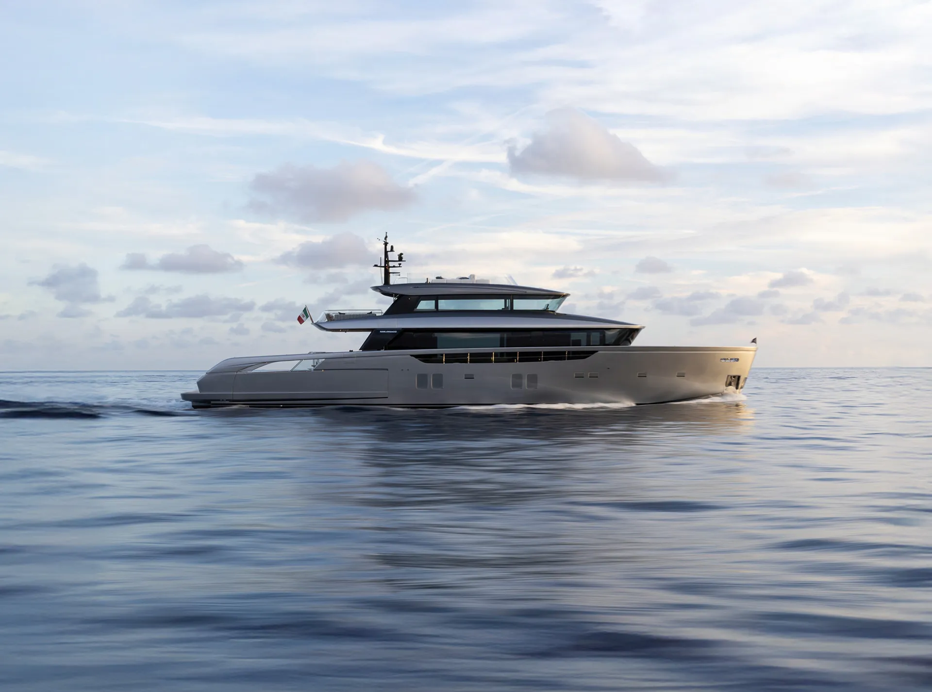
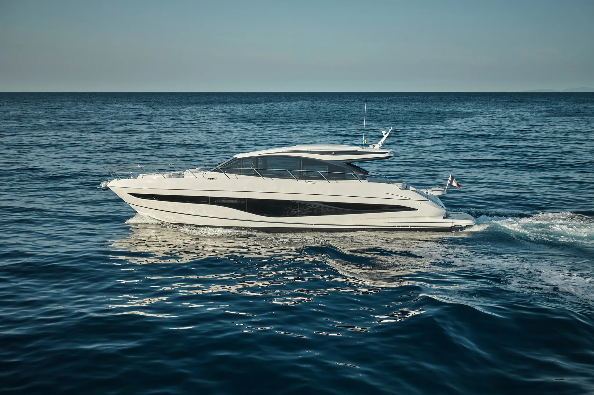
Yachts we'd shortlist for Desolation Sound
Reviewed the same way as everything on this site — specifications verified against the builder's own numbers.
Frequently Asked Questions
Is there dock-and-dine in Desolation Sound?
Yes, and here it is the lodges rather than restaurants in a town that make it work. Dent Island Lodge states that marina guests have full access to both lodge restaurants, the bar and the gift shop, and its moorage form carries a dinner reservation field; meals are à la carte on top of moorage, at $210 for dinner and $295 for the Rapids Grill. Blind Channel's Cedar Post serves dinner from the third weekend in May to mid-September with dock attendants standing by on VHF 66A. Gorge Harbour's Floathouse Restaurant is closed, replaced by a seasonal food truck, with a new restaurant planned for 2027.
What is the largest yacht that can berth in Desolation Sound?
Two hundred and fifty feet, at Gorge Harbour Marina Resort on Cortes Island — 250 feet against 1,800 feet of dock, open year-round with fuel. Coast Marina in Campbell River publishes 170 feet. Nothing berths inside the marine park itself, and the gateway at Lund is explicit that it cannot accept vessels over 65 feet. Dent Island Lodge, right at the rapids, is the most capable small facility, with 100-amp power and no fuel at all.
Why is the water so warm in Desolation Sound?
Because it is shallow, protected and poorly flushed — not because of tidal convergence. The BC Ministry of Environment's 2005 water quality assessment states it directly: the waters are relatively shallow and protected, allowing elevations in water temperature not seen in many other places on the coast. Weak currents, sills at many inlet entrances, long narrow inlets and low freshwater input produce little mixing and long retention. Measured summer maxima from 1999 to 2003 reach 20 °C — 68 °F — at Prideaux Haven.
Are there mooring buoys in Desolation Sound Marine Park?
No. Across 8,449 hectares BC Parks provides no mooring buoys and no stern-tie rings or chains, along with no potable water, no fuel and no dock of any kind. The only buoys in Desolation Sound are no-anchoring markers protecting eelgrass at Williams and Copplestone Islands. The 2008 management plan lists stern pins as a possible future addition, and none are installed. Campfires are not permitted throughout the park, sewage discharge is prohibited, and you are asked to anchor deeper than 10 metres and never over kelp or seagrass.
Where can you get fuel and water in Desolation Sound?
Plan it carefully, because the park provides neither. Gorge Harbour sells diesel and ethanol-free gas year-round with propane at the store. Blind Channel Resort sells marked diesel, mid-grade gas, oils and propane year-round and gives free UV-treated spring water to guests. Dent Island Lodge has unlimited potable water and states plainly that it does not sell gas, directing you to Refuge Cove or Blind Channel. Powell River South prohibits fuelling on its floats entirely. And the pump-out that BC Parks directs the entire Sound to is at Lund, at $10.50.
How do you time the rapids in Desolation Sound?
You plan the day around the tightest gate on your route, because the slack windows differ. Derived from CHS 15-minute predictions for July and August 2026, Gillard Passage and Dent Rapids each give a median window of about 60 minutes under 2 knots, while Hole in the Wall, Surge Narrows and Arran Rapids give about 45 — and the shortest observed windows are 15 to 30 minutes. Arran is the least forgiving: it runs above 6 knots more than half the time and peaks at 13.8 knots. Yuculta Rapids, Whirlpool Rapids and Okisollo Channel have no current predictions of their own, so you time them off Gillard Passage.