
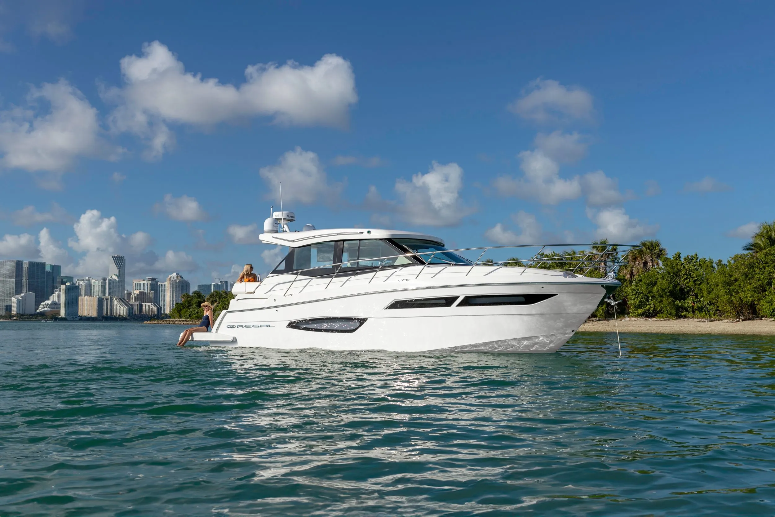
Regal 38 Grande Coupe38' 1"
View Specs & ReviewThe bridges, not the boat, decide where you cruise
Yachting in The California Delta
A Minted Location · The California Delta, California
A 200-foot yacht can run from San Francisco Bay to Stockton without a single bridge opening. NOAA puts it plainly: "There are no other bridges over the main channel below the turning basin at Stockton." Antioch gives you 142 feet, Benicia–Martinez 135, the Carquinez crossings 132 to 146. The main stem is wide open.
Turn off the main stem and it collapses to about twenty feet. Isleton 18 feet closed. Paintersville 18. Georgiana Slough 13. Mokelumne 11. Middle River 11 on its east side. The Delta is a thousand miles of navigable waterway where your air draft, not your length or your draft, decides which of it you will ever see.
And the season is written into federal law rather than into a brochure. Under 33 CFR Part 117, nearly every Delta drawbridge splits the year the same way: 1 May to 31 October, open on signal 06:00–22:00. 1 November to 30 April, open on signal 09:00–17:00 — and outside those hours, four hours' notice. Miner Slough wants twelve hours' notice, year-round, so plan that one a day ahead.
What you get for learning the rules is genuinely rare. Fresh water, seventy miles inland, still tidal — 4.08 feet of range at Rio Vista, essentially the same as out in Suisun Bay — running at about 72 °F through July and August, in a place NOAA itself explains people come to: *"many conventional powerboats and sailboats use these waters also, especially in summer when San Francisco Bay is foggy and choppy."*
Size the market honestly: this is a 40-to-70-foot cruising ground. The highest maximum LOA published by any Delta facility in the state's registry is 120 feet, at one marina with 95 slips. Most of the rest cap at 80.
Where to keep a yacht in The California Delta
The Delta's berthing base is large, and mostly modest. California's Division of Boating and Waterways registry lists roughly 140 boating facilities in the Delta. The slip counts that matter:
| Facility | Slips | Published maximum |
|---|---|---|
| Village West | 650 (595 covered 20′–72′, 26 uncovered 26′–92′) | 92 ft uncovered |
| Pittsburg | 575 | not stated |
| Oxbow | 423 | 50 ft |
| Tower Park | 393 | not stated |
| Willow Berm | 350, plus 1,400 ft of guest docking | 80 ft |
| Stockton Sailing Club | 350 | 36 ft |
| Benicia | 320 | not stated |
| Antioch | 310 | 80 ft |
| Martinez | 280 | 90 ft |
| Delta Marina Yacht Harbor | 275 | not stated |
| Discovery Bay | 263 | not stated |
| Turner Cut | 200 | 44–60 ft, an unusually high minimum |
| Walnut Grove | 178 | 80 ft |
| Herman & Helen's | 95 | 120 ft — the highest in the Delta |
Stockton Downtown Marina publishes "66 slips for boats up to 80 feet" plus "1,400 feet of guest docking space" across north and south shore, for overnight and day use. Rates are on request from the marina office.
Delta Marina Yacht Harbor at Rio Vista publishes the fullest transient terms in the market, and they are worth having: roughly 800 feet of guest dock at $1.50 per foot per night, maximum ten nights, first come first served, with reservations taken only for groups of ten boats or more. Gas is available 24 hours through a card reader.
Tower Park publishes "Open: Year Round" with a "Peak Season: May 22 – August 16, 2026." Korth's Pirate's Lair runs its office and fuel dock daily 08:30–17:00 with a 24-hour launch ramp, and states that "our Cafe is currently closed for 2026."
Haul-out here is arranged on the telephone. The capacity figures on record are NOAA's: a marine railway to 350 tons at Antioch, and marine railways up to 200 tons at Stockton. NOAA also sets the ceiling plainly — "major repairs to oceangoing vessels must be done at the drydocks in San Francisco, Oakland, Alameda and Richmond." A dozen Delta facilities offer haul-out, and tonnage, lift type and dates are all agreed on the call rather than set out on a tariff. The published length limits are 70 feet at one yard and 55 at another — workable for a 40-to-70-foot boat, and above that the answer is to run back down to the Bay.
Phone before you plan. The Delta runs informally: rates, guest-dock space, fuel hours and yard dates are settled on the call rather than on a page, and they move between seasons. Ring the marina the week you sail.
Anchoring is at Lower Sherman Island, General Anchorage No. 28 under 33 CFR 110.224 — "general and explosives anchorages are in the San Joaquin River on the west side of Sherman Island near the mouth and just north of Venice Cut."
Marinas
| Name | Where | Max yacht | Slips | Fuel |
|---|---|---|---|---|
| Herman & Helen's MarinaThe highest published maximum LOA anywhere in the Delta — 120 feet, across 95 slips — in California's Division of Boating and Waterways registry. Berthing terms are settled on the telephone, so call the office before you plan a season around that number. | Little Potato Slough, near Stockton | 120 ft | 95 | — |
| Delta Marina Yacht HarborRio Vista's guest-dock marina, and the one in this market that publishes full transient terms up front — dock length, rate, maximum stay and reservation policy. That makes it the default stop for a visiting boat, and the easy place to settle a night in advance. | Rio Vista, Sacramento River | — | 275 | Gas available 24 hours via card reader |
| Village West MarinaThe largest facility in the Delta by slip count: 595 covered berths from 20 to 72 feet, 26 uncovered from 26 to 92, and 29 jet ski spaces. Three on-site restaurants, with guest and gas docks — ring ahead and they will tell you which dock to take. | Stockton | 92 ft | 650 | Guest and gas docks stated |
| Stockton Downtown Marina"66 slips for boats up to 80 feet" at the very top of the navigable main stem, 28 miles above the Antioch Bridge. This is as far inland as a large yacht can reach without a single bridge opening. | Stockton turning basin, head of the Deep Water Ship Channel | 80 ft | 66 | — |
| Willow Berm Marina350 slips to a maximum of 80 feet, plus 1,400 feet of guest docking — one of the two substantial guest-dock frontages in the Delta. Note the air draft to reach it: the Walnut Grove bridge gives 24 feet closed and 21 at high water, and it operates on the standard federal seasonal split. | Walnut Grove, Sacramento River | 80 ft | 350 | — |
| Tower Park Marina393 slips, open year round, with a published peak season that lands squarely inside the federal open-on-signal months — a useful proxy for when the Delta is actually busy. | Little Potato Slough | — | 393 | — |
| Antioch · Martinez · Pittsburg · Benicia municipal marinasThe main-stem cluster where a larger boat realistically lives: Pittsburg 575 slips, Antioch 310 (maximum 80 ft), Benicia 320, Martinez 280 (maximum 90 ft). All four sit below the Antioch Bridge's 142 feet, so nothing here costs you a bridge opening. Slip availability, rates and length limits are settled with each harbormaster's office by telephone. | The lower Delta and Carquinez Strait | 90 ft | 1,485 | — |
| Turner Cut · Oxbow · Discovery Bay · Walnut GroveThe interior berthing base. Turner Cut's 200 slips run 44 to 60 feet — an unusually high minimum, which tells you what fleet it serves. Oxbow runs 423 slips from 18 to 50 feet, Discovery Bay 263, and Walnut Grove 178 to a maximum of 80 feet. Reaching several of them means accepting roughly 20 feet of air draft or less, so check the bridge on your route before you book. | The interior Delta | — | 1,058 | — |
| Korth's Pirate's LairSlips from 16 to 40 feet on the Mokelumne — reachable only under an 11-foot closed bridge clearance, which is the market's air-draft lesson in one venue. The operator states that "our Cafe is currently closed for 2026", so plan meals around it. | Mokelumne River | — | 212 | Fuel dock daily 08:30–17:00 |
Yacht clubs
| Name | Where | Max yacht | Slips | Fuel |
|---|---|---|---|---|
| Stockton Sailing ClubThree hundred and fifty berths capped at 36 feet — a useful corrective to the assumption that a large slip count means large-boat capacity, and a fair picture of what the Delta fleet mostly is. | Stockton | 36 ft | 350 | — |
Figures are as each facility publishes them on its own site; blank cells mean the facility doesn't state a number. Confirm slip availability and current rates directly — or ask us to make the calls.
Cruising from The California Delta
AIR DRAFT IS THE BINDING CONSTRAINT — and not where you expect it
On the main stem it is not a constraint at all. NOAA: "There are no other bridges over the main channel below the turning basin at Stockton."
Crossing Clearance Antioch Bridge 142 ft low water / 138 high Benicia–Martinez 135 ft I-80 Carquinez 146 north / 132 south I-680 153 ft Power cables 179 and 140 ft UP Railroad lift, Benicia 70 down / 135 up — opens on signal, VHF-FM 13 A 200-foot yacht can run from San Francisco Bay to Stockton — 28 miles above the Antioch Bridge — without a single bridge opening.
Off the main stem it collapses to roughly 20 feet closed: Rio Vista 22/18 · Isleton 18/15 · Walnut Grove 24/21 · Paintersville 18 · Steamboat Slough 24/21 · Miner Slough 21/17 · Sutter Slough 22/19 · Georgiana Slough 13/10 · Mokelumne 11/8 · Millers Ferry 15/12 · Old River 16/12 · Middle River 18/15 west, 11/8 east · Freeport 32/29 · upper Stockton channel 50/45. Overhead cables run 50 to 140 feet, with one over Old River at 26.
⚠️ "During flood stage levels, bridge and overhead cable clearances may be reduced as much as 29 feet or more." Take your margin off the winter and spring figures, not off the table above.
Rio Vista is published two ways: NOAA Coast Pilot gives 22 ft at low water and 18 at high, closed; the Coast Guard's Federal Register notice gives 17 feet at mean high water. Plan against 17 ft (5.2 m) and ask the drawtender if you need more.
The season is written into federal law. Under 33 CFR Part 117, nearly every Delta drawbridge splits the year identically: 1 May to 31 October, open on signal 06:00–22:00; 1 November to 30 April, open on signal 09:00–17:00, otherwise four hours' notice.
The details that catch people out, by section:
- §117.189 Sacramento River — Rio Vista, Isleton, Walnut Grove and Paintersville on the standard split; outside the window, four hours' notice to the Rio Vista drawtender. Freeport opens on signal 1 May to 30 September, 09:00–17:00. Knights Landing and Meridian need twelve hours' notice, and above Meridian draws need not open at all.
- §117.173 Miner Slough — twelve hours' notice, year-round. Book it the day before.
- §117.175 Mokelumne — East Isleton on the standard split with restricted recreational-only openings at peak weekend times; Millers Ferry 1 May to 31 October 09:00–17:00, otherwise twelve hours' notice; New Hope Landing is a removable span operating only on a declared emergency; above New Hope Landing draws need not open.
- §117.157 Georgiana Slough — on signal 1 May to 31 October only.
- §117.191 San Joaquin — the Port of Stockton railroad bridge needs twelve hours; the Navy drawbridge, BNSF and the Highway 4 crossing need not open; and above the Old River junction, drawbridges need not open at all.
- §117.171 Middle River — Bacon Island Road 15 May to 15 September, 09:00–17:00; BNSF twelve hours; Route 4 need not open. §117.183 Old River — four hours' notice. §117.201 Sutter Slough — need not open.
THREE MILE SLOUGH IS THE DOOR A REAL YACHT USES
There is no Part 117 section for it, so the Route 160 bridge at mile 0.1 falls under the general rule, 33 CFR 117.5: it opens on signal, on demand, with no schedule and no notice.
At 12.4 feet closed and 107.4 feet open, it is the only unscheduled gate between the San Joaquin and the Sacramento. If you are cruising the Delta in anything with real air draft, this is the connection you will actually use.
Depths: the main stem is deep and everything else is not. Federal project depths are 35 feet on the San Joaquin / Stockton Deep Water Ship Channel from the mouth to the turning basin, and the same through southern Suisun Bay and New York Slough. The Sacramento Deep Water Ship Channel is 30 feet and generally maintained — the authorised deepening to −35 is not in the water, so plan against 30. Deep-draft vessels leave the Sacramento at Cache Slough, 1.5 miles above the Rio Vista Bridge.
Off-channel is where a big boat gets caught: the Sacramento river route runs about 10 feet; above Sacramento to Colusa 6; the Mokelumne 12 feet to the lower junction, then 7, then 2; Georgiana Slough about 13; Middle River to Bacon Island about 6; and the San Joaquin above the Stockton Channel junction runs about 3 feet for seventy miles.
⚠️ The side channels are dredged for the levee, not for you. NOAA: *"the dredge pays more attention to the requirements of the levee than to the depth of the channel for navigation purposes. This leaves an uneven bottom."* Add to that "numerous uncharted piles, snags, pumps and pipes, some submerged, may exist along the edges of the river", and levees that "are faced with rock that may damage vessels that drag along them." Stay off the edges, and sound your way in anywhere you have not been.
The run in from San Francisco Bay. Carquinez Strait is six miles long, under half a mile wide for the first 3.5 and about a mile after, deep throughout. "The bottom… south of Benicia Point is sandy and changeable. Strong tides, alongshore currents and seasonal runoff influence the bottom, resulting in a shoaling trend migrating southeast from the point… with the expectation of changing depths, possibly shoaler than charted." In Suisun Bay, "it is recommended that large vessels take a pilot if bound above Crockett."
Currents decay fast inland, which is the useful part. NOAA CO-OPS 2026 maxima: Carquinez Strait 2.76 flood / 2.69 ebb · Carquinez Bridge 2.45 / 2.68 · Chipps Island 1.79 / 2.24 · Point Sacramento 1.37 / 1.62 · Antioch Point 1.35 / 1.80 · Sacramento River Light 14 1.10 / 1.25. Carquinez runs to about 2.8 knots both ways; by Antioch you are down to 1.3–1.8. Carquinez is the one place timing matters.
Inside the Delta the current answers to the river stage rather than to the tide book: *"During high-river stages, there is little or no flood current and the ebb current is strong to Sacramento… Local knowledge is required to estimate current conditions for a particular time."*
Fresh water, and the tide that still reaches it. NOAA: "The water is generally fresh at Antioch" — 16 miles east of the Suisun Point bridges, with everything upstream fresh. Measured temperatures from the state's own monitoring network, 1 July to 13 August 2026: Rio Vista Bridge mean 71.9 °F (69.7–74.5), Antioch mean 72.1 °F (69.4–76.3).
And the range does not die out inland: Antioch great diurnal 3.88 ft, Rio Vista 4.08, Mallard Island 4.41, Port Chicago 4.91, Martinez 5.36. Still 4.08 feet at Rio Vista, essentially the same as Mallard Island out in Suisun Bay. At extreme low river stages the flood current can reach Sacramento. A tidal system, in fresh water, 50 to 70 miles inland.
Flood is the seasonal reason to be elsewhere. An ordinary flood raises the river 8 feet at the San Joaquin mouth and 8.5 at Stockton; an extreme one, 10 and 13.5 — and 20 or 30 feet at Sacramento. Major floods run November to April, which is the same window that eats your bridge clearances.
Heat is the other half of the climate story. NOAA's Stockton climatology gives an annual average of 62 °F with a daily maximum of 74. "In summer, temperatures exceeding 100 °F can be expected on 6 days in July and about 14 days during the entire summer. During these hot afternoons the air is extremely dry, with relative humidities running generally less than 20 percent." The all-time maximum is 114 °F, July 1972. Rainfall is 13 to 14 inches, 90 percent of it November to April. What saves it is the sea breeze: gaps in the Coast Range "permit the passage inland of a sea breeze that fans out into the delta and has a moderating effect on summer heat", with winds reaching 20 knots or more through Carquinez Strait.
- Lower Sherman Island — General Anchorage No. 28 — San Joaquin River, west side of Sherman IslandThe Delta's designated anchorage under 33 CFR 110.224: "General and explosives anchorages are in the San Joaquin River on the west side of Sherman Island near the mouth and just north of Venice Cut."
- Three Mile Slough — the unscheduled gate — Route 160 bridge, mile 0.1The door a real yacht actually uses. Three Mile Slough has no section in 33 CFR Part 117, so its bridge falls under the general rule 117.5 and opens on demand — the only unscheduled gate between the San Joaquin and the Sacramento. 12.4 feet closed, 107.4 feet open. Every other Delta drawbridge runs on the seasonal split or on notice.
- The sloughs — where 20 feet ends the trip — Off the main stemClosed clearances: Georgiana Slough 13 ft, Mokelumne 11, Millers Ferry 15, Old River 16, Middle River 18 west and 11 east, Isleton 18, Paintersville 18, Rio Vista 22, Steamboat and Walnut Grove 24. One overhead cable across Old River is 26 ft. During flood stage levels, bridge and overhead cable clearances may be reduced as much as 29 feet or more — take your margin off the winter figures.
Service, refit & supplies
Shipyards & refit
| Name | Where | Max yacht | Dockage |
|---|---|---|---|
| Fulton Shipyard, AntiochA marine railway to 350 tons, the largest hauling capacity on record in the Delta. Tonnage, lift type and dates are agreed on the telephone rather than set out on a tariff, so call before you plan yard work around a week. | Antioch, San Joaquin River | — | — |
| Stockton marine railwaysMarine railways up to 200 tons. NOAA sets the ceiling explicitly: "major repairs to oceangoing vessels must be done at the drydocks in San Francisco, Oakland, Alameda and Richmond." The Delta services its own fleet; an oceangoing yacht refits back down in the Bay. | Stockton | — | — |
| Delta haul-out — the length limitsA dozen Delta facilities offer haul-out, and tonnage is agreed on the telephone rather than published. The maximum lengths on record are 70 feet at one yard and 55 at another. For a 40-to-70-foot boat that is workable; above it, plan on running back down to the Bay. | Throughout the Delta | 70 ft | — |
On the The California Delta calendar
The season here is not a marketing decision — it is federal regulation. Under 33 CFR Part 117, nearly every Delta drawbridge opens on signal 06:00–22:00 from 1 May to 31 October, and only 09:00–17:00 from 1 November to 30 April, with four hours' notice required outside those hours. Georgiana Slough opens 1 May to 31 October only. Miner Slough wants twelve hours' notice all year round.
That is your cruising calendar, and it aligns almost exactly with the weather. Major floods run November to April. Ninety percent of the 13 to 14 inches of annual rainfall falls in the same window. And the reason people come — the sea breeze that fans inland and moderates the summer heat, at the exact time NOAA notes that San Francisco Bay is "foggy and choppy" — peaks in the open-on-signal months.
Operator seasons match: Tower Park publishes "Open: Year Round" with a peak season of 22 May to 16 August 2026.
Two dates worth putting in the calendar:
- Rio Vista Bass Festival & Derby — the 78th annual event, with live music, on 2 to 3 October 2026. Confirm the on-water programme with the organiser.
- The Delta Ditch Run — the date and entry terms are set by the host club each year, so confirm them with the organiser before you plan a passage around it.
And one closure to note before you plan a stop: Korth's Pirate's Lair states that its café is closed for 2026.
Yachts we'd shortlist for The California Delta
Reviewed the same way as everything on this site — specifications verified against the builder's own numbers.
Frequently Asked Questions
Can a yacht be hauled out in the California Delta?
Up to about 70 feet. The capacity figures on record come from NOAA — a marine railway to 350 tons at Antioch and railways up to 200 tons at Stockton — and NOAA also sets the ceiling explicitly, stating that major repairs to oceangoing vessels must be done at the drydocks in San Francisco, Oakland, Alameda and Richmond. A dozen Delta facilities offer haul-out, and tonnage, lift type and dates are agreed on the telephone rather than set out on a tariff. The published length limits are 70 feet at one yard and 55 at another, so a 40-to-70-foot boat is workable in the Delta and anything larger runs back down to the Bay.
When do Delta drawbridges open?
The season is written into federal law. Under 33 CFR Part 117, nearly every Delta drawbridge opens on signal from 06:00 to 22:00 between 1 May and 31 October, and only from 09:00 to 17:00 between 1 November and 30 April, with four hours' notice required outside those hours. Georgiana Slough opens on signal from 1 May to 31 October only. Miner Slough requires twelve hours' notice year-round, so book that one a day ahead. And Three Mile Slough has no section in Part 117 at all, so its bridge falls under the general rule and opens on demand with no schedule and no notice — making it the only unscheduled gate between the San Joaquin and the Sacramento.
What is the air draft limit in the California Delta?
About 20 feet, the moment you leave the main stem — which is where the cruising actually is. Closed clearances run: Georgiana Slough 13 feet, Mokelumne 11, Millers Ferry 15, Old River 16, Middle River 18 west and 11 east, Isleton 18, Paintersville 18, Rio Vista 22, Steamboat Slough and Walnut Grove 24. One overhead cable over Old River is 26 feet. Rio Vista is published two ways — 22 feet at low water and 18 at high in the Coast Pilot, 17 feet at mean high water in the Coast Guard's notice — so plan against 17. And take your winter margin off all of it: during flood stage levels, bridge and overhead cable clearances may be reduced as much as 29 feet or more.
How big a yacht can reach Stockton from San Francisco Bay?
Bigger than almost anyone expects, because air draft is not the constraint on the main stem. NOAA states outright that there are no bridges over the main channel below the turning basin at Stockton. The Antioch Bridge gives 142 feet at low water, Benicia–Martinez 135, and the Carquinez crossings 132 to 146. A 200-foot yacht can run from San Francisco Bay to Stockton — 28 miles above the Antioch Bridge — without a single bridge opening. Depth is not the problem either: the Stockton Deep Water Ship Channel carries a 35-foot federal project depth. What a boat that size will not find is a slip; the highest maximum LOA published by any Delta facility is 120 feet.
Is the water in the California Delta fresh?
Yes. NOAA states that the water is generally fresh at Antioch, 16 miles east of the Suisun Point bridges, with everything upstream fresh. California's own monitoring network measured mean temperatures of 71.9 °F at the Rio Vista Bridge and 72.1 °F at Antioch between 1 July and 13 August 2026. And it is still tidal: the great diurnal range is 4.08 feet at Rio Vista, essentially the same as at Mallard Island out in Suisun Bay, with flood current reaching Sacramento at extreme low river stages.
How hot does the California Delta get in summer?
NOAA's Stockton climatology expects temperatures above 100 °F on about six days in July and roughly 14 across the whole summer, with relative humidity generally under 20 percent on those afternoons, against an all-time maximum of 114 °F in July 1972. What makes it workable is the sea breeze: gaps in the Coast Range let it fan inland and moderate the heat, with winds reaching 20 knots or more through Carquinez Strait. NOAA also explains why boats come — many powerboats and sailboats use these waters especially in summer, when San Francisco Bay is foggy and choppy.