
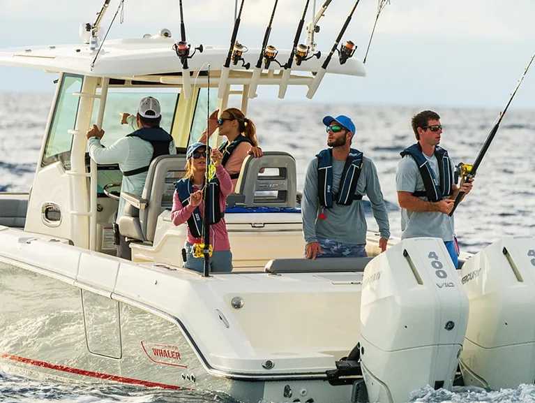
Boston Whaler 330 Outrage33' 0"
View Specs & ReviewSebastian Inlet to the Canaveral Lock — the launch-view coast
Yachting in Cape Canaveral & Melbourne
A Minted Location · Cape Canaveral & Melbourne, Florida
If your idea of a boating life runs from blue water in the morning to a rocket climbing off the pad over your own bow at night, the Space Coast gives you both. Port Canaveral is the region's all-weather, deep-draft door to the Atlantic — a jetty-protected entrance carrying a 44-foot Navy project depth to the East Basin — and just inside it the Canaveral Lock, the largest navigation lock in Florida, built oversized in 1965 to pass the Saturn rocket's first stage, passes any boat drawing up to 12 feet into the Banana River at no charge.
For an owner the market is really three waters: the port itself, where Ocean Club's 73 floating concrete slips take yachts to 110 feet; the protected Indian River towns — Titusville's city marina to 130 feet opposite the launch pads, Cocoa Village's walk-to-dinner basin, Melbourne's no-tide hurricane harbor; and Sebastian at the southern gate, where 90 percent of Capt Hiram's wet slips are public, first-come. Pick your water, and the boat follows.
Where to keep a yacht in Cape Canaveral & Melbourne
Space Coast dockage sorts into three clusters. Port Canaveral is the offshore cluster — Cape Marina's 115 slips in 12 feet of water inside the jetties, Ocean Club's big-boat basin, Bluepoints' lift slips and enclosed dry stack, Sunrise Marina's racks in The Cove, and Harbortown on the Barge Canal, inside the lock, in hurricane-hole water. The lagoon towns run down the Indian River: Titusville's city marina and mooring field on launch-view water, Kennedy Point, Cocoa Village's protected basin a street from the Village, and Melbourne's trio — the Crane Creek hurricane harbor, Waterline, and the Eau Gallie Yacht Basin the Coast Pilot credits with good shelter from storms. Sebastian holds the southern gate.
Marinas
| Name | Where | Max yacht | Slips | Fuel |
|---|---|---|---|---|
| Cape MarinaFamily-owned since 1976 in the all-weather harbor — 115 wet slips in 12 feet of water for boats 28 to 65 feet (beams to 21), plus an inside dry stack to 34 feet and outside rack storage. | Port Canaveral — 800 Scallop Dr, inside the jetties | 65 ft | 115 | ValvTect 93-octane ethanol-free; pump-out |
| Ocean Club MarinaThe port's big-boat basin: 73 Bellingham floating concrete slips for 40-to-110-footers — deepwater with no height limit, catamaran slips, pump-out at every berth, clubhouse and pool. | Port Canaveral — 930 Mullet Rd | 110 ft | 73 | Fuel dock — ValvTect 90-octane non-ethanol |
| Bluepoints MarinaThe lift-slip and dry-stack specialist — 26 wet slips each on a boat lift rated to 50,000 pounds (beams to 14 feet), and a fully enclosed storage building rated for 150-mph wind, with “the most comprehensive marina fire-suppression system in the state.” | Port Canaveral | — | 26 | — |
| Sunrise MarinaThe Cove's marina, sharing its docks with the sportfish fleet and Grills Seafood Deck on site — dry rack storage to 45 feet, so call ahead for a wet slip. | Port Canaveral — The Cove | — | — | — |
| Harbortown Marina — CanaveralWet slips plus covered and outdoor dry storage on the Barge Canal, inside the Canaveral Lock — hurricane-hole water — with a pool, restaurant, ship's store and app-scheduled launch. | Canaveral Barge Canal, Merritt Island — inside the lock | — | — | On-site fuel dock |
| Titusville MarinaThe region's northern harbor, owned by the City of Titusville and managed by F3 Marina — fixed and floating docks, ship's store and launch ramps on front-row launch-view water; reported approach 8 ft (2009 report) into a well-protected basin. | Titusville — ICW Mile 878.4, opposite the launch pads | 130 ft | — | Gas & diesel; pump-out station and pump-out boat |
| Kennedy Point MarinaThe rebuilt marina south of downtown Titusville, directly across from the Kennedy Space Center pads — Clean Marina certified, with a manatee-viewing lagoon and boats to 80 feet. | Titusville — ICW, 4749 S Washington Ave | 80 ft | — | — |
| Cocoa Village MarinaThe protected basin north of the SR 520 causeway — guests who dock here, in the marina's own words, simply walk across the street into the Old Florida charm of Historic Cocoa Village and its dining. | Cocoa Village — Indian River, 90 Delannoy Ave | — | — | — |
| Lee Wenner Park day docks & rampsThe City of Cocoa's riverfront landing for the Village — four boat ramps, day slips and the T-Dock, on a basin that ran about 5.5 to 6 feet before the city's 2022 FIND-funded dredge to about 7. | Cocoa Village — 300 Riveredge Blvd, city park | — | — | — |
| Melbourne Harbor MarinaA designated hurricane harbor in the Crane Creek turning basin — 85 modern concrete berths for vessels to 130 feet, dredged to 8 feet, no tides, two restaurants on site and downtown Melbourne a walk away. | Crane Creek, downtown Melbourne — ICW Mile ~918.7 | 130 ft | 85 | Gas & diesel |
| Waterline MarinaInside the Eau Gallie Yacht Basin — “the best-protected natural hurricane hole on Florida's east coast,” in the marina's words — walking distance to the Eau Gallie Arts District; live-aboard dockage not allowed. | Eau Gallie Yacht Basin, Melbourne — 911 N Harbor City Blvd | — | — | — |
| Eau Gallie Yacht BasinSixty slips in the sheltered basin the Coast Pilot credits with good shelter from storms — no-wake water by city ordinance, shared with several marinas and a boatyard. | Eau Gallie River mouth, Melbourne | — | 60 | — |
| Telemar Bay MarinaThe marina at the foot of the Banana River by Dragon Point and the Mathers swing bridge — the closest fuel to the Dragon Point anchorage, with a ship store, laundry, and the beach a mile away. | Banana River at Dragon Point — 1399 Banana River Dr, Indian Harbour Beach | — | — | REC 90 gas & diesel, open to the public |
| Capt Hiram's Resort & MarinaThe resort marina at the region's southern gate — a deep-water channel to the Intracoastal and Sebastian Inlet, with the resort's two restaurants and four bars up the dock; marina desk 772-589-4345. | Sebastian — Indian River, ICW near Mile 938 | — | — | — |
Yacht clubs
| Name | Where | Max yacht | Slips | Fuel |
|---|---|---|---|---|
| Eau Gallie Yacht ClubFounded 1907 where the Banana River meets the Intracoastal — full-service marina, dining, six clay tennis courts, heated pool and fitness center; dockage and reciprocity terms are member-side, so call before counting on a visiting slip. | Indian Harbour Beach — mouth of the Banana River, near Dragon Point | — | — | — |
| Melbourne Yacht ClubThe active sailing club on the river's west shore at Melbourne — dockage and racing calendars are a phone call away. | Melbourne — Indian River, west shore | — | — | — |
Figures are as each facility publishes them on its own site; blank cells mean the facility doesn't state a number. Confirm slip availability and current rates directly — or ask us to make the calls.
Cruising from Cape Canaveral & Melbourne
The inlet. Port Canaveral is the Space Coast's all-weather door: jetty-protected with lighted ranges, a customs port of entry, the Coast Guard station at the northeast corner of the West Basin, and the Canaveral Port Authority running the harbor. Project depths step down the basins — 44 feet (Navy project) to the East Basin, 40 between East and Middle, 35 in the Middle Basin, 31 to and in the West Basin. Offshore, respect the cape: shoals extend 13 miles north and northeast of Cape Canaveral, the outer shoals carry a least depth of 11 feet and Southeast Shoal 5 to 7 — the Coast Pilot limits passage inside the outer shoals to small light-draft vessels in calm seas.
The lock and the Barge Canal. Canaveral Lock — 90 by 600 feet, the largest navigation lock in Florida, built oversized in 1965 to pass the Saturn rocket's first stage — operates 6 a.m. to 9:30 p.m. daily, monitors VHF 13, takes any vessel drawing up to 12 feet, and locks through free in 20 to 30 minutes on a normal lift of 3 to 4 feet. Tie fore and aft to the south wall; no lockage while a petroleum barge is in passage, and no smoking, per Corps rules. The Barge Canal itself carries a 12-foot federal project depth from the ICW across the Banana River to the port's turning basin; the SR 401 drawbridges give 21 feet at center closed, the A1A bascule crosses on Merritt Island, and overhead cables run 65 feet.
The Intracoastal. Between Haulover Canal and Melbourne the mainline is a 65-foot-fixed-bridge highway — Max Brewer, SR 528, SR 520 at Cocoa, Pineda, Eau Gallie and Melbourne causeways, all 65 feet per the Coast Pilot — with two working exceptions: the SR 405 Addison Point bascule at Mile 885 (27 feet at center) and Haulover Canal's 27-foot bascule, a 1.2-mile rock-sided cut with wind-driven currents to 1.5 knots, water levels that swing as much as 2 feet, and manatee speed zones. The Jay Jay railroad bridge north of Titusville normally sits open (7 feet closed, closing automatically for trains), and Titusville's well-protected basin reported an 8-foot approach (2009 report).
The Banana River. Inside water for the shoal-draft fleet: controlling depth 3 feet (1976–78 report) from the southern entrance at Mile 914.2 some 16 miles up to the Barge Canal, under the 7-foot Mathers swing bridge and fixed spans of 43 and 36 feet, with severe shoaling along the channel edges. Small boats use it as a storm refuge. Everything north of the Barge Canal is security-zone water, with a prohibited area at the missile-test annex and the east side south of NASA Parkway closed to motorized craft April 1 through November 14.
Launch days. All areas north of the Port Canaveral harbor channel lie within Security Zones A and B, a danger area runs the coast from False Cape around Cape Canaveral to the port entrance extending 3 nautical miles offshore, and radio transmissions are not allowed during missile launchings — plan passages around announced closures, then take the show from the lagoon.
Sebastian Inlet. The only charted inlet between Cape Canaveral and Fort Pierce is a fair-weather, local-knowledge cut for smaller boats: the Coast Pilot reports tidal currents reaching 10 knots and breaking, confused seas except in flat calm, with 5 feet controlling from the ICW through the inside channel (1983 report), 8 feet to the eastern entrance, and 12 feet reported across the bar in smooth seas. The A1A bridge is published at 39 feet by the Sebastian Inlet District and 37 feet by the Coast Pilot — plan against 37 feet (11.3 m). The District, an independent state district maintaining the inlet since 1919, is piloting solar lighting on the channel markers; the state park's ramp and 24-hour North Ranger Station serve trailer boats, with construction on the inlet bridge scheduled from May 2026. For a boat transiting this coast the planning rule is simple: treat Port Canaveral and Fort Pierce as the serious inlets, and Sebastian as a settled-weather option with local knowledge aboard.
Where to hide. The Coast Pilot gives the Eau Gallie basin and the area close east good shelter from storms; Melbourne Harbor is a designated hurricane harbor in Crane Creek's no-tide turning basin, dredged to 8 feet; the Barge Canal marinas sit inside the lock; and the lower Banana River serves small boats as a harbor of refuge.
- Dragon Point & the lower Banana River — South tip of Merritt Island — Banana River entrance, off ICW Mile 914.2The gathering spot just inside the river entrance, before the 7-foot Mathers swing bridge — Telemar Bay's public fuel dock and the Eau Gallie Yacht Club are the neighbors. It is informal water: pick your spot, watch the depth on the way in, and stay clear of the bridge channel.
- Titusville Municipal Mooring Field — Titusville — off the marina basin, ICW Mile 878.4Launch-view moorings opposite the Kennedy Space Center, served by the marina's pump-out boat — informational buoys mark the seagrass closure, so pick up a ball rather than anchoring the flats.
- Special anchorage off Sebastian — Sebastian — ICW Mile 938.3Shoal-draft swing room at the region's southern gate — deeper boats pair it with Capt Hiram's first-come public slips a short way up the same shore.
Service, refit & supplies
Shipyards & refit
| Name | Where | Max yacht | Dockage |
|---|---|---|---|
| Westland Boatyard & MarinaThe region's DIY yard: a travel lift hauling boats to 60 feet and 50 tons, 6-plus upland acres, and bottom paint, diesel and gas mechanics, welding, rigging and fiberglass — basin 8 to 12 feet, approach channel 7 to 9. | Titusville basin — 419 N Washington Ave | — | 55 wet slips + do-it-yourself upland yard; outside contractors welcome |
On the Cape Canaveral & Melbourne calendar
Launch days — the Space Coast's signature spectacle runs on federal rules, not a race calendar: published security zones close the water north of the port channel and a 3-nautical-mile danger area along the cape on announced windows, radio transmissions are barred during launchings, and the protected Indian River off Titusville — directly opposite the Kennedy Space Center — is the boater's grandstand.
Sebastian Inlet bridge construction — construction on the Sebastian Inlet bridge (the Jimmy Buffett Memorial Highway) is scheduled from May 2026, with congestion and possible changes to the state park's campground entrance.
Earl's Hideaway live music — Sebastian's storied riverfront blues bar posts its band calendar into 2027, a fixture of the Indian River Drive waterfront.
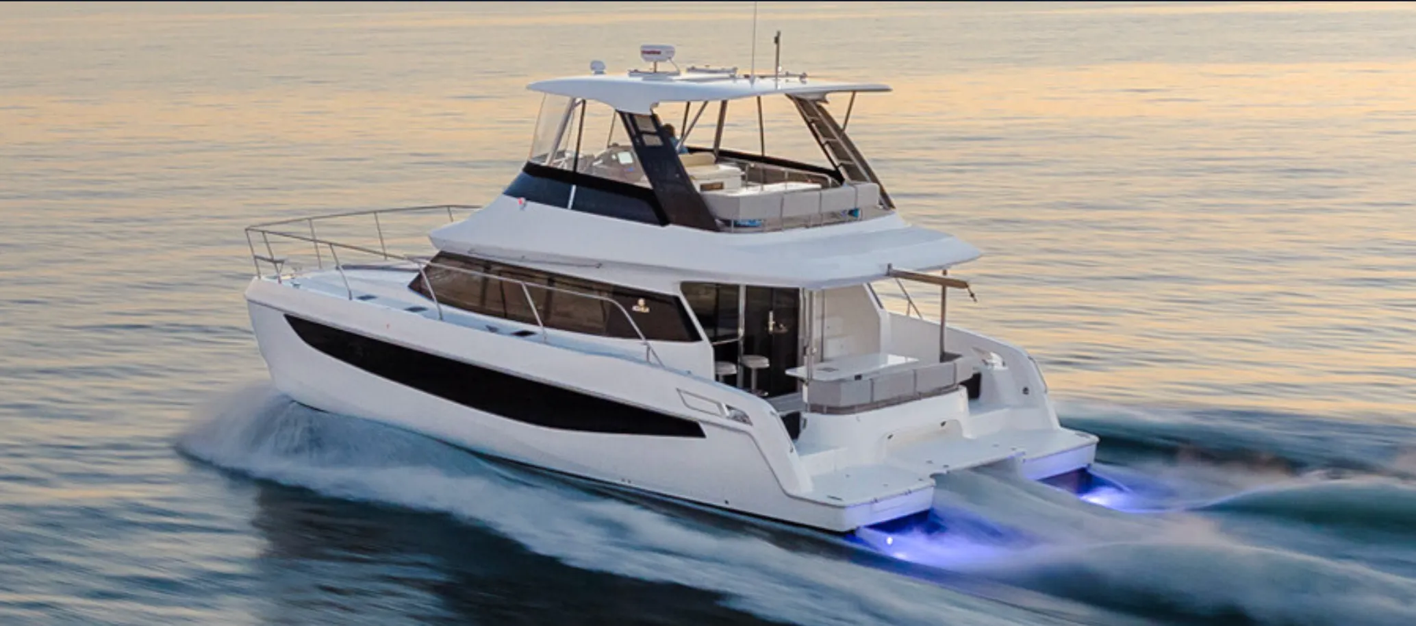
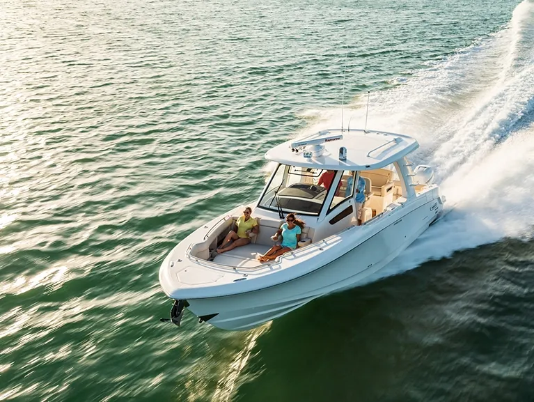
Yachts we'd shortlist for Cape Canaveral & Melbourne
Reviewed the same way as everything on this site — specifications verified against the builder's own numbers.
Frequently Asked Questions
Which Space Coast restaurants can I reach by boat?
The direct welcomes: Capt Hiram's in Sebastian (accessible by car or water, 90 percent of its slips public and first-come), Squid Lips' over-the-river Sebastian original, Grills Riverside in Melbourne (come by car or by boat, with tour boats docked on site), and Grills Portside at Sunrise Marina in The Cove. Squid Lips' Eau Gallie and Cocoa Beach rooms take boats as well as cars. The Cove landmarks — Fishlips, Rusty's, Seafood Atlantic — plus Chart House and Pier 220 work the other way round: take a transient slip at Cape Marina, Melbourne Harbor Marina or Titusville Marina respectively, and walk to the table.
Can I run Sebastian Inlet?
In settled weather, with local knowledge, in the right boat. It's the only charted inlet between Cape Canaveral and Fort Pierce, and the Coast Pilot reports tidal currents reaching 10 knots with breaking, confused seas except in flat calm — 5 feet controlling from the ICW through the inside channel (1983 report), 8 feet to the eastern entrance, 12 reported across the bar in smooth seas. The A1A bridge is published at 39 feet by the Sebastian Inlet District and 37 by the Coast Pilot — plan against 37. Serious passages use Port Canaveral or Fort Pierce; the District, maintaining the inlet since 1919, runs a real-time wind-and-wave webcam.
Is the Space Coast a good home port?
If you want real ocean capability and protected-water living from the same slip, it's hard to beat: an all-weather deep-draft inlet, a free lock into the lagoon, city marinas at Titusville and Melbourne taking boats to 130 feet, published hurricane holes, and rocket launches over the bow. The honest trade-offs — it's a one-serious-inlet coast (Sebastian is fair-weather only), the Banana River runs shoal, and launch days close water on their own schedule. Tell us how you'll use this coast and we'll match the boat: TS@MintedYachts.com or +1 (404) 805-9819.
Where are the hurricane holes on the Space Coast?
The Coast Pilot gives the Eau Gallie basin and the area close east good shelter from storms — Waterline, inside it, calls the basin the best-protected natural hurricane hole on Florida's east coast. Melbourne Harbor is a designated hurricane harbor: a no-tide turning basin in Crane Creek, dredged to 8 feet. The Barge Canal marinas — Harbortown among them — sit inside the Canaveral Lock, and the lower Banana River serves small boats as a harbor of refuge, per the Coast Pilot. None of that replaces a real storm plan: agree yours with your underwriter well before the season.
What are the bridge clearances on the ICW through the Space Coast?
Plan on 65 feet: the Max Brewer (Mile 878.9), SR 528 (894.0), SR 520 at Cocoa (897.4), Pineda (909.0), Eau Gallie SR 518 (914.4) and Melbourne SR 516 (918.2) bridges are all 65-foot fixed spans per the Coast Pilot. The exceptions open: the SR 405 Addison Point bascule at Mile 885 (27 feet at center), Haulover Canal's bascule (27 feet), and the Jay Jay railroad bridge north of Titusville — 7 feet closed but normally open, closing automatically for trains. Off the ICW, the Banana River runs 43- and 36-foot fixed spans behind the 7-foot Mathers swing bridge, and the Barge Canal's SR 401 drawbridges give 21 feet closed.
Where can I dock at Port Canaveral?
Five facilities cluster at the port. Cape Marina runs 115 wet slips in 12 feet of water for boats 28 to 65 feet, with ValvTect ethanol-free fuel and transient dockage whenever possible (VHF 16, working 68). Ocean Club Marina takes 40-to-110-footers on 73 Bellingham floating concrete slips with in-slip pump-out and a fuel dock. Bluepoints runs 26 lift slips rated to 50,000 pounds plus a 150-mph-rated enclosed dry stack, Sunrise Marina racks boats to 45 feet in The Cove, and Harbortown — on the Barge Canal, inside the lock — welcomes transients year-round.
What happens to boaters on launch days?
The published federal zones take over: all areas north of the Port Canaveral harbor channel lie within Security Zones A and B, a danger area runs the coast from False Cape around Cape Canaveral to the port entrance extending 3 nautical miles offshore, and radio transmissions are not allowed during missile launchings. Year-round, the Banana River above the Barge Canal is security-zone water with a prohibited area at the missile-test annex, and its east side south of NASA Parkway is closed to motorized craft April 1 through November 14. Plan around the announced windows — then take the show from the Indian River off Titusville.
How does the Canaveral Lock work?
It's free, and it's the largest navigation lock in Florida — 90 by 600 feet, built oversized in 1965 to pass the Saturn rocket's first stage. The lock operates 6 a.m. to 9:30 p.m. daily and monitors VHF 13; any vessel drawing up to 12 feet locks through in 20 to 30 minutes on a normal lift of 3 to 4 feet. Tie fore and aft to the south wall, expect no lockage while a petroleum barge is in passage, and leave the cigarettes alone — Corps rules.